Directions to Moskowitz Consulting (Brookline) with public transportation
The following transit lines have routes that pass near Moskowitz Consulting
 Bus: 15, 57, 66, GREEN LINE B SHUTTLE, GREEN LINE B SHUTTLE.
- Train: FRAMINGHAM/WORCESTER.
- Subway: GREEN LINE B, GREEN LINE C.
How to get to Moskowitz Consulting by bus?
Click on the bus route to see step by step directions with maps, line arrival times and updated time schedules.
From Faneuil Hall Marketplace, Boston
50 minFrom Newton-Wellesley Hospital, Newton
91 minFrom Santarpio's Pizza, Boston
78 minFrom Best Western Adams Inn Quincy - Boston, Quincy
96 minFrom One Beacon Street, Boston
50 minFrom Marina Bay, Quincy
154 minFrom Constitution Beach, Boston
90 minFrom US Coast Guard Base Boston, Boston
66 minFrom Newton Wellesley Hospital Green Building, Newton
91 minFrom Freedom Trail, Boston
54 min
How to get to Moskowitz Consulting by train?
Click on the train route to see step by step directions with maps, line arrival times and updated time schedules.
How to get to Moskowitz Consulting by subway?
Click on the subway route to see step by step directions with maps, line arrival times and updated time schedules.
From Faneuil Hall Marketplace, Boston
42 minFrom Newton-Wellesley Hospital, Newton
69 minFrom Santarpio's Pizza, Boston
54 minFrom Best Western Adams Inn Quincy - Boston, Quincy
73 minFrom One Beacon Street, Boston
38 minFrom Constitution Beach, Boston
61 minFrom US Coast Guard Base Boston, Boston
54 minFrom Newton Wellesley Hospital Green Building, Newton
69 minFrom Freedom Trail, Boston
44 min
Bus stops near Moskowitz Consulting in Brookline
Subway stations near Moskowitz Consulting in Brookline
Bus lines to Moskowitz Consulting in Brookline
- GREEN LINE B SHUTTLE, Boston College (Shuttle),VIEW
- 66, Nubian Via Allston,VIEW
- 57, Kenmore - Watertown Yard,VIEW
- GREEN LINE B SHUTTLE, Boston College - Back Bay (Shuttle),VIEW
- GREEN LINE B SHUTTLE, Washington Street - Blandford Street,VIEW
- GREEN LINE B SHUTTLE, Boston College - Babcock Street,VIEW
- GREEN LINE B SHUTTLE, Babcock Street - Blandford Street,VIEW
- GREEN LINE B SHUTTLE, Babcock Street - Copley,VIEW
- GREEN LINE B SHUTTLE, Boston College - Blandford Street,VIEW
- GREEN LINE B SHUTTLE, Babcock Street - Kenmore,VIEW
- GREEN LINE B SHUTTLE, Washington Street - Kenmore,VIEW
- GREEN LINE B SHUTTLE, Babcock Street - Back Bay via Copley (Shuttle),VIEW
- GREEN LINE B SHUTTLE, Babcock Street - Back Bay,VIEW
- SHUTTLE, Boston College - Kenmore (Shuttle),VIEW
What are the closest stations to Moskowitz Consulting?
The closest stations to Moskowitz Consulting are:
- Packard's Corner is 526 yards away, 7 min walk.
- Harvard St @ Stedman St is 591 yards away, 8 min walk.
- Commonwealth Ave @ Babcock St is 684 yards away, 9 min walk.
- Harvard Ave. is 788 yards away, 10 min walk.
- Coolidge Corner is 1017 yards away, 13 min walk.
Which bus lines stop near Moskowitz Consulting?
These bus lines stop near Moskowitz Consulting: 15, 57, 66.
Which train line stops near Moskowitz Consulting?
FRAMINGHAM/WORCESTER (#525 | Worcester)
Which subway line stops near Moskowitz Consulting?
GREEN LINE B (Boston College)
What’s the nearest subway station to Moskowitz Consulting in Brookline?
The nearest subway station to Moskowitz Consulting in Brookline is Harvard Ave.. It’s a 10 min walk away.
What’s the nearest bus station to Moskowitz Consulting in Brookline?
The nearest bus station to Moskowitz Consulting in Brookline is Packard's Corner. It’s a 7 min walk away.
What time is the first subway to Moskowitz Consulting in Brookline?
The GREEN LINE C is the first subway that goes to Moskowitz Consulting in Brookline. It stops nearby at 5:09 AM.
What time is the last subway to Moskowitz Consulting in Brookline?
The GREEN LINE B is the last subway that goes to Moskowitz Consulting in Brookline. It stops nearby at 1:30 AM.
What time is the first bus to Moskowitz Consulting in Brookline?
The 57 is the first bus that goes to Moskowitz Consulting in Brookline. It stops nearby at 4:41 AM.
What time is the last bus to Moskowitz Consulting in Brookline?
The 57 is the last bus that goes to Moskowitz Consulting in Brookline. It stops nearby at 2:18 AM.
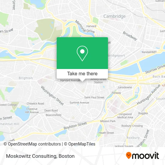
See Moskowitz Consulting, Brookline, on the map
Public Transit to Moskowitz Consulting in Brookline
Wondering how to get to Moskowitz Consulting in Brookline? Moovit helps you find the best way to get to Moskowitz Consulting with step-by-step directions from the nearest public transit station.
Moovit provides free maps and live directions to help you navigate through your city. View schedules, routes, timetables, and find out how long does it take to get to Moskowitz Consulting in real time.
Looking for the nearest stop or station to Moskowitz Consulting? Check out this list of stops closest to your destination: Packard's Corner; Harvard St @ Stedman St; Commonwealth Ave @ Babcock St; Harvard Ave.; Coolidge Corner.
Bus: 15, 57, 66, GREEN LINE B SHUTTLE, GREEN LINE B SHUTTLE, GREEN LINE B SHUTTLE, GREEN LINE B SHUTTLE, GREEN LINE B SHUTTLE.Train: FRAMINGHAM/WORCESTER.Subway: GREEN LINE B, GREEN LINE C.
Want to see if there’s another route that gets you there at an earlier time? Moovit helps you find alternative routes or times. Get directions from and directions to Moskowitz Consulting easily from the Moovit App or Website.
We make riding to Moskowitz Consulting easy, which is why over 1.5 million users, including users in Brookline, trust Moovit as the best app for public transit. You don’t need to download an individual bus app or train app, Moovit is your all-in-one transit app that helps you find the best bus time or train time available.
For information on prices of bus, subway, train and ferry, costs and ride fares to Moskowitz Consulting, please check the Moovit app.
Use the app to navigate to popular places including to the airport, hospital, stadium, grocery store, mall, coffee shop, school, college, and university.
Moskowitz Consulting Address: 20 Gibbs St Brookline, MA 02446 street in Brookline
- Odessit Capital,
- Executive Perspective,
- Good Celebrations,
- Grillos Pickles,
- John F Kennedy Birthplace,
- John F Kennedy Nat'l Historic Site (John Fitzgerald Kennedy National Historic Site),
- 110 Babcock St Parking,
- Suremilk,
- Lorna McKenzie-Pollock, Licsw,
- Clear Flour Bread (Clear Flour Bakery),
- Clear Flour Bakery,
- Old Owl,
- 76 Babcock,
- Landscape Collaborative of New England,
- Daniel Rosenbaum MD,
- The Achievement Institute,
- 218 Freeman St Parking,
- Town Stable,
- Harvard Street Locksmith,
- Zhangliang Malatang
Places Near Moskowitz Consulting (Brookline)
- Boston Medical Center, Boston,
- Leader Bank Pavilion (Leader Bank Pavillion), Boston,
- Museum Of Science, Boston,
- Massachusetts General Hospital, Boston,
- Cheers, Boston,
- Quincy Market, Boston,
- Seaport District, Boston,
- North End, Boston,
- Faneuil Hall, Boston,
- Td Garden, Boston,
- City Hall Plaza, Boston,
- Castle Island, Boston,
- House Of Blues, Boston,
- Wang Theater, Boston,
- Boston Common, Boston,
- Boston Children's Hospital, Boston,
- Mgm Music Hall, Boston,
- Boston Convention & Exhibition Center, Boston,
- Prudential Center, Boston,
- Wilbur Theatre, Boston
How to get to popular places in Boston with public transit
Get around Brookline by public transit!
Traveling around Brookline has never been so easy. See step by step directions as you travel to any attraction, street or major public transit station. View bus and train schedules, arrival times, service alerts and detailed routes on a map, so you know exactly how to get to anywhere in Brookline.
When traveling to any destination around Brookline use Moovit's Live Directions with Get Off Notifications to know exactly where and how far to walk, how long to wait for your line, and how many stops are left. Moovit will alert you when it's time to get off — no need to constantly re-check whether yours is the next stop.
Wondering how to use public transit in Brookline or how to pay for public transit in Brookline? Moovit public transit app can help you navigate your way with public transit easily, and at minimum cost. It includes public transit fees, ticket prices, and costs. Looking for a map of Brookline public transit lines? Moovit public transit app shows all public transit maps in Brookline with all Bus, Train, Subway and Ferry routes and stops on an interactive map.
Boston has 4 transit type(s), including: Bus, Train, Subway and Ferry, operated by several transit agencies, including MBTA, Southeastern Regional Transit Authority, MetroWest Regional Transit Authority, Rhode Island Public Transit Authority, WRTA, Lowell Regional Transit Authority, Merrimack Valley Transit, Montachusett Regional Transit Authority, Cape Cod Regional Transit Authority, Brockton Area Transit Authority, Martha's Vineyard Transit Authority, the WAVE - Nantucket Regional Transit Authority, GATRA, Cape Ann Transportation Authority and Massport