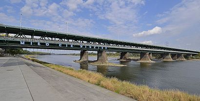
See Most Gdański, Warsaw, on the map
Directions to Most Gdański (Warsaw) with public transportation
The following transit lines have routes that pass near Most Gdański
 Bus:
Bus: - Train:
- Metro:
- Light Rail:
How to get to Most Gdański by bus?
Click on the bus route to see step by step directions with maps, line arrival times and updated time schedules.
How to get to Most Gdański by train?
Click on the train route to see step by step directions with maps, line arrival times and updated time schedules.
How to get to Most Gdański by metro?
Click on the metro route to see step by step directions with maps, line arrival times and updated time schedules.
Bus stations near Most Gdański in Warsaw
- Konwiktorska 04,4 min walk,
- Konwiktorska 03,4 min walk,
- Sanguszki 01,5 min walk,
- Wybrzeże Helskie 01,6 min walk,
- Rondo Starzyńskiego 01,11 min walk,
Light Rail stations near Most Gdański in Warsaw
- Wybrzeże Helskie 03,5 min walk,
Bus lines to Most Gdański in Warsaw
- 503,Natolin Płn.,
- 178,Konwiktorska,
- 100,Centrum,
- 185,Al. Witosa,
- N12,Metro Trocka,
- N62,PKP Wołomin,
- 409,Cm. Północny - Brama Zach.,
- 500,Rondo Radosława,
What are the closest stations to Most Gdański?
The closest stations to Most Gdański are:
- Konwiktorska 04 is 287 meters away, 4 min walk.
- Konwiktorska 03 is 298 meters away, 4 min walk.
- Sanguszki 01 is 338 meters away, 5 min walk.
- Wybrzeże Helskie 03 is 378 meters away, 5 min walk.
- Wybrzeże Helskie 01 is 436 meters away, 6 min walk.
- Rondo Starzyńskiego 01 is 836 meters away, 11 min walk.
Which bus lines stop near Most Gdański?
These bus lines stop near Most Gdański: 185, 503, 509.
Which train line stops near Most Gdański?
S3
Which metro line stops near Most Gdański?
M1
Which light rail lines stop near Most Gdański?
These light rail lines stop near Most Gdański: 1, 18, 28.
What’s the nearest light rail station to Most Gdański in Warsaw?
The nearest light rail station to Most Gdański in Warsaw is Wybrzeże Helskie 03. It’s a 5 min walk away.
What’s the nearest bus stop to Most Gdański in Warsaw?
The nearest bus stops to Most Gdański in Warsaw are Konwiktorska 04 and Konwiktorska 03. The closest one is a 4 min walk away.
What time is the first light rail to Most Gdański in Warsaw?
The 4 is the first light rail that goes to Most Gdański in Warsaw. It stops nearby at 4:30 AM.
What time is the last light rail to Most Gdański in Warsaw?
The 1 is the last light rail that goes to Most Gdański in Warsaw. It stops nearby at 12:43 AM.
What time is the first bus to Most Gdański in Warsaw?
The N12 is the first bus that goes to Most Gdański in Warsaw. It stops nearby at 3:14 AM.
What time is the last bus to Most Gdański in Warsaw?
The N62 is the last bus that goes to Most Gdański in Warsaw. It stops nearby at 3:47 AM.
How much is the metro fare to Most Gdański?
The metro fare to Most Gdański costs about zł3.40.
How much is the train fare to Most Gdański?
The train fare to Most Gdański costs about zł3.40.
How much is the light rail fare to Most Gdański?
The light rail fare to Most Gdański costs about zł3.40.
How much is the bus fare to Most Gdański?
The bus fare to Most Gdański costs about zł3.40.
See Most Gdański, Warsaw, on the map
Public Transit to Most Gdański in Warsaw
Wondering how to get to Most Gdański in Warsaw, Poland? Moovit helps you find the best way to get to Most Gdański with step-by-step directions from the nearest public transit station.
Moovit provides free maps and live directions to help you navigate through your city. View schedules, routes, timetables, and find out how long does it take to get to Most Gdański in real time.
Looking for the nearest stop or station to Most Gdański? Check out this list of stops closest to your destination: Konwiktorska 04; Konwiktorska 03; Sanguszki 01; Wybrzeże Helskie 03; Wybrzeże Helskie 01; Rondo Starzyńskiego 01.
Bus:Train:Metro:Light Rail:
Want to see if there’s another route that gets you there at an earlier time? Moovit helps you find alternative routes or times. Get directions from and directions to Most Gdański easily from the Moovit App or Website.
We make riding to Most Gdański easy, which is why over 1.5 million users, including users in Warsaw, trust Moovit as the best app for public transit. You don’t need to download an individual bus app or train app, Moovit is your all-in-one transit app that helps you find the best bus time or train time available.
For information on prices of bus, light rail, train and metro, costs and ride fares to Most Gdański, please check the Moovit app.
Use the app to navigate to popular places including to the airport, hospital, stadium, grocery store, mall, coffee shop, school, college, and university.
Location: Warsaw
Attractions near Most Gdański
Most Gdański 01,Betonowy Brzeg Wisły,Muzeum Katyńskie,Rolniczy Targ w Fortecy u Kręglickich,Zakroczymska 12,Park Traugutta,Przystanek Traugutta,Wybrzeże Helskie 01,Pawilon Edukacyjny ""Kamień"",Sanguszki 1,Wybrzeże Helskie - Zoo,Warsaw Zoo,River Cafe,Polska Wytwórnia Papierów Wartościowych,Ul. Wybrzeże Gdańskie- Sanguszki- Skwer 1 Dywizji Pancernej 1,Technikum Architektoniczno-Budowlane Im. Stanisława Noakowskiego,Konwiktorska 04,Międzyparkowa 4,Konwiktorska 03,Sanguszki 01How to get to popular attractions in Warsaw with public transit
Zaścianek - Kuchnia za Ścianą, Warsaw,Alternatywy 4, Warsaw,Basen "Namysłowska", Warsaw,Blue City, Warsaw,Restauracja Lotos, Warsaw,Tramwaj 35, Warsaw,Racławicka, Warsaw,Myśliborska, Warsaw,Procter & Gamble PSC - Warsaw, Warsaw,XLVIII LO im. E. Dembowskiego, Warsaw,Hotel Partner, Warsaw,Marriott, Warsaw,1 minute - stacja Metro Młociny (wyjscie poludniowe), Warsaw,Ulica Tyniecka, Warsaw,Pętla autobusowa Esperanto, Warsaw,tor stegny, Warsaw,przystanek Ks.Czartoryskiej, Wołomin,Przystanek Reduta Wolska, Warsaw,Przystanek Stare Miasto, Warsaw,BEST WESTERN Hotel Portos, WarsawGet around Warsaw by public transit!
Traveling around Warsaw has never been so easy. See step by step directions as you travel to any attraction, street or major public transit station. View bus and train schedules, arrival times, service alerts and detailed routes on a map, so you know exactly how to get to anywhere in Warsaw.
When traveling to any destination around Warsaw use Moovit's Live Directions with Get Off Notifications to know exactly where and how far to walk, how long to wait for your line, and how many stops are left. Moovit will alert you when it's time to get off — no need to constantly re-check whether yours is the next stop.
Wondering how to use public transit in Warsaw or how to pay for public transit in Warsaw? Moovit public transit app can help you navigate your way with public transit easily, and at minimum cost. It includes public transit fees, ticket prices, and costs. Looking for a map of Warsaw public transit lines? Moovit public transit app shows all public transit maps in Warsaw with all bus, light rail, train or metro routes and stops on an interactive map.
Warsaw has 4 transit type(s), including: bus, light rail, train or metro, operated by several transit agencies, including Warszawski Transport Publiczny, Warszawski Transport Publiczny, Warszawski Transport Publiczny, Warszawska Kolej Dojazdowa, Warszawska Kolej Dojazdowa, Koleje Mazowieckie, Koleje Mazowieckie, Warszawski Transport Publiczny, ZTP Kraków, Miasto Piastów, ZTP Kraków, Miasto Ząbki, Koleje Małopolskie, Komunikacja Miejska Łomianki and Koleje Małopolskie