Directions to Motor City Boston with public transportation
The following transit lines have routes that pass near Motor City Boston
 Bus: 23, 41, 45, 15, 10.
- Train: FAIRMOUNT, FRANKLIN/FOXBORO, PROVIDENCE/STOUGHTON.
- Subway: ORANGE LINE, RED LINE.
How to get to Motor City Boston by bus?
Click on the bus route to see step by step directions with maps, line arrival times and updated time schedules.
How to get to Motor City Boston by subway?
Click on the subway route to see step by step directions with maps, line arrival times and updated time schedules.
Bus stops near Motor City Boston
Subway station near Motor City Boston
- Jackson Square, 7 min walk,VIEW
Train station near Motor City Boston
- Four Corners/Geneva, 9 min walk,VIEW
Bus lines to Motor City Boston
What are the closest stations to Motor City Boston?
The closest stations to Motor City Boston are:
- Dudley St @ Dennis St is 11 yards away, 1 min walk.
- Blue Hill Ave @ Julian St is 182 yards away, 3 min walk.
- Warren St @ Waverly St is 301 yards away, 4 min walk.
- Jackson Square is 539 yards away, 7 min walk.
- Four Corners/Geneva is 761 yards away, 9 min walk.
Which bus lines stop near Motor City Boston?
These bus lines stop near Motor City Boston: 23, 41, 45.
Which subway lines stop near Motor City Boston?
These subway lines stop near Motor City Boston: ORANGE LINE, RED LINE.
What’s the nearest subway station to Motor City Boston?
The nearest subway station to Motor City Boston is Jackson Square. It’s a 7 min walk away.
What’s the nearest train station to Motor City Boston?
The nearest train station to Motor City Boston is Four Corners/Geneva. It’s a 9 min walk away.
What’s the nearest bus station to Motor City Boston?
The nearest bus station to Motor City Boston is Dudley St @ Dennis St. It’s a 1 min walk away.
What time is the first subway to Motor City Boston?
The ORANGE LINE is the first subway that goes to Motor City Boston. It stops nearby at 5:20 AM.
What time is the last subway to Motor City Boston?
The ORANGE LINE is the last subway that goes to Motor City Boston. It stops nearby at 1:52 AM.
What time is the first train to Motor City Boston?
The FAIRMOUNT is the first train that goes to Motor City Boston. It stops nearby at 4:47 AM.
What time is the last train to Motor City Boston?
The FAIRMOUNT is the last train that goes to Motor City Boston. It stops nearby at 12:00 AM.
What time is the first bus to Motor City Boston?
The 28 is the first bus that goes to Motor City Boston. It stops nearby at 3:18 AM.
What time is the last bus to Motor City Boston?
The 23 is the last bus that goes to Motor City Boston. It stops nearby at 2:31 AM.
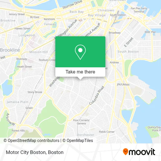
See Motor City Boston on the map
Public Transportation to Motor City Boston
Wondering how to get to Motor City Boston? Moovit helps you find the best way to get to Motor City Boston with step-by-step directions from the nearest public transit station.
Moovit provides free maps and live directions to help you navigate through your city. View schedules, routes, timetables, and find out how long does it take to get to Motor City Boston in real time.
Looking for the nearest stop or station to Motor City Boston? Check out this list of stops closest to your destination: Dudley St @ Dennis St; Blue Hill Ave @ Julian St; Warren St @ Waverly St; Jackson Square; Four Corners/Geneva.
Bus: 23, 41, 45, 15, 10, 14, 19, 28.Train: FAIRMOUNT, FRANKLIN/FOXBORO, PROVIDENCE/STOUGHTON.Subway: ORANGE LINE, RED LINE.
Want to see if there’s another route that gets you there at an earlier time? Moovit helps you find alternative routes or times. Get directions from and directions to Motor City Boston easily from the Moovit App or Website.
We make riding to Motor City Boston easy, which is why over 1.7 million users, including users in Boston, trust Moovit as the best app for public transit. You don’t need to download an individual bus app or train app, Moovit is your all-in-one transit app that helps you find the best bus time or train time available.
For information on prices of bus and subway, costs and ride fares to Motor City Boston, please check the Moovit app.
Use the app to navigate to popular places including to the airport, hospital, stadium, grocery store, mall, coffee shop, school, college, and university.
Motor City Boston Address: 120 Blue Hill Ave street in Boston
- Velocidad Auto Repair,
- Analla Café,
- La Chapi Market,
- Stacks Management,
- Rey del Pollo,
- Allan Construction,
- Darro Chea - Guitarist,
- Ujam Records,
- Blue Hill Missionary Baptist Church,
- Sarah J. Baker School,
- Gracie-Ma Planet,
- Hiron,
- Xposure by Noel,
- Apartments,
- Jaezoe Studio,
- JD Romero Home Cleaning,
- Dudley Greenhouse,
- Boston Auto Locksmith,
- Moreland Street Historic District,
- Styled by Yari
Places Near Motor City Boston
- Mgm Music Hall, Boston,
- Quincy Market, Boston,
- Td Garden, Boston,
- Boston Common, Boston,
- House Of Blues, Boston,
- Wilbur Theatre, Boston,
- Isabella Stewart Gardner Museum, Boston,
- Leader Bank Pavilion (Leader Bank Pavillion), Boston,
- Boston Children's Hospital, Boston,
- Boston Medical Center, Boston,
- Wang Theater, Boston,
- Museum Of Science, Boston,
- Massachusetts General Hospital, Boston,
- Castle Island, Boston,
- Prudential Center, Boston,
- Cheers, Boston,
- Faneuil Hall, Boston,
- Seaport District, Boston,
- North End, Boston,
- Boston Convention & Exhibition Center, Boston
How to get to popular places in Boston with public transit
Get around Boston by public transit!
Traveling around Boston has never been so easy. See step by step directions as you travel to any attraction, street or major public transit station. View bus and train schedules, arrival times, service alerts and detailed routes on a map, so you know exactly how to get to anywhere in Boston.
When traveling to any destination around Boston use Moovit's Live Directions with Get Off Notifications to know exactly where and how far to walk, how long to wait for your line, and how many stops are left. Moovit will alert you when it's time to get off — no need to constantly re-check whether yours is the next stop.
Wondering how to use public transit in Boston or how to pay for public transit in Boston? Moovit public transit app can help you navigate your way with public transit easily, and at minimum cost. It includes public transit fees, ticket prices, and costs. Looking for a map of Boston public transit lines? Moovit public transit app shows all public transit maps in Boston with all Bus, Train, Subway and Ferry routes and stops on an interactive map.
Boston has 4 transit type(s), including: Bus, Train, Subway and Ferry, operated by several transit agencies, including MBTA, Southeastern Regional Transit Authority, MetroWest Regional Transit Authority, Rhode Island Public Transit Authority, WRTA, Lowell Regional Transit Authority, Merrimack Valley Transit, Montachusett Regional Transit Authority, Cape Cod Regional Transit Authority, Brockton Area Transit Authority, Martha's Vineyard Transit Authority, the WAVE - Nantucket Regional Transit Authority, GATRA, Cape Ann Transportation Authority and Massport