Directions to Mount Dennis Station (Toronto) with public transportation
The following transit lines have routes that pass near Mount Dennis Station
 Bus:
Bus: - Train:
How to get to Mount Dennis Station by bus?
Click on the bus route to see step by step directions with maps, line arrival times and updated time schedules.
How to get to Mount Dennis Station by train?
Click on the train route to see step by step directions with maps, line arrival times and updated time schedules.
Bus stations near Mount Dennis Station in Toronto
- Eglinton Ave West at Weston Rd,2 min walk,
- Weston Rd at Eglinton Ave West,3 min walk,
Streetcar stations near Mount Dennis Station in Toronto
- St Clair Ave West at Keele St/ Weston Rd,34 min walk,
Bus lines to Mount Dennis Station in Toronto
- 32A,Renforth Station,
- 32D,Emmett Ave at Verona Ave,
- 171,Weston Rd at Jane St,
- 332,Pearson Airport Terminal 1 - Ground Level Column R4,
- 71,Runnymede Station,
- 89,Weston Rd at Albion Rd South Side,
- 989,Keele Station,
- 32,Eglinton Station,
What are the closest stations to Mount Dennis Station?
The closest stations to Mount Dennis Station are:
- Eglinton Ave West at Weston Rd is 106 meters away, 2 min walk.
- Weston Rd at Eglinton Ave West is 167 meters away, 3 min walk.
- St Clair Ave West at Keele St/ Weston Rd is 2604 meters away, 34 min walk.
Which bus lines stop near Mount Dennis Station?
These bus lines stop near Mount Dennis Station: 32, 32A, 32D, 71, 89.
Which train lines stop near Mount Dennis Station?
These train lines stop near Mount Dennis Station: KI, UP.
What’s the nearest bus stop to Mount Dennis Station in Toronto?
The nearest bus stop to Mount Dennis Station in Toronto is Eglinton Ave West at Weston Rd. It’s a 2 min walk away.
What time is the first Streetcar to Mount Dennis Station in Toronto?
The 312 is the first Streetcar that goes to Mount Dennis Station in Toronto. It stops nearby at 3:14 AM.
What time is the last Streetcar to Mount Dennis Station in Toronto?
The 312 is the last Streetcar that goes to Mount Dennis Station in Toronto. It stops nearby at 3:15 AM.
What time is the first bus to Mount Dennis Station in Toronto?
The 332 is the first bus that goes to Mount Dennis Station in Toronto. It stops nearby at 3:03 AM.
What time is the last bus to Mount Dennis Station in Toronto?
The 332 is the last bus that goes to Mount Dennis Station in Toronto. It stops nearby at 3:20 AM.
How much is the train fare to Mount Dennis Station?
The train fare to Mount Dennis Station costs about $4.71 - $9.25.
How much is the bus fare to Mount Dennis Station?
The bus fare to Mount Dennis Station costs about $3.30.
How much is the subway fare to Mount Dennis Station?
The subway fare to Mount Dennis Station costs about $3.30.
See Mount Dennis Station, Toronto, on the map
Public Transit to Mount Dennis Station in Toronto
Wondering how to get to Mount Dennis Station in Toronto, Canada? Moovit helps you find the best way to get to Mount Dennis Station with step-by-step directions from the nearest public transit station.
Moovit provides free maps and live directions to help you navigate through your city. View schedules, routes, timetables, and find out how long does it take to get to Mount Dennis Station in real time.
Looking for the nearest stop or station to Mount Dennis Station? Check out this list of stops closest to your destination: Eglinton Ave West at Weston Rd; Weston Rd at Eglinton Ave West; St Clair Ave West at Keele St/ Weston Rd.
Bus:Train:
Want to see if there’s another route that gets you there at an earlier time? Moovit helps you find alternative routes or times. Get directions from and directions to Mount Dennis Station easily from the Moovit App or Website.
We make riding to Mount Dennis Station easy, which is why over 1.5 million users, including users in Toronto, trust Moovit as the best app for public transit. You don’t need to download an individual bus app or train app, Moovit is your all-in-one transit app that helps you find the best bus time or train time available.
For information on prices of bus, subway and train, costs and ride fares to Mount Dennis Station, please check the Moovit app.
Use the app to navigate to popular places including to the airport, hospital, stadium, grocery store, mall, coffee shop, school, college, and university.
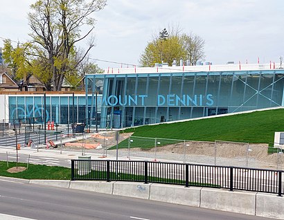
Mount Dennis Station Address: Eglinton Avenue West street in Toronto
Attractions near Mount Dennis Station
Eglinton Ave West at Weston RD,Kodak Building,Scotiabank,3400 Eglinton Ave W,Eglinton Avenue West & Weston Road,Simone's International Couture,1100 Weston Road,UofT Exam Centre,Bethel Born Again Church Of Jesus Christ Apostolic,Casa De Esteban,Eglinton Ave W & Black Creek Dr,Digicel,Iglesia Ni Cristo - Toronto Central,3561 Eglinton Ave West,Iglesia Ni Cristo,70 Guestville Avenue,Black Creek Drive & Eglinton Ave W,Our Lady Of Victory Catholic School,No Frills Gas Bar,Can-Sky Roofing & Sheet MetalHow to get to popular attractions in Toronto with public transit
Sheppard West Subway Station, Toronto,Highway 401 & 404 Merge, Toronto,City of Hamilton, Hamilton,GoodLife Fitness Centres, Toronto,Jack Astor's Bar & Grill, Toronto,GoodLife Fitness Centres, Toronto,Lawrence Subway Station, Toronto,Stoney Creek, Ontario, Hamilton,Cn Tower, Toronto,Oliver & Bonacini Café Grill, Yonge and Front, Toronto,Square One Bus Terminal, Mississauga,Conestoga College Doon Campus, Kitchener,Starbucks, Toronto,Costco Wholesale, Burlington,Humber College - Lakeshore Campus, Toronto,TTC 505 Dundas Streetcar, Toronto,Starbucks, Toronto,Burlington Bay James N. Allan Skyway, Hamilton,TTC #511 Bathurst Streetcar, Toronto,Landmark Theatres Whitby 24, WhitbyGet around Toronto by public transit!
Traveling around Toronto has never been so easy. See step by step directions as you travel to any attraction, street or major public transit station. View bus and train schedules, arrival times, service alerts and detailed routes on a map, so you know exactly how to get to anywhere in Toronto.
When traveling to any destination around Toronto use Moovit's Live Directions with Get Off Notifications to know exactly where and how far to walk, how long to wait for your line, and how many stops are left. Moovit will alert you when it's time to get off — no need to constantly re-check whether yours is the next stop.
Wondering how to use public transit in Toronto or how to pay for public transit in Toronto? Moovit public transit app can help you navigate your way with public transit easily, and at minimum cost. It includes public transit fees, ticket prices, and costs. Looking for a map of Toronto public transit lines? Moovit public transit app shows all public transit maps in Toronto with all bus, subway or train routes and stops on an interactive map.
Toronto has 3 transit type(s), including: bus, subway or train, operated by several transit agencies, including TTC, TTC Streetcar, Toronto Subway, GO Transit Bus, GO Transit, Amtrak, York Region Transit, Grand River Transit, Guelph Transit, grt, Hamilton Street Railway, MiWay, Brampton Transit, Burlington Transit and Oakville Transit