See Mount Vernon Square, Washington, on the map
Directions to Mount Vernon Square (Washington) with public transportation
The following transit lines have routes that pass near Mount Vernon Square
 Bus:
Bus: - Train:
- Metro:
How to get to Mount Vernon Square by bus?
Click on the bus route to see step by step directions with maps, line arrival times and updated time schedules.
How to get to Mount Vernon Square by train?
Click on the train route to see step by step directions with maps, line arrival times and updated time schedules.
How to get to Mount Vernon Square by metro?
Click on the metro route to see step by step directions with maps, line arrival times and updated time schedules.
Bus stations near Mount Vernon Square in Washington
- 7 St Nw+M St NW,1 min walk,
- 9 St Nw+L St NW,5 min walk,
- Massachusetts Ave & 7th St,5 min walk,
- 7 St Nw+Massachusetts Av NW,6 min walk,
- K St Nw+5 St NW,8 min walk,
Metro stations near Mount Vernon Square in Washington
- Gallery Place-Chinatown,9 min walk,
- Metro Center,14 min walk,
Bus lines to Mount Vernon Square in Washington
- 70,North To Silver Spring,
- 79,South To Archives,
- G8,West To Farragut Square,
- GT-US,Union Station,
- D4,East To Ivy City,
- 74,North To Convention Center,
- P6,South To Anacostia,
What are the closest stations to Mount Vernon Square?
The closest stations to Mount Vernon Square are:
- 7 St Nw+M St NW is 34 yards away, 1 min walk.
- 9 St Nw+L St NW is 341 yards away, 5 min walk.
- Massachusetts Ave & 7th St is 416 yards away, 5 min walk.
- 7 St Nw+Massachusetts Av NW is 436 yards away, 6 min walk.
- K St Nw+5 St NW is 596 yards away, 8 min walk.
- Gallery Place-Chinatown is 712 yards away, 9 min walk.
- Metro Center is 1166 yards away, 14 min walk.
Which bus lines stop near Mount Vernon Square?
These bus lines stop near Mount Vernon Square: 16Y, 3Y, 70, 79, G8, GT-US.
Which train lines stop near Mount Vernon Square?
These train lines stop near Mount Vernon Square: FREDERICKSBURG LINE, MARC.
Which metro lines stop near Mount Vernon Square?
These metro lines stop near Mount Vernon Square: METRORAIL GREEN LINE, METRORAIL YELLOW LINE.
What’s the nearest metro station to Mount Vernon Square in Washington?
The nearest metro station to Mount Vernon Square in Washington is Gallery Place-Chinatown. It’s a 9 min walk away.
What’s the nearest bus stop to Mount Vernon Square in Washington?
The nearest bus stop to Mount Vernon Square in Washington is 7 St Nw+M St NW. It’s a 1 min walk away.
What time is the first metro to Mount Vernon Square in Washington?
The METRORAIL GREEN LINE is the first metro that goes to Mount Vernon Square in Washington. It stops nearby at 5:23 AM.
What time is the last metro to Mount Vernon Square in Washington?
The METRORAIL GREEN LINE is the last metro that goes to Mount Vernon Square in Washington. It stops nearby at 12:19 AM.
What time is the first bus to Mount Vernon Square in Washington?
The 70 is the first bus that goes to Mount Vernon Square in Washington. It stops nearby at 3:05 AM.
What time is the last bus to Mount Vernon Square in Washington?
The 70 is the last bus that goes to Mount Vernon Square in Washington. It stops nearby at 3:14 AM.
How much is the metro fare to Mount Vernon Square?
The metro fare to Mount Vernon Square costs about $2.00 - $6.75.
See Mount Vernon Square, Washington, on the map
Public Transit to Mount Vernon Square in Washington
Wondering how to get to Mount Vernon Square in Washington, United States? Moovit helps you find the best way to get to Mount Vernon Square with step-by-step directions from the nearest public transit station.
Moovit provides free maps and live directions to help you navigate through your city. View schedules, routes, timetables, and find out how long does it take to get to Mount Vernon Square in real time.
Looking for the nearest stop or station to Mount Vernon Square? Check out this list of stops closest to your destination: 7 St Nw+M St NW; 9 St Nw+L St NW; Massachusetts Ave & 7th St; 7 St Nw+Massachusetts Av NW; K St Nw+5 St NW; Gallery Place-Chinatown; Metro Center.
Bus:Train:Metro:
Want to see if there’s another route that gets you there at an earlier time? Moovit helps you find alternative routes or times. Get directions from and directions to Mount Vernon Square easily from the Moovit App or Website.
We make riding to Mount Vernon Square easy, which is why over 1.5 million users, including users in Washington, trust Moovit as the best app for public transit. You don’t need to download an individual bus app or train app, Moovit is your all-in-one transit app that helps you find the best bus time or train time available.
For information on prices of metro, bus and train, costs and ride fares to Mount Vernon Square, please check the Moovit app.
Use the app to navigate to popular places including to the airport, hospital, stadium, grocery store, mall, coffee shop, school, college, and university.
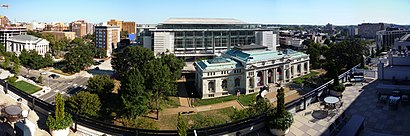
Mount Vernon Square Address: 7th Street Northwest street in Washington
Attractions near Mount Vernon Square
Mt Vernon Sq 7th St-Convention Center Metro Station,7th St NW,Mount Vernon Square Station,Metro-Mt Vernon Sq 7th St-Convention Center,Chinatown Carpet Cleaners,Asian Outcall Massage,Interstate I-495 Capital Beltway,McCollough Paradise Gardens Apartments,801 Mt Vernon Place NW,Mount Vernon Square,Unconventional Diner,Walter E. Washington Convention Center,Tunnel between Convention Ctr & Marriott Marquis,Pearl's Bagels (Pearlâs Bagels),Long View Gallery,Courtyard by Marriott Washington Downtown Convention Center,Wework 655 New York Ave NW,Walter E Washington Convention Center,Mt Vernon Square,KinshipHow to get to popular attractions in Washington with public transit
Under Armour, Baltimore,Coastal Flats, Fairfax County,Earth Treks Climbing Center, Montgomery County,The Cheesecake Factory, Washington,Toki Underground, Washington,Gordon Biersch Brewery Restaurant, Fairfax County,Bluejacket Brewery, Washington,Intercounty Connector (ICC) / MD 200, Montgomery County,New Psalmist Baptist Church, Baltimore County,Rasika, Washington,Dumfries, VA, Prince William County,The Hippodrome Theatre at the France-Merrick Performing Arts Center, Baltimore,District Taco, Arlington County,Baltimore Marriott Inner Harbor at Camden Yards, Baltimore,AMC Owings Mills 17, Baltimore County,Penn Quarter Sports Tavern, Washington,Dacha Beer Garden, Washington,Nando's Peri-Peri, Washington,Big Bear Cafe, Washington,Howard Community College, Howard CountyGet around Washington by public transit!
Traveling around Washington has never been so easy. See step by step directions as you travel to any attraction, street or major public transit station. View bus and train schedules, arrival times, service alerts and detailed routes on a map, so you know exactly how to get to anywhere in Washington.
When traveling to any destination around Washington use Moovit's Live Directions with Get Off Notifications to know exactly where and how far to walk, how long to wait for your line, and how many stops are left. Moovit will alert you when it's time to get off — no need to constantly re-check whether yours is the next stop.
Wondering how to use public transit in Washington or how to pay for public transit in Washington? Moovit public transit app can help you navigate your way with public transit easily, and at minimum cost. It includes public transit fees, ticket prices, and costs. Looking for a map of Washington public transit lines? Moovit public transit app shows all public transit maps in Washington with all metro, bus or train routes and stops on an interactive map.
Washington has 3 transit type(s), including: metro, bus or train, operated by several transit agencies, including WMATA, WMATA, Montgomery County Ride On, Fairfax Connector, TheBus, DC Circulator, MDOT MTA, Marc, MDOT MTA, MDOT MTA, Virginia Railway Express (VRE), PRTC, DASH - Alexandria, Arlington Transit (ART) and DC Streetcar