Directions to Move Mountains Co. (Boston) with public transportation
The following transit lines have routes that pass near Move Mountains Co.
 Bus: 1, 72, 73.
- Train: PROVIDENCE/STOUGHTON, FOXBORO EVENT SERVICE.
How to get to Move Mountains Co. by bus?
Click on the bus route to see step by step directions with maps, line arrival times and updated time schedules.
How to get to Move Mountains Co. by train?
Click on the train route to see step by step directions with maps, line arrival times and updated time schedules.
Bus stops near Move Mountains Co. in Boston
Train station near Move Mountains Co. in Boston
- Pawtucket/Central Falls, 57 min walk,VIEW
Bus lines to Move Mountains Co. in Boston
What are the closest stations to Move Mountains Co.?
The closest stations to Move Mountains Co. are:
- Lonsdale & Mineral Spring (Samuel Slater School) is 1 yards away, 1 min walk.
- Weeden Opposite Hazel is 253 yards away, 3 min walk.
- Pawtucket/Central Falls is 4821 yards away, 57 min walk.
Which bus lines stop near Move Mountains Co.?
These bus lines stop near Move Mountains Co.: 1, 72, 73.
Which train line stops near Move Mountains Co.?
PROVIDENCE/STOUGHTON (#819 | Providence)
What’s the nearest bus station to Move Mountains Co. in Boston?
The nearest bus station to Move Mountains Co. in Boston is Lonsdale & Mineral Spring (Samuel Slater School). It’s a 1 min walk away.
What time is the first train to Move Mountains Co. in Boston?
The PROVIDENCE/STOUGHTON is the first train that goes to Move Mountains Co. in Boston. It stops nearby at 4:16 AM.
What time is the last train to Move Mountains Co. in Boston?
The PROVIDENCE/STOUGHTON is the last train that goes to Move Mountains Co. in Boston. It stops nearby at 12:56 AM.
What time is the first bus to Move Mountains Co. in Boston?
The 72 is the first bus that goes to Move Mountains Co. in Boston. It stops nearby at 5:19 AM.
What time is the last bus to Move Mountains Co. in Boston?
The 72 is the last bus that goes to Move Mountains Co. in Boston. It stops nearby at 11:28 PM.
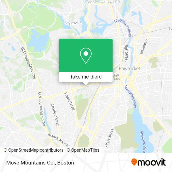
See Move Mountains Co., Boston, on the map
Public Transit to Move Mountains Co. in Boston
Wondering how to get to Move Mountains Co. in Boston? Moovit helps you find the best way to get to Move Mountains Co. with step-by-step directions from the nearest public transit station.
Moovit provides free maps and live directions to help you navigate through your city. View schedules, routes, timetables, and find out how long does it take to get to Move Mountains Co. in real time.
Looking for the nearest stop or station to Move Mountains Co.? Check out this list of stops closest to your destination: Lonsdale & Mineral Spring (Samuel Slater School); Weeden Opposite Hazel; Pawtucket/Central Falls.
Bus: 1, 72, 73.Train: PROVIDENCE/STOUGHTON, FOXBORO EVENT SERVICE.
Want to see if there’s another route that gets you there at an earlier time? Moovit helps you find alternative routes or times. Get directions from and directions to Move Mountains Co. easily from the Moovit App or Website.
We make riding to Move Mountains Co. easy, which is why over 1.7 million users, including users in Boston, trust Moovit as the best app for public transit. You don’t need to download an individual bus app or train app, Moovit is your all-in-one transit app that helps you find the best bus time or train time available.
For information on prices of bus and train, costs and ride fares to Move Mountains Co., please check the Moovit app.
Use the app to navigate to popular places including to the airport, hospital, stadium, grocery store, mall, coffee shop, school, college, and university.
Move Mountains Co. Address: 560 Mineral Spring Ave street in Boston
- Figmints Design,
- Heirloom Restoration & Repair,
- Ecmd,
- K Gottfried,
- Colonial Mi,
- Fairy Magic Scar Removal,
- Safari Modeling,
- Roxy Makeup Artist,
- Federation of Aboriginal Nations of the Americas,
- Appliance Repair in My City,
- KeyMe,
- 401 Gourmet Inc.,
- Carlos Gonzalez,
- Gameday Fitness,
- Crooked Current Br,
- Teresa Sweet Photography,
- Gloss Temple of Feminization,
- Anchor Upholstery,
- T.K.O Furniture Design,
- Fireworks Ri
Places Near Move Mountains Co. (Boston)
- Boston Medical Center, Boston,
- Leader Bank Pavilion (Leader Bank Pavillion), Boston,
- House Of Blues, Boston,
- Mgm Music Hall, Boston,
- Museum Of Science, Boston,
- Castle Island, Boston,
- Boston Convention & Exhibition Center, Boston,
- Isabella Stewart Gardner Museum, Boston,
- Td Garden, Boston,
- Wang Theater, Boston,
- Massachusetts General Hospital, Boston,
- Quincy Market, Boston,
- Boston Common, Boston,
- North End, Boston,
- Wilbur Theatre, Boston,
- Seaport District, Boston,
- Cheers, Boston,
- Faneuil Hall, Boston,
- Boston Children's Hospital, Boston,
- Prudential Center, Boston
How to get to popular places in Boston with public transit
Get around Boston by public transit!
Traveling around Boston has never been so easy. See step by step directions as you travel to any attraction, street or major public transit station. View bus and train schedules, arrival times, service alerts and detailed routes on a map, so you know exactly how to get to anywhere in Boston.
When traveling to any destination around Boston use Moovit's Live Directions with Get Off Notifications to know exactly where and how far to walk, how long to wait for your line, and how many stops are left. Moovit will alert you when it's time to get off — no need to constantly re-check whether yours is the next stop.
Wondering how to use public transit in Boston or how to pay for public transit in Boston? Moovit public transit app can help you navigate your way with public transit easily, and at minimum cost. It includes public transit fees, ticket prices, and costs. Looking for a map of Boston public transit lines? Moovit public transit app shows all public transit maps in Boston with all Bus, Train, Subway and Ferry routes and stops on an interactive map.
Boston has 4 transit type(s), including: Bus, Train, Subway and Ferry, operated by several transit agencies, including MBTA, Southeastern Regional Transit Authority, MetroWest Regional Transit Authority, Rhode Island Public Transit Authority, WRTA, Lowell Regional Transit Authority, Merrimack Valley Transit, Montachusett Regional Transit Authority, Cape Cod Regional Transit Authority, Brockton Area Transit Authority, Martha's Vineyard Transit Authority, the WAVE - Nantucket Regional Transit Authority, GATRA, Cape Ann Transportation Authority and Massport