Directions to Moving (Guapimirim) with public transportation
The following transit lines have routes that pass near Moving
 Bus: 196C, 800I, 805I, TERESÓPOLIS - RIO DE JANEIRO, GUAPIMIRIM - CITROLÂNDIA.
- Train: EXTENSÃO GUAPIMIRIM.
How to get to Moving by bus?
Click on the bus route to see step by step directions with maps, line arrival times and updated time schedules.
From Taquara, Duque De Caxias
121 minFrom Magé, Magé
65 minFrom Rodovia BR-101, Km 298 s/n, Itaboraí
84 minFrom SESC Nogueira, Petrópolis
258 minFrom Itaboraí, Itaboraí
116 minFrom Praia de Mauá, Magé
96 minFrom Itaipava, Petrópolis
265 minFrom Ponto Final TREL - PETRÓPOLIS X PIABETÁ, Petrópolis
136 minFrom Presidio Romeiro Neto Mage, Magé
71 minFrom Petrópolis, Petrópolis
149 min
Bus stops near Moving in Guapimirim
Train station near Moving in Guapimirim
- Parada Bananal, 10 min walk,VIEW
Bus lines to Moving in Guapimirim
- BARREIRA - CITROLÂNDIA (VIA PREFEITURA), Barreira - Citrolândia (Via Prefeitura),VIEW
- PARADA MODELO - BARREIRA, Parada Modelo - Barreira,VIEW
- PARAÍSO - LIMOEIRO, Paraíso - Limoeiro,VIEW
- TERESÓPOLIS - MAGÉ, Teresópolis - Magé,VIEW
- LINHA 2, Parque Santa Eugênia - Limoeiro (Via Guapimirim),VIEW
- LINHA 3, Paraíso - Barreira (Via Guapimirim),VIEW
- MS11, Teresópolis - Guapimirim [Via BR-116, Parada Modelo],VIEW
- MS200, Teresópolis - Guapimirim (Parada Modelo),VIEW
- 800I, Magé - Caneca Fina,VIEW
- 805I, Magé - Paraíso,VIEW
- GUAPIMIRIM - CITROLÂNDIA, Guapimirim (Via Prefeitura),VIEW
- JARDIM GUAPIMIRIM - CANECA FINA (VIA GUAPIMIRIM), Jardim Guapimirim,VIEW
- LINHA 1, Caneca Fina,VIEW
- MB15, Magé,VIEW
- MB16, Caxias,VIEW
- 195C, Guapimirim (Seletiva),VIEW
- 2195C (EXECUTIVO), Guapimirim,VIEW
What are the closest stations to Moving?
The closest stations to Moving are:
- Avenida Dedo De Deus, 470 is 144 meters away, 3 min walk.
- Avenida Dedo De Deus, 491 is 144 meters away, 3 min walk.
- Avenida Itá, 114-154 is 603 meters away, 9 min walk.
- Parada Bananal is 783 meters away, 10 min walk.
Which bus lines stop near Moving?
These bus lines stop near Moving: 196C, 800I, 805I, TERESÓPOLIS - RIO DE JANEIRO.
What’s the nearest train station to Moving in Guapimirim?
The nearest train station to Moving in Guapimirim is Parada Bananal. It’s a 10 min walk away.
What’s the nearest bus station to Moving in Guapimirim?
The nearest bus stations to Moving in Guapimirim are Avenida Dedo De Deus, 470 and Avenida Dedo De Deus, 491. The closest one is a 3 min walk away.
What time is the first train to Moving in Guapimirim?
The EXTENSÃO GUAPIMIRIM is the first train that goes to Moving in Guapimirim. It stops nearby at 3:55 AM.
What time is the last train to Moving in Guapimirim?
The EXTENSÃO GUAPIMIRIM is the last train that goes to Moving in Guapimirim. It stops nearby at 8:45 PM.
What time is the first bus to Moving in Guapimirim?
The 196C is the first bus that goes to Moving in Guapimirim. It stops nearby at 4:40 AM.
What time is the last bus to Moving in Guapimirim?
The 196C is the last bus that goes to Moving in Guapimirim. It stops nearby at 1:55 AM.
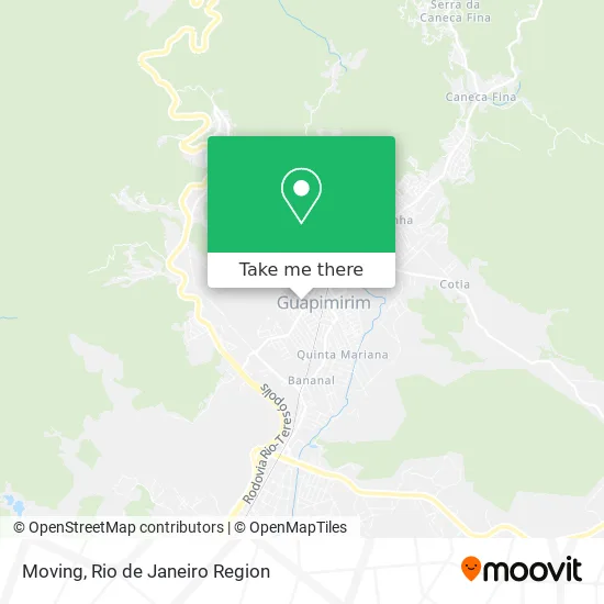
See Moving, Guapimirim, on the map
Public Transit to Moving in Guapimirim
Wondering how to get to Moving in Guapimirim? Moovit helps you find the best way to get to Moving with step-by-step directions from the nearest public transit station.
Moovit provides free maps and live directions to help you navigate through your city. View schedules, routes, timetables, and find out how long does it take to get to Moving in real time.
Looking for the nearest stop or station to Moving? Check out this list of stops closest to your destination: Avenida Dedo De Deus; Avenida Dedo De Deus; Avenida Itá; Parada Bananal.
Bus: 196C, 800I, 805I, TERESÓPOLIS - RIO DE JANEIRO, GUAPIMIRIM - CITROLÂNDIA, BARREIRA - CITROLÂNDIA (VIA PREFEITURA), PARADA MODELO - BARREIRA, PARAÍSO - LIMOEIRO, TERESÓPOLIS - MAGÉ, LINHA 2, JARDIM GUAPIMIRIM - CANECA FINA (VIA GUAPIMIRIM), LINHA 1, MB15, MB16, 195C.Train: EXTENSÃO GUAPIMIRIM.
Want to see if there’s another route that gets you there at an earlier time? Moovit helps you find alternative routes or times. Get directions from and directions to Moving easily from the Moovit App or Website.
We make riding to Moving easy, which is why over 1.5 million users, including users in Guapimirim, trust Moovit as the best app for public transit. You don’t need to download an individual bus app or train app, Moovit is your all-in-one transit app that helps you find the best bus time or train time available.
For information on prices of bus, costs and ride fares to Moving, please check the Moovit app.
Use the app to navigate to popular places including to the airport, hospital, stadium, grocery store, mall, coffee shop, school, college, and university.
Moving Address: Rua Pedro Rufino street in Guapimirim
- Horto Colibri,
- Sumicity 💻,
- New World,
- Auto Escola Guapi,
- Espaço J,
- Bar e Deposito de Bebidas da Vera,
- Vila Recreio,
- Haras Vianna Vcv,
- Casa de Oração Guapimirim,
- Prefeitura de Guapimirim,
- Guapi Shopping,
- SOS Baterias Guapimirim,
- Bg Fest Casa de Festa,
- Rua Itacoatiara,
- orquidário santa clara,
- Espaço Granlem,
- Stilo,
- "Toca da Traira" Cantinho do Sabor,
- Roda d'Agua,
- Clinvet Guapimirim
Places Near Moving (Guapimirim)
- Feira Livre da Gloria, Glória,
- Norte Shopping, Cachambi,
- Shopping RioSul, Botafogo,
- Shopping Rio Sul, Botafogo,
- Niterói, Niterói,
- Rua Ulysses Guimarães 16, Cidade Nova,
- Rio De Janeiro,
- Hospital Federal Cardoso Fontes, Jacarepaguá,
- Rodoviária Novo Rio (Rodoviária do Rio de Janeiro), Santo Cristo,
- Feirão De Malhas, Duque De Caxias,
- Avenida Venezuela 134, Saúde,
- Shopping Downtown, Barra Da Tijuca,
- Hospital Municipal Ronaldo Gazolla, Acari,
- Hospital Federal Do Andaraí, Andaraí,
- Hospital Pedro Ernesto, Vila Isabel,
- Museu Do Amanhã, Centro,
- Praia do Arpoador, Ipanema,
- Avenida Rio Branco, Centro,
- Rua Licínio Cardoso, São Francisco Xavier,
- Shopping Nova América, Del Castilho
How to get to popular places in Rio de Janeiro Region with public transit
Get around Guapimirim by public transit!
Traveling around Guapimirim has never been so easy. See step by step directions as you travel to any attraction, street or major public transit station. View bus and train schedules, arrival times, service alerts and detailed routes on a map, so you know exactly how to get to anywhere in Guapimirim.
When traveling to any destination around Guapimirim use Moovit's Live Directions with Get Off Notifications to know exactly where and how far to walk, how long to wait for your line, and how many stops are left. Moovit will alert you when it's time to get off — no need to constantly re-check whether yours is the next stop.
Wondering how to use public transit in Guapimirim or how to pay for public transit in Guapimirim? Moovit public transit app can help you navigate your way with public transit easily, and at minimum cost. It includes public transit fees, ticket prices, and costs. Looking for a map of Guapimirim public transit lines? Moovit public transit app shows all public transit maps in Guapimirim with all Bus, Train, Metro, Light Rail, Ferry, Cable Car, Gondola and Funicular routes and stops on an interactive map.
Rio de Janeiro Region has 8 transit type(s), including: Bus, Train, Metro, Light Rail, Ferry, Cable Car, Gondola and Funicular, operated by several transit agencies, including TrensRJ, Metrô Rio, VLT Carioca, Barcas Rio, BRT MOBI-Rio, Auto Viação Alpha, Auto Viação Tijuca, Gire Transportes, Transurb, Viação Nossa Senhora das Graças, Consórcio INTERSUL, Braso Lisboa (Municipal), Caprichosa Auto Ônibus, Auto Viação Três Amigos and Rodoviária Âncora Matias