Directions to Mp Business Assistance (Everett) with public transportation
The following transit lines have routes that pass near Mp Business Assistance
 Bus: 104, 109, 97, 110, 112.
- Train: NEWBURYPORT/ROCKPORT.
- Subway: ORANGE LINE.
How to get to Mp Business Assistance by bus?
Click on the bus route to see step by step directions with maps, line arrival times and updated time schedules.
From Choi's Health Spa, Saugus
46 minFrom Boston Marathon Finish Line, Boston
65 minFrom Homewood Suites by Hilton Boston Brookline-Longwood Medical, Brookline
83 minFrom Jamaica Plain VA Medical Center (VA Hospital), Boston
77 minFrom Central Square, Cambridge
37 minFrom Legal Harborside, Boston
39 minFrom Jamaica Plain V.A., Boston
76 minFrom Uphams Corner, Boston
98 minFrom John Hancock Tower, Boston
65 minFrom MBTA Jackson Square Station, Boston
80 min
How to get to Mp Business Assistance by subway?
Click on the subway route to see step by step directions with maps, line arrival times and updated time schedules.
From Boston Marathon Finish Line, Boston
53 minFrom Homewood Suites by Hilton Boston Brookline-Longwood Medical, Brookline
78 minFrom Jamaica Plain VA Medical Center (VA Hospital), Boston
78 minFrom Central Square, Cambridge
54 minFrom Legal Harborside, Boston
68 minFrom Jamaica Plain V.A., Boston
79 minFrom Uphams Corner, Boston
69 minFrom John Hancock Tower, Boston
53 minFrom MBTA Jackson Square Station, Boston
55 min
Bus stops near Mp Business Assistance in Everett
Subway station near Mp Business Assistance in Everett
- Wellington, 40 min walk,VIEW
Train station near Mp Business Assistance in Everett
- Chelsea, 43 min walk,VIEW
Bus lines to Mp Business Assistance in Everett
What are the closest stations to Mp Business Assistance?
The closest stations to Mp Business Assistance are:
- Second St @ Revere St is 38 yards away, 1 min walk.
- Broadway @ Church St is 155 yards away, 2 min walk.
- Chelsea St @ Cabot St is 300 yards away, 4 min walk.
- Wellington is 3419 yards away, 40 min walk.
- Chelsea is 3442 yards away, 43 min walk.
Which bus lines stop near Mp Business Assistance?
These bus lines stop near Mp Business Assistance: 104, 109, 97.
Which subway line stops near Mp Business Assistance?
ORANGE LINE (Oak Grove)
What’s the nearest bus station to Mp Business Assistance in Everett?
The nearest bus station to Mp Business Assistance in Everett is Second St @ Revere St. It’s a 1 min walk away.
What time is the first subway to Mp Business Assistance in Everett?
The ORANGE LINE is the first subway that goes to Mp Business Assistance in Everett. It stops nearby at 5:19 AM.
What time is the last subway to Mp Business Assistance in Everett?
The ORANGE LINE is the last subway that goes to Mp Business Assistance in Everett. It stops nearby at 1:53 AM.
What time is the first train to Mp Business Assistance in Everett?
The NEWBURYPORT/ROCKPORT is the first train that goes to Mp Business Assistance in Everett. It stops nearby at 5:40 AM.
What time is the last train to Mp Business Assistance in Everett?
The NEWBURYPORT/ROCKPORT is the last train that goes to Mp Business Assistance in Everett. It stops nearby at 12:06 AM.
What time is the first bus to Mp Business Assistance in Everett?
The 104 is the first bus that goes to Mp Business Assistance in Everett. It stops nearby at 4:35 AM.
What time is the last bus to Mp Business Assistance in Everett?
The 110 is the last bus that goes to Mp Business Assistance in Everett. It stops nearby at 2:09 AM.
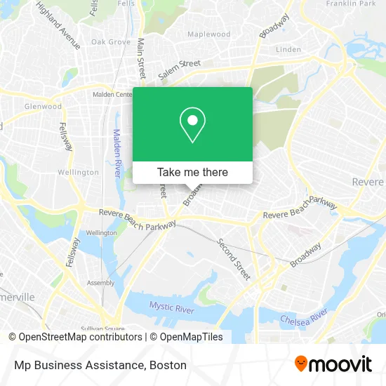
See Mp Business Assistance, Everett, on the map
Public Transit to Mp Business Assistance in Everett
Wondering how to get to Mp Business Assistance in Everett? Moovit helps you find the best way to get to Mp Business Assistance with step-by-step directions from the nearest public transit station.
Moovit provides free maps and live directions to help you navigate through your city. View schedules, routes, timetables, and find out how long does it take to get to Mp Business Assistance in real time.
Looking for the nearest stop or station to Mp Business Assistance? Check out this list of stops closest to your destination: Second St @ Revere St; Broadway @ Church St; Chelsea St @ Cabot St; Wellington; Chelsea.
Bus: 104, 109, 97, 110, 112.Train: NEWBURYPORT/ROCKPORT.Subway: ORANGE LINE.
Want to see if there’s another route that gets you there at an earlier time? Moovit helps you find alternative routes or times. Get directions from and directions to Mp Business Assistance easily from the Moovit App or Website.
We make riding to Mp Business Assistance easy, which is why over 1.7 million users, including users in Everett, trust Moovit as the best app for public transit. You don’t need to download an individual bus app or train app, Moovit is your all-in-one transit app that helps you find the best bus time or train time available.
For information on prices of bus and subway, costs and ride fares to Mp Business Assistance, please check the Moovit app.
Use the app to navigate to popular places including to the airport, hospital, stadium, grocery store, mall, coffee shop, school, college, and university.
Location: Everett, Boston
- Zip Property Management Boston,
- Narconon,
- Khalid Karkache,
- Faster English Boston,
- VIVI Nails,
- Nick Cerios Kenpo Karate,
- Tachic,
- Igreja Universal,
- Chimney Doctor Plus,
- Talent Barbershop,
- Everett, Massachusetts,
- La Hacienda,
- Flavia Leal Beauty School (Flavia Leal Beauty Creator's Academy),
- Father's House Chu,
- Iglesia Pentecostal Unida Hispana,Inc.,
- Elim Boston,
- Ingles,
- Anthony Pisapia Licensed Electrician,
- David Home Expert,
- Camila Santana
Places Near Mp Business Assistance (Everett)
- Cheers, Boston,
- Boston Children's Hospital, Boston,
- Boston Medical Center, Boston,
- Prudential Center, Boston,
- Boston Convention & Exhibition Center, Boston,
- Wilbur Theatre, Boston,
- Quincy Market, Boston,
- Castle Island, Boston,
- Mgm Music Hall, Boston,
- House Of Blues, Boston,
- Isabella Stewart Gardner Museum, Boston,
- Td Garden, Boston,
- Seaport District, Boston,
- North End, Boston,
- Museum Of Science, Boston,
- Massachusetts General Hospital, Boston,
- Leader Bank Pavilion (Leader Bank Pavillion), Boston,
- Boston Common, Boston,
- Wang Theater, Boston,
- Faneuil Hall, Boston
How to get to popular places in Boston with public transit
Get around Everett by public transit!
Traveling around Everett has never been so easy. See step by step directions as you travel to any attraction, street or major public transit station. View bus and train schedules, arrival times, service alerts and detailed routes on a map, so you know exactly how to get to anywhere in Everett.
When traveling to any destination around Everett use Moovit's Live Directions with Get Off Notifications to know exactly where and how far to walk, how long to wait for your line, and how many stops are left. Moovit will alert you when it's time to get off — no need to constantly re-check whether yours is the next stop.
Wondering how to use public transit in Everett or how to pay for public transit in Everett? Moovit public transit app can help you navigate your way with public transit easily, and at minimum cost. It includes public transit fees, ticket prices, and costs. Looking for a map of Everett public transit lines? Moovit public transit app shows all public transit maps in Everett with all Bus, Train, Subway and Ferry routes and stops on an interactive map.
Boston has 4 transit type(s), including: Bus, Train, Subway and Ferry, operated by several transit agencies, including MBTA, Southeastern Regional Transit Authority, MetroWest Regional Transit Authority, Rhode Island Public Transit Authority, WRTA, Lowell Regional Transit Authority, Merrimack Valley Transit, Montachusett Regional Transit Authority, Cape Cod Regional Transit Authority, Brockton Area Transit Authority, Martha's Vineyard Transit Authority, the WAVE - Nantucket Regional Transit Authority, GATRA, Cape Ann Transportation Authority and Massport