Directions to Mr D. Desserts (Boston) with public transportation
The following transit lines have routes that pass near Mr D. Desserts
 Bus: 1, 10, 15, CT3, 41.
- Train: FAIRMOUNT, FRANKLIN/FOXBORO, PROVIDENCE/STOUGHTON, FALL RIVER/NEW BEDFORD, GREENBUSH.
- Subway: RED LINE.
How to get to Mr D. Desserts by bus?
Click on the bus route to see step by step directions with maps, line arrival times and updated time schedules.
From Academy Of the Pacific Rim Charter Public School, Boston
75 minFrom Heartbreak Hill, Newton
56 minFrom Everett, MA, Everett
94 minFrom AC Hotel by Marriott Boston Cleveland Circle, Boston
71 minFrom Target, Everett
104 minFrom Newton, MA, Newton
57 minFrom Hampton Inn Boston Logan Airport, Revere
66 minFrom Medford, MA, Medford
92 minFrom Terminal E- Logan International Airport, Boston
55 minFrom Terminal B- Logan International Airport, Boston
58 min
How to get to Mr D. Desserts by train?
Click on the train route to see step by step directions with maps, line arrival times and updated time schedules.
How to get to Mr D. Desserts by subway?
Click on the subway route to see step by step directions with maps, line arrival times and updated time schedules.
From Heartbreak Hill, Newton
83 minFrom Terminal E- Logan International Airport, Boston
51 minFrom AC Hotel by Marriott Boston Cleveland Circle, Boston
64 minFrom Target, Everett
59 minFrom Terminal B- Logan International Airport, Boston
67 minFrom Newton, MA, Newton
82 minFrom Hampton Inn Boston Logan Airport, Revere
71 minFrom Medford, MA, Medford
73 min
Bus stops near Mr D. Desserts in Boston
Bus lines to Mr D. Desserts in Boston
What are the closest stations to Mr D. Desserts?
The closest stations to Mr D. Desserts are:
- Dudley St @ Howard Ave is 277 yards away, 4 min walk.
- Blue Hill Ave @ Dudley St is 295 yards away, 4 min walk.
- Massachusetts Ave @ Magazine St is 351 yards away, 5 min walk.
- Newmarket Sq @ Massachusetts Ave1024 is 552 yards away, 7 min walk.
- Newmarket is 1397 yards away, 17 min walk.
- Jfk/Umass is 2131 yards away, 26 min walk.
Which bus lines stop near Mr D. Desserts?
These bus lines stop near Mr D. Desserts: 1, 10, 15, CT3.
Which train line stops near Mr D. Desserts?
FAIRMOUNT (#1619 | Fairmount)
Which subway line stops near Mr D. Desserts?
RED LINE (Ashmont/Braintree)
What’s the nearest train station to Mr D. Desserts in Boston?
The nearest train station to Mr D. Desserts in Boston is Newmarket. It’s a 17 min walk away.
What’s the nearest bus station to Mr D. Desserts in Boston?
The nearest bus stations to Mr D. Desserts in Boston are Dudley St @ Howard Ave and Blue Hill Ave @ Dudley St. The closest one is a 4 min walk away.
What time is the first subway to Mr D. Desserts in Boston?
The RED LINE is the first subway that goes to Mr D. Desserts in Boston. It stops nearby at 5:21 AM.
What time is the last subway to Mr D. Desserts in Boston?
The RED LINE is the last subway that goes to Mr D. Desserts in Boston. It stops nearby at 1:57 AM.
What time is the first train to Mr D. Desserts in Boston?
The FAIRMOUNT is the first train that goes to Mr D. Desserts in Boston. It stops nearby at 4:47 AM.
What time is the last train to Mr D. Desserts in Boston?
The FAIRMOUNT is the last train that goes to Mr D. Desserts in Boston. It stops nearby at 11:57 PM.
What time is the first bus to Mr D. Desserts in Boston?
The 15 is the first bus that goes to Mr D. Desserts in Boston. It stops nearby at 3:36 AM.
What time is the last bus to Mr D. Desserts in Boston?
The 10 is the last bus that goes to Mr D. Desserts in Boston. It stops nearby at 1:27 AM.
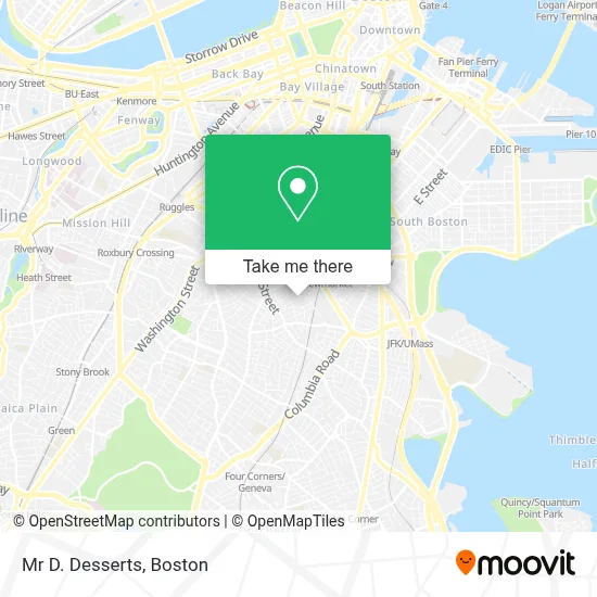
See Mr D. Desserts, Boston, on the map
Public Transit to Mr D. Desserts in Boston
Wondering how to get to Mr D. Desserts in Boston? Moovit helps you find the best way to get to Mr D. Desserts with step-by-step directions from the nearest public transit station.
Moovit provides free maps and live directions to help you navigate through your city. View schedules, routes, timetables, and find out how long does it take to get to Mr D. Desserts in real time.
Looking for the nearest stop or station to Mr D. Desserts? Check out this list of stops closest to your destination: Dudley St @ Howard Ave; Blue Hill Ave @ Dudley St; Massachusetts Ave @ Magazine St; Newmarket Sq @ Massachusetts Ave1024; Newmarket; Jfk/Umass.
Bus: 1, 10, 15, CT3, 41, 45, 8, FAIRMOUNT LINE SHUTTLE.Train: FAIRMOUNT, FRANKLIN/FOXBORO, PROVIDENCE/STOUGHTON, FALL RIVER/NEW BEDFORD, GREENBUSH, KINGSTON, RED LINE.Subway: RED LINE.
Want to see if there’s another route that gets you there at an earlier time? Moovit helps you find alternative routes or times. Get directions from and directions to Mr D. Desserts easily from the Moovit App or Website.
We make riding to Mr D. Desserts easy, which is why over 1.7 million users, including users in Boston, trust Moovit as the best app for public transit. You don’t need to download an individual bus app or train app, Moovit is your all-in-one transit app that helps you find the best bus time or train time available.
For information on prices of bus, subway and train, costs and ride fares to Mr D. Desserts, please check the Moovit app.
Use the app to navigate to popular places including to the airport, hospital, stadium, grocery store, mall, coffee shop, school, college, and university.
Mr D. Desserts Address: 94 Shirley St street in Boston
- Ces 258,
- Noon Mediterranean,
- Wei's Yunnan Rice Noodles,
- Pizza Bae,
- Wingz and Tingz,
- Palmita,
- Issa Onigiri,
- Ben's Fast Food,
- Pasta Tana's,
- Kemet,
- Mini Donut Diva,
- Redred Kitchen,
- Arc Document Solutions,
- Bully Boy Distillers,
- 65 Burrell St Parking,
- Rules of Attraction Salon,
- Be Our Guest (Showroom),
- Flores Electrical,
- Locks Rekey,
- DVM Consulting
Places Near Mr D. Desserts (Boston)
- Boston Children's Hospital, Boston,
- Boston Common, Boston,
- Td Garden, Boston,
- Castle Island, Boston,
- Museum Of Science, Boston,
- North End, Boston,
- Leader Bank Pavilion (Leader Bank Pavillion), Boston,
- Boston Medical Center, Boston,
- Wilbur Theatre, Boston,
- Prudential Center, Boston,
- Wang Theater, Boston,
- Boston Convention & Exhibition Center, Boston,
- Massachusetts General Hospital, Boston,
- House Of Blues, Boston,
- Seaport District, Boston,
- Faneuil Hall, Boston,
- Quincy Market, Boston,
- Cheers, Boston,
- Isabella Stewart Gardner Museum, Boston,
- Mgm Music Hall, Boston
How to get to popular places in Boston with public transit
Get around Boston by public transit!
Traveling around Boston has never been so easy. See step by step directions as you travel to any attraction, street or major public transit station. View bus and train schedules, arrival times, service alerts and detailed routes on a map, so you know exactly how to get to anywhere in Boston.
When traveling to any destination around Boston use Moovit's Live Directions with Get Off Notifications to know exactly where and how far to walk, how long to wait for your line, and how many stops are left. Moovit will alert you when it's time to get off — no need to constantly re-check whether yours is the next stop.
Wondering how to use public transit in Boston or how to pay for public transit in Boston? Moovit public transit app can help you navigate your way with public transit easily, and at minimum cost. It includes public transit fees, ticket prices, and costs. Looking for a map of Boston public transit lines? Moovit public transit app shows all public transit maps in Boston with all Bus, Train, Subway and Ferry routes and stops on an interactive map.
Boston has 4 transit type(s), including: Bus, Train, Subway and Ferry, operated by several transit agencies, including MBTA, Southeastern Regional Transit Authority, MetroWest Regional Transit Authority, Rhode Island Public Transit Authority, WRTA, Lowell Regional Transit Authority, Merrimack Valley Transit, Montachusett Regional Transit Authority, Cape Cod Regional Transit Authority, Brockton Area Transit Authority, Martha's Vineyard Transit Authority, the WAVE - Nantucket Regional Transit Authority, GATRA, Cape Ann Transportation Authority and Massport