Directions to Msd Decatur Township (Indianapolis City (Balance)) with public transportation
The following transit lines have routes that pass near Msd Decatur Township
 Bus: 24.
How to get to Msd Decatur Township by bus?
Click on the bus route to see step by step directions with maps, line arrival times and updated time schedules.
From AMC Theatres-Indianapolis 17 (AMC Showplace 17 IMAX), Indianapolis City (Balance)
104 minFrom Yrc/Usf Drop Lot, Indianapolis City (Balance)
58 minFrom Ronald Reagan Pkwy / W Washington St, Plainfield
120 minFrom Eli Lilly LTC South, Indianapolis City (Balance)
59 minFrom Eli Lilly Corporate Center 31/5 Queen Mary, Indianapolis City (Balance)
142 minFrom HomeGoods, Avon
132 minFrom Expo Design, Indianapolis City (Balance)
50 minFrom Budget, Indianapolis City (Balance)
96 minFrom Interstate 70 & Holt Rd, Indianapolis City (Balance)
43 min
Bus stop near Msd Decatur Township in Indianapolis City (Balance)
- Gatwick Dr & Decatur Blvd, 8 min walk,VIEW
Bus lines to Msd Decatur Township in Indianapolis City (Balance)
- 24, Ameriplex,VIEW
What are the closest stations to Msd Decatur Township?
The closest stations to Msd Decatur Township are:
- Gatwick Dr & Decatur Blvd is 621 yards away, 8 min walk.
Which bus line stops near Msd Decatur Township?
24 (Ameriplex)
What’s the nearest bus station to Msd Decatur Township in Indianapolis City (Balance)?
The nearest bus station to Msd Decatur Township in Indianapolis City (Balance) is Gatwick Dr & Decatur Blvd. It’s a 8 min walk away.
What time is the first bus to Msd Decatur Township in Indianapolis City (Balance)?
The 24 is the first bus that goes to Msd Decatur Township in Indianapolis City (Balance). It stops nearby at 5:22 AM.
What time is the last bus to Msd Decatur Township in Indianapolis City (Balance)?
The 24 is the last bus that goes to Msd Decatur Township in Indianapolis City (Balance). It stops nearby at 10:04 PM.
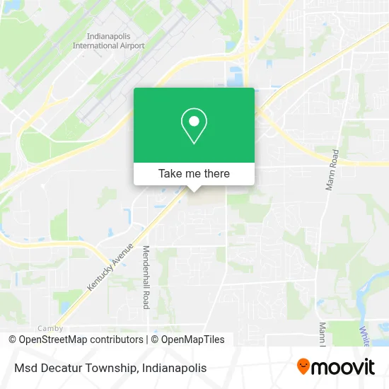
See Msd Decatur Township, Indianapolis City (Balance), on the map
Public Transit to Msd Decatur Township in Indianapolis City (Balance)
Wondering how to get to Msd Decatur Township in Indianapolis City (Balance)? Moovit helps you find the best way to get to Msd Decatur Township with step-by-step directions from the nearest public transit station.
Moovit provides free maps and live directions to help you navigate through your city. View schedules, routes, timetables, and find out how long does it take to get to Msd Decatur Township in real time.
Looking for the nearest stop or station to Msd Decatur Township? Check out this list of stops closest to your destination: Gatwick Dr & Decatur Blvd.
Bus: 24.
Want to see if there’s another route that gets you there at an earlier time? Moovit helps you find alternative routes or times. Get directions from and directions to Msd Decatur Township easily from the Moovit App or Website.
We make riding to Msd Decatur Township easy, which is why over 1.5 million users, including users in Indianapolis City (Balance), trust Moovit as the best app for public transit. You don’t need to download an individual bus app or train app, Moovit is your all-in-one transit app that helps you find the best bus time or train time available.
For information on prices of bus, costs and ride fares to Msd Decatur Township, please check the Moovit app.
Use the app to navigate to popular places including to the airport, hospital, stadium, grocery store, mall, coffee shop, school, college, and university.
Msd Decatur Township Address: 5275 S Kentucky Ave street in Indianapolis City (Balance)
- St Vincent Hosp & Health Care Center,
- Valley Mills, Indiana,
- MERRELL,
- Coin Cloud Bitcoin ATM,
- Footworks (Foot Works),
- Hot Stylz Barber Shop,
- High Caliber Tattoo 67,
- Yoyo Spa,
- Toa USA,
- Checkers,
- Valley Mills Elementary Schhol,
- DAMAR Charter School,
- Killion & Hall Insurance Agency,
- Reco Commercial Systems,
- 4 Sale by Scott,
- Strength Martial Arts Academy,
- Humble Beginnings South,
- Starmaker Studio For Performing Arts,
- Bluegrass Equipment and Small Engine Service,
- Hydro-Gear
Places Near Msd Decatur Township (Indianapolis City (Balance))
- St. Vincent entrance #1, Indianapolis City (Balance),
- I-465 / I-65 Interchange, Indianapolis City (Balance),
- Indianapolis Airport Zone 2, Indianapolis City (Balance),
- I U Health Methodist Hospital, Indianapolis City (Balance),
- Plainfield, IN, Plainfield,
- Methodist Hospital of Indianapolis, Indianapolis City (Balance),
- Lucas Oil Stadium, Indianapolis City (Balance),
- Castleton Square Mall, Indianapolis,
- Train Ride At Castleton Mall, Indianapolis City (Balance),
- Indianapolis Motor Speedway, Speedway,
- St. Vincent Hospital - Indianapolis, Indianapolis City (Balance),
- Cotter's Massage Parlor With Happy Endings, Indianapolis City (Balance),
- THE BALT, Indianapolis City (Balance),
- Jersey Barn, Indianapolis City (Balance),
- Eskenazi Hospital, Indianapolis City (Balance),
- Indiana, Indianapolis City (Balance),
- Indiana Convention Center, Indianapolis City (Balance),
- Gainbridge Fieldhouse, Indianapolis City (Balance),
- Lilly Corporate Center (Eli Lilly & Co), Indianapolis City (Balance),
- 119 W 19th St Parking, Indianapolis City (Balance)
How to get to popular places in Indianapolis with public transit
Get around Indianapolis City (Balance) by public transit!
Traveling around Indianapolis City (Balance) has never been so easy. See step by step directions as you travel to any attraction, street or major public transit station. View bus and train schedules, arrival times, service alerts and detailed routes on a map, so you know exactly how to get to anywhere in Indianapolis City (Balance).
When traveling to any destination around Indianapolis City (Balance) use Moovit's Live Directions with Get Off Notifications to know exactly where and how far to walk, how long to wait for your line, and how many stops are left. Moovit will alert you when it's time to get off — no need to constantly re-check whether yours is the next stop.
Wondering how to use public transit in Indianapolis City (Balance) or how to pay for public transit in Indianapolis City (Balance)? Moovit public transit app can help you navigate your way with public transit easily, and at minimum cost. It includes public transit fees, ticket prices, and costs. Looking for a map of Indianapolis City (Balance) public transit lines? Moovit public transit app shows all public transit maps in Indianapolis City (Balance) with all bus routes and stops on an interactive map.
Indianapolis has 1 transit type(s), including: bus, operated by several transit agencies, including IndyGo, FlixBus-us and Greyhound-us