Directions to Mt Washington Arboretum (Baltimore) with public transportation
The following transit lines have routes that pass near Mt Washington Arboretum
How to get to Mt Washington Arboretum by bus?
Click on the bus route to see step by step directions with maps, line arrival times and updated time schedules.
How to get to Mt Washington Arboretum by metro?
Click on the metro route to see step by step directions with maps, line arrival times and updated time schedules.
Bus stations near Mt Washington Arboretum in Baltimore
- Kelly Ave & Sulgrave Ave Eb,3 min walk,
- Kelly Ave & Sulgrave Ave Wb,5 min walk,
Bus lines to Mt Washington Arboretum in Baltimore
- 94,Sinai Hospital,
- 33,Overlea,
- 34,Westview Mall,
What are the closest stations to Mt Washington Arboretum?
The closest stations to Mt Washington Arboretum are:
- Kelly Ave & Sulgrave Ave Eb is 223 yards away, 3 min walk.
- Kelly Ave & Sulgrave Ave Wb is 346 yards away, 5 min walk.
Which bus line stops near Mt Washington Arboretum?
94
Which metro line stops near Mt Washington Arboretum?
METRO
Which light rail line stops near Mt Washington Arboretum?
LIGHT RAIL
What’s the nearest bus stop to Mt Washington Arboretum in Baltimore?
The nearest bus stop to Mt Washington Arboretum in Baltimore is Kelly Ave & Sulgrave Ave Eb. It’s a 3 min walk away.
See Mt Washington Arboretum, Baltimore, on the map
Public Transit to Mt Washington Arboretum in Baltimore
Wondering how to get to Mt Washington Arboretum in Baltimore, United States? Moovit helps you find the best way to get to Mt Washington Arboretum with step-by-step directions from the nearest public transit station.
Moovit provides free maps and live directions to help you navigate through your city. View schedules, routes, timetables, and find out how long does it take to get to Mt Washington Arboretum in real time.
Looking for the nearest stop or station to Mt Washington Arboretum? Check out this list of stops closest to your destination: Kelly Ave & Sulgrave Ave Eb; Kelly Ave & Sulgrave Ave Wb.
Bus:943334Metro:METROLight Rail:LIGHT RAIL
Want to see if there’s another route that gets you there at an earlier time? Moovit helps you find alternative routes or times. Get directions from and directions to Mt Washington Arboretum easily from the Moovit App or Website.
We make riding to Mt Washington Arboretum easy, which is why over 1.5 million users, including users in Baltimore, trust Moovit as the best app for public transit. You don’t need to download an individual bus app or train app, Moovit is your all-in-one transit app that helps you find the best bus time or train time available.
For information on prices of bus, light rail and metro, costs and ride fares to Mt Washington Arboretum, please check the Moovit app.
Use the app to navigate to popular places including to the airport, hospital, stadium, grocery store, mall, coffee shop, school, college, and university.
Mt Washington Arboretum Address: Kelly Ave and Lochlea street in Baltimore
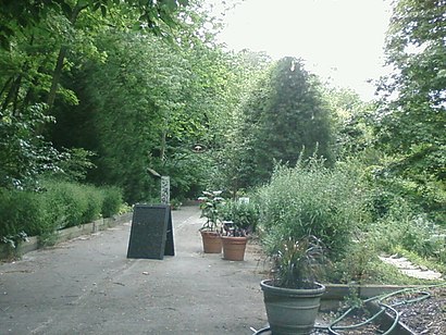
The Mt. Washington Arboretum is a 1-acre (4,000 m2) park with various trees, shrubs, and other plants in the Mt. Washington area of Baltimore.Wiki
Attractions near Mt Washington Arboretum
Chimes Curtis Hall Senior Living Center,Sacred Heart Roman Catholic Church,The Shrine Of The Sacred Heart,2000 South Rd,5818 Smith Ave,Johns Hopkins University-Mt Washington,JHU Cafeteria,Mt Washington Conference Center,Ernst Valery Investment,Finkelstein Daniel, MD,Hopkins Fellows' Quarterly,Animal Center of Mt. Washington,Village Vet,Mount Washington Conference Center Hotel Baltimore,Johns Hopkins MTW Fitness Center,Octagon,The Village Vet,Johns Hopkins at Mount Washington,Baltimore Clayworks,Mt. Washington Bus Stop ( 60, 58, 27 )How to get to popular attractions in Baltimore with public transit
Hank's Oyster Bar, Washington,Sticky Rice, Washington,Hyatt Regency Reston, Fairfax County,Damascus, MD, Montgomery County,Mount Vernon Place, Baltimore,Ebenezers Coffeehouse, Washington,Coastal Flats, Fairfax County,I-95 Exit 158: Prince William Pkwy, Prince William County,Teaism Penn Quarter, Washington,Peking Gourmet Inn, Fairfax County,Honey Pig Gooldaegee Korean Grill, Fairfax County,Lost Society, Washington,Union Pub, Washington,Uncle Julio's Rio Grande Cafe, Montgomery County,P.J. Clarke's, Washington,Pearl Dive Oyster Palace, Washington,Arlington Rooftop Bar & Grill, Arlington County,Tunnicliff's Tavern, Washington,Estadio, Washington,Maryland State Fairgrounds, Baltimore CountyGet around Baltimore by public transit!
Traveling around Baltimore has never been so easy. See step by step directions as you travel to any attraction, street or major public transit station. View bus and train schedules, arrival times, service alerts and detailed routes on a map, so you know exactly how to get to anywhere in Baltimore.
When traveling to any destination around Baltimore use Moovit's Live Directions with Get Off Notifications to know exactly where and how far to walk, how long to wait for your line, and how many stops are left. Moovit will alert you when it's time to get off — no need to constantly re-check whether yours is the next stop.
Wondering how to use public transit in Baltimore or how to pay for public transit in Baltimore? Moovit public transit app can help you navigate your way with public transit easily, and at minimum cost. It includes public transit fees, ticket prices, and costs. Looking for a map of Baltimore public transit lines? Moovit public transit app shows all public transit maps in Baltimore with all bus, light rail or metro routes and stops on an interactive map.
Baltimore has 3 transit type(s), including: bus, light rail or metro, operated by several transit agencies, including WMATA, WMATA, Montgomery County Ride On, Fairfax Connector, TheBus, DC Circulator, MDOT MTA, Marc, MDOT MTA, MDOT MTA, Virginia Railway Express (VRE), PRTC, DASH - Alexandria, Arlington Transit (ART) and DC Streetcar