See Muir Woods National Monument, San Francisco - San Jose, CA, on the map
Directions to Muir Woods National Monument (San Francisco - San Jose, CA) with public transportation
The following transit lines have routes that pass near Muir Woods National Monument
 Bus:
Bus:
How to get to Muir Woods National Monument by bus?
Click on the bus route to see step by step directions with maps, line arrival times and updated time schedules.
Bus stations near Muir Woods National Monument in San Francisco - San Jose, CA
- Panoramic Hwy & Bayview Dr,22 min walk,
Bus lines to Muir Woods National Monument in San Francisco - San Jose, CA
- 61,Sausalito,
What are the closest stations to Muir Woods National Monument?
The closest stations to Muir Woods National Monument are:
- Panoramic Hwy & Bayview Dr is 1892 yards away, 22 min walk.
Which bus line stops near Muir Woods National Monument?
17
What time is the first bus to Muir Woods National Monument in San Francisco - San Jose, CA?
The 61 is the first bus that goes to Muir Woods National Monument in San Francisco - San Jose, CA. It stops nearby at 7:22 AM.
What time is the last bus to Muir Woods National Monument in San Francisco - San Jose, CA?
The 61 is the last bus that goes to Muir Woods National Monument in San Francisco - San Jose, CA. It stops nearby at 7:15 PM.
How much is the bus fare to Muir Woods National Monument?
The bus fare to Muir Woods National Monument costs about $1.80 - $11.20.
How much is the light rail fare to Muir Woods National Monument?
The light rail fare to Muir Woods National Monument costs about $2.50.
See Muir Woods National Monument, San Francisco - San Jose, CA, on the map
Public Transit to Muir Woods National Monument in San Francisco - San Jose, CA
Wondering how to get to Muir Woods National Monument in San Francisco - San Jose, CA, United States? Moovit helps you find the best way to get to Muir Woods National Monument with step-by-step directions from the nearest public transit station.
Moovit provides free maps and live directions to help you navigate through your city. View schedules, routes, timetables, and find out how long does it take to get to Muir Woods National Monument in real time.
Looking for the nearest stop or station to Muir Woods National Monument? Check out this list of stops closest to your destination: Panoramic Hwy & Bayview Dr.
Bus:
Want to see if there’s another route that gets you there at an earlier time? Moovit helps you find alternative routes or times. Get directions from and directions to Muir Woods National Monument easily from the Moovit App or Website.
We make riding to Muir Woods National Monument easy, which is why over 1.5 million users, including users in San Francisco - San Jose, CA, trust Moovit as the best app for public transit. You don’t need to download an individual bus app or train app, Moovit is your all-in-one transit app that helps you find the best bus time or train time available.
For information on prices of bus and light rail, costs and ride fares to Muir Woods National Monument, please check the Moovit app.
Use the app to navigate to popular places including to the airport, hospital, stadium, grocery store, mall, coffee shop, school, college, and university.
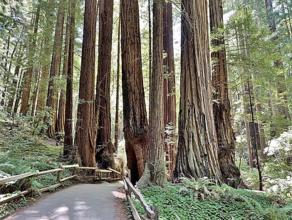
Muir Woods National Monument Address: Conlon Avenue street in San Francisco - San Jose, CA
Popular routes to Muir Woods National Monument, San Francisco - San Jose, CA
Attractions near Muir Woods National Monument
Druid Heights,Panoramic Hwy & Muir Woods Rd,Panoramic Highway & Sequoia Valley Road,Muir Woods Gift Shop,The Dylan Hotel,Muir Woods Trading Company (Muir Woods Redwood Forest),Dylan at SFO,Planetquest,Homestead Hill (262m),2 Forest Way Mill Valley,Panoramic Highway & Ridge Avenue,Belluomini Westhoff Group,Mig Jewelry and A,Setbreak,Quoia,Cascade Cottage,Pacific Union,William Berger MD,Marks Realty Group,20 Minute LoopHow to get to popular attractions in San Francisco - San Jose, CA with public transit
Sharks Ice at San Jose, San Jose,Costco Wholesale,Safeway, Campbell,Genentech Inc, South San Francisco,Union City BART Station, Union City,Safeway, Rohnert Park,City of Los Altos, Los Altos,Golden Gate Park, Golden Gate Park, Sf,Safeway Corporate Headquarters, Pleasanton,Costco Wholesale, Sunnyvale,City of Newark, Newark,Best Western Plus Grosvenor Airport Hotel, South San Francisco,Serramonte Center, Daly City,Tamien Caltrain Station, San Jose,Sonoma County Fairgrounds, Santa Rosa,City of Antioch, Antioch,City of Pleasanton, Pleasanton,Googleplex - Charlie's Cafe,City of San José, San Jose,Sunnyvale, CA, SunnyvaleGet around San Francisco - San Jose, CA by public transit!
Traveling around San Francisco - San Jose, CA has never been so easy. See step by step directions as you travel to any attraction, street or major public transit station. View bus and train schedules, arrival times, service alerts and detailed routes on a map, so you know exactly how to get to anywhere in San Francisco - San Jose, CA.
When traveling to any destination around San Francisco - San Jose, CA use Moovit's Live Directions with Get Off Notifications to know exactly where and how far to walk, how long to wait for your line, and how many stops are left. Moovit will alert you when it's time to get off — no need to constantly re-check whether yours is the next stop.
Wondering how to use public transit in San Francisco - San Jose, CA or how to pay for public transit in San Francisco - San Jose, CA? Moovit public transit app can help you navigate your way with public transit easily, and at minimum cost. It includes public transit fees, ticket prices, and costs. Looking for a map of San Francisco - San Jose, CA public transit lines? Moovit public transit app shows all public transit maps in San Francisco - San Jose, CA with all bus or light rail routes and stops on an interactive map.
San Francisco - San Jose, CA has 2 transit type(s), including: bus or light rail, operated by several transit agencies, including BART, Bay Area Rapid Transit, Muni Metro, Caltrain, VTA, Capitol Corridor, Sonoma Marin Area Rail Transit, MUNI, VTA, SF Cable Car, AC Transit, Dumbarton Express, Golden Gate Transit, County Connection and SamTrans