Directions to Multi Service Fuel Card (Overland Park) with public transportation
The following transit lines have routes that pass near Multi Service Fuel Card
 Bus: 403.
How to get to Multi Service Fuel Card by bus?
Click on the bus route to see step by step directions with maps, line arrival times and updated time schedules.
From Westlake Ace Hardware Gladstone, Merriam
32 minFrom Celsius Tannery, Olathe
37 minFrom Absolute Interlock, Lenexa
49 minFrom Rakar, Lenexa
42 minFrom El Fisher Marisqueria Y Taqueria Commissary, Olathe
43 minFrom Leelawadee Thai Massage, Shawnee
70 minFrom Entrance I-35 S, Lenexa
65 minFrom Mainstreet Credit Union, Mission
29 minFrom Park Overland Garden Center, Overland Park
45 minFrom Shawnee Mission District Stadium at SMN, Overland Park
35 min
Bus stop near Multi Service Fuel Card in Overland Park
- On Antioch at Indian Creek Parkway Sb, 4 min walk,VIEW
Bus lines to Multi Service Fuel Card in Overland Park
- 403, Ku Medical Center,VIEW
What are the closest stations to Multi Service Fuel Card?
The closest stations to Multi Service Fuel Card are:
- On Antioch at Indian Creek Parkway Sb is 311 yards away, 4 min walk.
Which bus line stops near Multi Service Fuel Card?
403 (Walmart Park N Ride)
What’s the nearest bus station to Multi Service Fuel Card in Overland Park?
The nearest bus station to Multi Service Fuel Card in Overland Park is On Antioch at Indian Creek Parkway Sb. It’s a 4 min walk away.
What time is the first bus to Multi Service Fuel Card in Overland Park?
The 403 is the first bus that goes to Multi Service Fuel Card in Overland Park. It stops nearby at 5:36 AM.
What time is the last bus to Multi Service Fuel Card in Overland Park?
The 403 is the last bus that goes to Multi Service Fuel Card in Overland Park. It stops nearby at 8:33 PM.
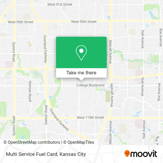
See Multi Service Fuel Card, Overland Park, on the map
Public Transit to Multi Service Fuel Card in Overland Park
Wondering how to get to Multi Service Fuel Card in Overland Park? Moovit helps you find the best way to get to Multi Service Fuel Card with step-by-step directions from the nearest public transit station.
Moovit provides free maps and live directions to help you navigate through your city. View schedules, routes, timetables, and find out how long does it take to get to Multi Service Fuel Card in real time.
Looking for the nearest stop or station to Multi Service Fuel Card? Check out this list of stops closest to your destination: On Antioch at Indian Creek Parkway Sb.
Bus: 403.
Want to see if there’s another route that gets you there at an earlier time? Moovit helps you find alternative routes or times. Get directions from and directions to Multi Service Fuel Card easily from the Moovit App or Website.
We make riding to Multi Service Fuel Card easy, which is why over 1.5 million users, including users in Overland Park, trust Moovit as the best app for public transit. You don’t need to download an individual bus app or train app, Moovit is your all-in-one transit app that helps you find the best bus time or train time available.
For information on prices of bus, costs and ride fares to Multi Service Fuel Card, please check the Moovit app.
Use the app to navigate to popular places including to the airport, hospital, stadium, grocery store, mall, coffee shop, school, college, and university.
Multi Service Fuel Card Address: 8595 W 110th St street in Overland Park
- College Blvd & Antioch,
- Bp,
- Lifeworks Integrative Health (In2great Functional Medicine and Integrative Health),
- Corporate Woods Office Park,
- Silvercreek RCM,
- Westar Foods,
- New Day Chiropractic & Wellness,
- Block Funds Block Multifamily Block Hawley,
- USPS Collection Box - Blue Box,
- Grand Mere,
- Midwest Anxiety Treatment Center,
- Edwards Gutter Cleaning,
- Goosehead Insurance - Jarod Tibbetts,
- Future Electronics,
- Central Group Mortgage,
- Nvision Wealth,
- Safeco Insurance Company of America,
- KC Vision Performance,
- Take Charge,
- Pale Bear Apothecary
Places Near Multi Service Fuel Card (Overland Park)
- Amazon Fulfilment Center-MKC6, Kansas City,
- Legends Outlets Kansas City, Kansas City,
- Country Club Plaza,
- The Glory Hole,
- Walmart, Kansas City,
- Kauffman Stadium,
- Kansas City Zoo,
- Arrowhead Stadium,
- T-Mobile Center,
- Stans Glory Hole,
- Liberty, MO, Liberty,
- St. Luke's Hospital - Medical Plaza I,
- Kansas City International Airport (MCI) (Kansas City International Airport),
- Harrah's Casino, North Kansas City,
- Truman Medical Center,
- Ku Medical Center, Kansas City,
- GEHA Field at Arrowhead Stadium,
- Grandview, MO, Grandview,
- Walmart Supercenter,
- Worlds of Fun
How to get to popular places in Kansas City with public transit
Get around Overland Park by public transit!
Traveling around Overland Park has never been so easy. See step by step directions as you travel to any attraction, street or major public transit station. View bus and train schedules, arrival times, service alerts and detailed routes on a map, so you know exactly how to get to anywhere in Overland Park.
When traveling to any destination around Overland Park use Moovit's Live Directions with Get Off Notifications to know exactly where and how far to walk, how long to wait for your line, and how many stops are left. Moovit will alert you when it's time to get off — no need to constantly re-check whether yours is the next stop.
Wondering how to use public transit in Overland Park or how to pay for public transit in Overland Park? Moovit public transit app can help you navigate your way with public transit easily, and at minimum cost. It includes public transit fees, ticket prices, and costs. Looking for a map of Overland Park public transit lines? Moovit public transit app shows all public transit maps in Overland Park with all Bus, Train and Light Rail routes and stops on an interactive map.
Kansas City has 3 transit type(s), including: Bus, Train and Light Rail, operated by several transit agencies, including Kansas City Area Transportation Authority, Lawrence Transit, Topeka Metro, RideKC Johnson County, Amtrak, Greyhound-us and FlixBus-us