How to get to Multiopticas by bus?
Click on the bus route to see step by step directions with maps, line arrival times and updated time schedules.
Bus stops near Multiopticas in Sé, Santa Maria e Meixedo
Bus lines to Multiopticas in Sé, Santa Maria e Meixedo
- R1, Rural | Bragança - Rebordãos,VIEW
- U2, Urbana | Linha Amarela,VIEW
- R3, Rural | Bragança - Alfaião,VIEW
- R5, Rural | Bragança - Rio de Onor,VIEW
- R6, Rural | Bragança - Terroso,VIEW
- R7, Rural | Bragança - Portelo,VIEW
- R2, Rural | Bragança - Castrelos,VIEW
- U3, Urbana | Linha Vermelha,VIEW
- R4, Rural | Bragança - Gondesende,VIEW
- U1, Circular ⟲ Bragança (Sul),VIEW
- C-3006, Bragança / Dine,VIEW
- C-3007, Bragança / Calvelhe,VIEW
- C-3008, Bragança / Izeda,VIEW
- C-3009, Bragança / Miranda do Douro,VIEW
- C-3010, Bragança / Veigas,VIEW
- C-3030, Bragança / Freixedelo,VIEW
What are the closest stations to Multiopticas?
The closest stations to Multiopticas are:
- Escola Secundária Abade de Baçal is 199 meters away, 3 min walk.
- Rua Alexandre Herculano 2 is 245 meters away, 4 min walk.
- Bragança (Escolas) is 895 meters away, 12 min walk.
Which bus line stops near Multiopticas?
C-3013 (Penso→Bragança)
What’s the nearest bus station to Multiopticas in Sé, Santa Maria e Meixedo?
The nearest bus station to Multiopticas in Sé, Santa Maria e Meixedo is Escola Secundária Abade de Baçal. It’s a 3 min walk away.
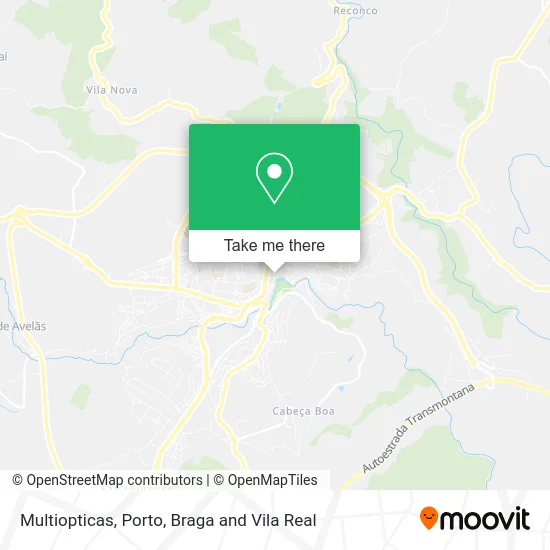
See Multiopticas, Sé, Santa Maria e Meixedo, on the map
Public Transit to Multiopticas in Sé, Santa Maria e Meixedo
Wondering how to get to Multiopticas in Sé, Santa Maria e Meixedo? Moovit helps you find the best way to get to Multiopticas with step-by-step directions from the nearest public transit station.
Moovit provides free maps and live directions to help you navigate through your city. View schedules, routes, timetables, and find out how long does it take to get to Multiopticas in real time.
Looking for the nearest stop or station to Multiopticas? Check out this list of stops closest to your destination: Escola Secundária Abade de Baçal; Rua Alexandre Herculano 2; Bragança (Escolas).
Bus: C-3013, R1, U2, R3, R5, R6, R2, U3, R4, U1, C-3006, C-3007, C-3008, C-3009, C-3010.
Want to see if there’s another route that gets you there at an earlier time? Moovit helps you find alternative routes or times. Get directions from and directions to Multiopticas easily from the Moovit App or Website.
We make riding to Multiopticas easy, which is why over 1.5 million users, including users in Sé, Santa Maria e Meixedo, trust Moovit as the best app for public transit. You don’t need to download an individual bus app or train app, Moovit is your all-in-one transit app that helps you find the best bus time or train time available.
For information on prices of bus, costs and ride fares to Multiopticas, please check the Moovit app.
Use the app to navigate to popular places including to the airport, hospital, stadium, grocery store, mall, coffee shop, school, college, and university.
Multiopticas Address: Rua Alexandre Herculano 105 Bragança, 5300-075 Bragança street in Sé, Santa Maria e Meixedo
- Multiopticas Bragança,
- Kafe Kopus Bar,
- Lelo & Gonçalves,
- Grande Loja Nacional Portuguesa,
- Pintos Ourivesaria e Relojoaria, Lda,
- Centrak,
- Zulmira N Albino Teixeira,
- Rio Live Concept,
- Sapataria Máxima,
- Farmacia Soeiro,
- Amorim, Esperança Neli Gonçalves,
- Upstairs,
- Movie Line - Cabeleireira Unipessoal,
- Supermercado de Alcatifas e Cortinados,
- Herminio Silva e Ca,
- Alma Lusa,
- Culstore,
- Maria Conceição Almeida,
- O Corpetto,
- Sapataria Gomes
Places Near Multiopticas (Sé, Santa Maria e Meixedo)
- Valongo, Valongo,
- Avintes, Vila Nova De Gaia,
- VILA do CONDE PORTO FASHION OUTLET, Modivas,
- Hospital de Santo António, Cedofeita, Santo Ildefonso, Sé, Miragaia, São Nicolau e Vitória,
- MAR Shopping, Matosinhos e Leça da Palmeira,
- Palácio de Cristal, Lordelo do Ouro e Massarelos,
- Espinho, Espinho,
- Zoo Santo Inácio, Vila Nova De Gaia,
- Senhor de Matosinhos, Matosinhos e Leça da Palmeira,
- Hospital Santos Silva, Vila Nova De Gaia,
- Canidelo, Vila Nova De Gaia,
- Estádio do Dragão, Campanhã,
- Acesso ao Shopping Parque Nascente, Campanhã,
- Leça da Palmeira, Matosinhos e Leça da Palmeira,
- Rua Calouste Gulbenkian, Lordelo do Ouro e Massarelos,
- Maia, Maia,
- Parque Aquatico Amarante - Aqua Aventura, Amarante,
- El Corte Inglés de Gaia, Mafamude e Vilar do Paraíso,
- Hospital da Prelada, Ramalde,
- Arrábida Shopping, Santa Marinha e São Pedro da Afurada
How to get to popular places in Porto, Braga and Vila Real with public transit
Get around Sé, Santa Maria e Meixedo by public transit!
Traveling around Sé, Santa Maria e Meixedo has never been so easy. See step by step directions as you travel to any attraction, street or major public transit station. View bus and train schedules, arrival times, service alerts and detailed routes on a map, so you know exactly how to get to anywhere in Sé, Santa Maria e Meixedo.
When traveling to any destination around Sé, Santa Maria e Meixedo use Moovit's Live Directions with Get Off Notifications to know exactly where and how far to walk, how long to wait for your line, and how many stops are left. Moovit will alert you when it's time to get off — no need to constantly re-check whether yours is the next stop.
Wondering how to use public transit in Sé, Santa Maria e Meixedo or how to pay for public transit in Sé, Santa Maria e Meixedo? Moovit public transit app can help you navigate your way with public transit easily, and at minimum cost. It includes public transit fees, ticket prices, and costs. Looking for a map of Sé, Santa Maria e Meixedo public transit lines? Moovit public transit app shows all public transit maps in Sé, Santa Maria e Meixedo with all Bus, Train, Metro, Ferry, Funicular and Gondola routes and stops on an interactive map.
Porto, Braga and Vila Real has 6 transit type(s), including: Bus, Train, Metro, Ferry, Funicular and Gondola, operated by several transit agencies, including Metro do Porto, Metro do Porto - Metrobus, CP - Comboios de Portugal, STCP, UNIR Mobilidade da Area Metropolitana do Porto, Getbus - Aerobus, Mobiave, Valpibus, TUB - Transportes Urbanos de Braga, TuViana, Guimabus, Ave Mobilidade, Cávado Mobilidade, Transdev and Câmara Municipal de Santo Tirso