Directions to Mun's Boston (Quincy) with public transportation
The following transit lines have routes that pass near Mun's Boston
 Bus: 210, 211, 215, 217, RED LINE SHUTTLE.
- Train: FALL RIVER/NEW BEDFORD, GREENBUSH.
- Subway: RED LINE, MATTAPAN LINE.
How to get to Mun's Boston by bus?
Click on the bus route to see step by step directions with maps, line arrival times and updated time schedules.
From Christopher Columbus Waterfront Park, Boston
102 minFrom Millennium Tower Boston, Boston
81 minFrom City Hall Plaza, Boston
84 minFrom Hotel Commonwealth, Boston
83 minFrom Samuel Adams Brewery, Boston
69 minFrom Suffolk County Courthouse, Boston
85 minFrom The Institute Of Contemporary Art, Boston
103 minFrom Puttshack, Boston
101 minFrom Dubliner, Boston
84 minFrom Museum Of Fine Arts MBTA Station, Boston
68 min
How to get to Mun's Boston by train?
Click on the train route to see step by step directions with maps, line arrival times and updated time schedules.
From Christopher Columbus Waterfront Park, Boston
77 minFrom Millennium Tower Boston, Boston
71 minFrom City Hall Plaza, Boston
75 minFrom Hotel Commonwealth, Boston
93 minFrom Suffolk County Courthouse, Boston
77 minFrom The Institute Of Contemporary Art, Boston
77 minFrom Puttshack, Boston
76 minFrom Dubliner, Boston
75 minFrom Museum Of Fine Arts MBTA Station, Boston
86 min
How to get to Mun's Boston by subway?
Click on the subway route to see step by step directions with maps, line arrival times and updated time schedules.
From Christopher Columbus Waterfront Park, Boston
36 minFrom Millennium Tower Boston, Boston
24 minFrom City Hall Plaza, Boston
32 minFrom Hotel Commonwealth, Boston
42 minFrom Samuel Adams Brewery, Boston
45 minFrom Suffolk County Courthouse, Boston
31 minFrom The Institute Of Contemporary Art, Boston
39 minFrom Puttshack, Boston
37 minFrom Dubliner, Boston
31 minFrom Museum Of Fine Arts MBTA Station, Boston
47 min
Bus stops near Mun's Boston in Quincy
Bus lines to Mun's Boston in Quincy
- 211, Squantum,VIEW
- 215, North Quincy,VIEW
- 217, Bryant Ave & Upton St,VIEW
- 210, Fields Corner,VIEW
- RED LINE SHUTTLE, Ashmont - Braintree,VIEW
- RED LINE SHUTTLE, North Quincy - JFK/UMass,VIEW
- RED LINE SHUTTLE, Braintree - Broadway,VIEW
- RED LINE SHUTTLE, Braintree - JFK/UMass (Shuttle),VIEW
- RED LINE SHUTTLE, Quincy Center - Broadway (Shuttle),VIEW
What are the closest stations to Mun's Boston?
The closest stations to Mun's Boston are:
- W Squantum St Opp Harriet Ave is 138 yards away, 2 min walk.
- Hancock St @ Billings Rd is 553 yards away, 7 min walk.
- North Quincy is 878 yards away, 11 min walk.
- Wollaston is 2565 yards away, 31 min walk.
- Milton is 3472 yards away, 41 min walk.
Which bus line stops near Mun's Boston?
210 (Quincy Center)
Which train lines stop near Mun's Boston?
These train lines stop near Mun's Boston: FALL RIVER/NEW BEDFORD, GREENBUSH.
Which subway line stops near Mun's Boston?
RED LINE (Ashmont/Braintree)
What’s the nearest bus station to Mun's Boston in Quincy?
The nearest bus station to Mun's Boston in Quincy is W Squantum St Opp Harriet Ave. It’s a 2 min walk away.
What time is the first subway to Mun's Boston in Quincy?
The MATTAPAN LINE is the first subway that goes to Mun's Boston in Quincy. It stops nearby at 5:06 AM.
What time is the last subway to Mun's Boston in Quincy?
The MATTAPAN LINE is the last subway that goes to Mun's Boston in Quincy. It stops nearby at 2:35 AM.
What time is the first bus to Mun's Boston in Quincy?
The 210 is the first bus that goes to Mun's Boston in Quincy. It stops nearby at 5:06 AM.
What time is the last bus to Mun's Boston in Quincy?
The 210 is the last bus that goes to Mun's Boston in Quincy. It stops nearby at 1:11 AM.
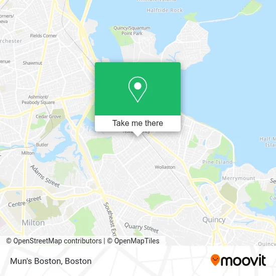
See Mun's Boston, Quincy, on the map
Public Transit to Mun's Boston in Quincy
Wondering how to get to Mun's Boston in Quincy? Moovit helps you find the best way to get to Mun's Boston with step-by-step directions from the nearest public transit station.
Moovit provides free maps and live directions to help you navigate through your city. View schedules, routes, timetables, and find out how long does it take to get to Mun's Boston in real time.
Looking for the nearest stop or station to Mun's Boston? Check out this list of stops closest to your destination: W Squantum St Opp Harriet Ave; Hancock St @ Billings Rd; North Quincy; Wollaston; Milton.
Bus: 210, 211, 215, 217, RED LINE SHUTTLE, RED LINE SHUTTLE, RED LINE SHUTTLE, RED LINE SHUTTLE, RED LINE SHUTTLE.Train: FALL RIVER/NEW BEDFORD, GREENBUSH.Subway: RED LINE, MATTAPAN LINE.
Want to see if there’s another route that gets you there at an earlier time? Moovit helps you find alternative routes or times. Get directions from and directions to Mun's Boston easily from the Moovit App or Website.
We make riding to Mun's Boston easy, which is why over 1.7 million users, including users in Quincy, trust Moovit as the best app for public transit. You don’t need to download an individual bus app or train app, Moovit is your all-in-one transit app that helps you find the best bus time or train time available.
For information on prices of subway, bus and train, costs and ride fares to Mun's Boston, please check the Moovit app.
Use the app to navigate to popular places including to the airport, hospital, stadium, grocery store, mall, coffee shop, school, college, and university.
Mun's Boston Address: 33 Fayette St street in Quincy
- Tan,
- Vera Bradley,
- Alibaba Locksmith,
- Motto Clear Aligners,
- Competiello,J W,DDS,
- North Quincy,
- Holiday Inn Express-Boston Quincy,
- Staybridge Suites Boston-Quincy,
- Fifteen Minute Locksmith,
- Eaves Avalon N. Quincy,
- Archstone Smith Oprating Trust,
- Granite,
- MBTA-North Quincy (N Quincy Station @ Red Line),
- Safford 1 24 Hour Emergency Locksmith,
- Appliances Connection,
- VIVI Spa,
- Great Hangup,
- Sunny Florists,
- Super Stop & Shop,
- My Tutoring Center
Places Near Mun's Boston (Quincy)
- North End, Boston,
- Faneuil Hall, Boston,
- Leader Bank Pavilion (Leader Bank Pavillion), Boston,
- Isabella Stewart Gardner Museum, Boston,
- Quincy Market, Boston,
- Cheers, Boston,
- Boston Convention & Exhibition Center, Boston,
- House Of Blues, Boston,
- Museum Of Science, Boston,
- Massachusetts General Hospital, Boston,
- Wilbur Theatre, Boston,
- Castle Island, Boston,
- Wang Theater, Boston,
- Boston Medical Center, Boston,
- Mgm Music Hall, Boston,
- Boston Common, Boston,
- Boston Children's Hospital, Boston,
- Td Garden, Boston,
- Prudential Center, Boston,
- Seaport District, Boston
How to get to popular places in Boston with public transit
Get around Quincy by public transit!
Traveling around Quincy has never been so easy. See step by step directions as you travel to any attraction, street or major public transit station. View bus and train schedules, arrival times, service alerts and detailed routes on a map, so you know exactly how to get to anywhere in Quincy.
When traveling to any destination around Quincy use Moovit's Live Directions with Get Off Notifications to know exactly where and how far to walk, how long to wait for your line, and how many stops are left. Moovit will alert you when it's time to get off — no need to constantly re-check whether yours is the next stop.
Wondering how to use public transit in Quincy or how to pay for public transit in Quincy? Moovit public transit app can help you navigate your way with public transit easily, and at minimum cost. It includes public transit fees, ticket prices, and costs. Looking for a map of Quincy public transit lines? Moovit public transit app shows all public transit maps in Quincy with all Bus, Train, Subway and Ferry routes and stops on an interactive map.
Boston has 4 transit type(s), including: Bus, Train, Subway and Ferry, operated by several transit agencies, including MBTA, Southeastern Regional Transit Authority, MetroWest Regional Transit Authority, Rhode Island Public Transit Authority, WRTA, Lowell Regional Transit Authority, Merrimack Valley Transit, Montachusett Regional Transit Authority, Cape Cod Regional Transit Authority, Brockton Area Transit Authority, Martha's Vineyard Transit Authority, the WAVE - Nantucket Regional Transit Authority, GATRA, Cape Ann Transportation Authority and Massport