How to get to Mundo das Máquinas by bus?
Click on the bus route to see step by step directions with maps, line arrival times and updated time schedules.
From Engenho De Dentro, Engenho De Dentro
66 minFrom Estádio Nilton Santos (Engenhão), Engenho De Dentro
61 minFrom Brás De Pina, Brás De Pina
39 minFrom Hospital Piedade/Rj, Piedade
61 minFrom Hospital Estadual Da Mãe, Mesquita
56 minFrom Rua Cardoso de Morais 61, Bonsucesso
49 minFrom SuperVia-Bonsucesso (Estação Bonsucesso), Bonsucesso
57 minFrom Praça Das Nações, Bonsucesso
46 minFrom Higienópolis, Higienópolis
51 minFrom Carrefour Belford Roxo, Belford Roxo
58 min
How to get to Mundo das Máquinas by train?
Click on the train route to see step by step directions with maps, line arrival times and updated time schedules.
From Engenho De Dentro, Engenho De Dentro
89 minFrom Estádio Nilton Santos (Engenhão), Engenho De Dentro
83 minFrom Brás De Pina, Brás De Pina
128 minFrom Hospital Piedade/Rj, Piedade
78 minFrom Rua Cardoso de Morais 61, Bonsucesso
98 minFrom SuperVia-Bonsucesso (Estação Bonsucesso), Bonsucesso
93 minFrom Praça Das Nações, Bonsucesso
94 minFrom Higienópolis, Higienópolis
91 minFrom Carrefour Belford Roxo, Belford Roxo
72 min
How to get to Mundo das Máquinas by metro?
Click on the metro route to see step by step directions with maps, line arrival times and updated time schedules.
Bus stops near Mundo das Máquinas in Acari
Metro station near Mundo das Máquinas in Acari
- Colégio, 25 min walk,VIEW
Train station near Mundo das Máquinas in Acari
- Barros Filho, 43 min walk,VIEW
Bus lines to Mundo das Máquinas in Acari
- 112B, Itaguaí - Central (Brs I),VIEW
- 113D, Itaguaí - Niterói,VIEW
- 119T, Caxias - Itaguaí (via Vila Militar/Campo Grande/Palmares),VIEW
- 121T, Caxias - Itaguaí (Via Estrada do Campinho / Santa Cruz),VIEW
- 124, Nilópolis - Candelária (Brs I - Via Anchieta - Rápido),VIEW
- 133, Nova Iguaçu - Central (Brs I - Via Deodoro),VIEW
- 300, Sulacap - Candelária (Brs 5 - via BRT Deodoro),VIEW
- SR 300, Sulacap - Candelária (Rápido),VIEW
- 362, Honório - Castelo (Brs 4),VIEW
- SR 362, Honório - Castelo (Rápido),VIEW
- 378, Marechal Hermes - Castelo (Brs 4),VIEW
- SR 378, Marechal Hermes - Castelo (Rápido),VIEW
- 384, Pavuna - Passeio (Brs 4 - Via Anchieta / Central),VIEW
- SV 384, Pavuna - Passeio (Via Anchieta / Via Binário),VIEW
- 386, Mariópolis - Candelária (Brs 4 - Parador - Via Anchieta),VIEW
- SR 386, Mariópolis - Candelária (Rápido),VIEW
- 388, Cesarão - Candelária (Brs 5 - Via Santa Cruz - Parador),VIEW
- SN 388, Cesarão - Candelária (BRS 5 - via Terminal Deodoro / Lapa),VIEW
- 393, Bangu - Candelária (Brs 5 - Via Vila Militar / Av. Brasil),VIEW
- 397, Terminal Campo Grande - Candelária (Brs 5 - Via Bangu - Parador),VIEW
What are the closest stations to Mundo das Máquinas?
The closest stations to Mundo das Máquinas are:
- Avenida Brasil - Passarela 27 (Conjunto Amarelinho) is 896 meters away, 12 min walk.
- Metrô Acari/Fazenda Botafogo (Sentido Pavuna) is 959 meters away, 13 min walk.
- Avenida Brasil | Passarela 27 / Assaí Ceasa is 1056 meters away, 14 min walk.
- Rua Embaú, 381-389 is 1582 meters away, 21 min walk.
- Rua Embaú, 380 is 1594 meters away, 21 min walk.
- Colégio is 1886 meters away, 25 min walk.
- Barros Filho is 3338 meters away, 43 min walk.
Which bus lines stop near Mundo das Máquinas?
These bus lines stop near Mundo das Máquinas: 378, 388, 394, 428L, 734L, 736L, 800L.
Which metro line stops near Mundo das Máquinas?
L2 (Pavuna)
Which train line stops near Mundo das Máquinas?
RAMAL BELFORD ROXO (Belford Roxo)
What’s the nearest metro station to Mundo das Máquinas in Acari?
The nearest metro station to Mundo das Máquinas in Acari is Colégio. It’s a 25 min walk away.
What’s the nearest bus station to Mundo das Máquinas in Acari?
The nearest bus station to Mundo das Máquinas in Acari is Avenida Brasil - Passarela 27 (Conjunto Amarelinho). It’s a 12 min walk away.
What time is the first metro to Mundo das Máquinas in Acari?
The L2 is the first metro that goes to Mundo das Máquinas in Acari. It stops nearby at 5:01 AM.
What time is the last metro to Mundo das Máquinas in Acari?
The L2 is the last metro that goes to Mundo das Máquinas in Acari. It stops nearby at 12:49 AM.
What time is the first train to Mundo das Máquinas in Acari?
The RAMAL BELFORD ROXO is the first train that goes to Mundo das Máquinas in Acari. It stops nearby at 4:59 AM.
What time is the last train to Mundo das Máquinas in Acari?
The RAMAL BELFORD ROXO is the last train that goes to Mundo das Máquinas in Acari. It stops nearby at 10:09 PM.
What time is the first bus to Mundo das Máquinas in Acari?
The SN 397 is the first bus that goes to Mundo das Máquinas in Acari. It stops nearby at 3:04 AM.
What time is the last bus to Mundo das Máquinas in Acari?
The 388 is the last bus that goes to Mundo das Máquinas in Acari. It stops nearby at 4:13 AM.
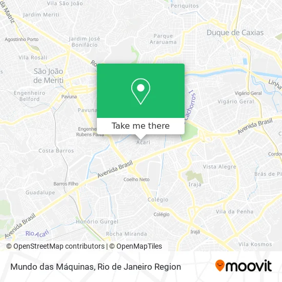
See Mundo das Máquinas, Acari, on the map
Public Transit to Mundo das Máquinas in Acari
Wondering how to get to Mundo das Máquinas in Acari? Moovit helps you find the best way to get to Mundo das Máquinas with step-by-step directions from the nearest public transit station.
Moovit provides free maps and live directions to help you navigate through your city. View schedules, routes, timetables, and find out how long does it take to get to Mundo das Máquinas in real time.
Looking for the nearest stop or station to Mundo das Máquinas? Check out this list of stops closest to your destination: Avenida Brasil - Passarela 27 (Conjunto Amarelinho); Metrô Acari/Fazenda Botafogo (Sentido Pavuna); Avenida Brasil | Passarela 27 / Assaí Ceasa; Rua Embaú; Rua Embaú; Colégio; Barros Filho.
Bus: 378, 388, 394, 428L, 734L, 736L, 800L, 112B, 113D, 119T, 121T, 124, SVA 685, 687, 688, 713L, 385, SR 393, SVA 665.Metro: L2.Train: RAMAL BELFORD ROXO.
Want to see if there’s another route that gets you there at an earlier time? Moovit helps you find alternative routes or times. Get directions from and directions to Mundo das Máquinas easily from the Moovit App or Website.
We make riding to Mundo das Máquinas easy, which is why over 1.5 million users, including users in Acari, trust Moovit as the best app for public transit. You don’t need to download an individual bus app or train app, Moovit is your all-in-one transit app that helps you find the best bus time or train time available.
For information on prices of bus, train and metro, costs and ride fares to Mundo das Máquinas, please check the Moovit app.
Use the app to navigate to popular places including to the airport, hospital, stadium, grocery store, mall, coffee shop, school, college, and university.
Mundo das Máquinas Address: Acari Rio de Janeiro-RJ street in Acari
- Acari,
- Rua União,
- Ifb Moto Shopping,
- Guaravan Industria e Comercio,
- Acari,
- Rua Nova SN,
- Vila Rica De Irajá,
- Churrascaria Boi Bom Na Brasa,
- Padaria da Rua Nova,
- Creche Municipal Edna Lotte,
- Rua Maria Edwirges Inacio,
- Karen Distribuidora,
- Bg Rações,
- Rua.Nova_acari,
- Acari,
- Salão de Festas Rei Davi,
- Travessa Pereira Silva,
- Praça Roberto Carlos,
- Bar do Bau,
- Rua Matura, 411
Places Near Mundo das Máquinas (Acari)
- Hospital Municipal Ronaldo Gazolla, Acari,
- Rodoviária Novo Rio (Rodoviária do Rio de Janeiro), Santo Cristo,
- Shopping Rio Sul, Botafogo,
- Museu Do Amanhã, Centro,
- Avenida Rio Branco, Centro,
- Avenida Venezuela 134, Saúde,
- Rua Licínio Cardoso, São Francisco Xavier,
- Feirão De Malhas, Duque De Caxias,
- Shopping Nova América, Del Castilho,
- Rio De Janeiro,
- Shopping RioSul, Botafogo,
- Norte Shopping, Cachambi,
- Rua Ulysses Guimarães 16, Cidade Nova,
- Shopping Downtown, Barra Da Tijuca,
- Feira Livre da Gloria, Glória,
- Praia do Arpoador, Ipanema,
- Niterói, Niterói,
- Hospital Federal Do Andaraí, Andaraí,
- Hospital Federal Cardoso Fontes, Jacarepaguá,
- Hospital Pedro Ernesto, Vila Isabel
How to get to popular places in Rio de Janeiro Region with public transit
Get around Acari by public transit!
Traveling around Acari has never been so easy. See step by step directions as you travel to any attraction, street or major public transit station. View bus and train schedules, arrival times, service alerts and detailed routes on a map, so you know exactly how to get to anywhere in Acari.
When traveling to any destination around Acari use Moovit's Live Directions with Get Off Notifications to know exactly where and how far to walk, how long to wait for your line, and how many stops are left. Moovit will alert you when it's time to get off — no need to constantly re-check whether yours is the next stop.
Wondering how to use public transit in Acari or how to pay for public transit in Acari? Moovit public transit app can help you navigate your way with public transit easily, and at minimum cost. It includes public transit fees, ticket prices, and costs. Looking for a map of Acari public transit lines? Moovit public transit app shows all public transit maps in Acari with all Bus, Train, Metro, Light Rail, Ferry, Cable Car, Gondola and Funicular routes and stops on an interactive map.
Rio de Janeiro Region has 8 transit type(s), including: Bus, Train, Metro, Light Rail, Ferry, Cable Car, Gondola and Funicular, operated by several transit agencies, including TrensRJ, Metrô Rio, VLT Carioca, Barcas Rio, BRT MOBI-Rio, Auto Viação Alpha, Auto Viação Tijuca, Gire Transportes, Transurb, Viação Nossa Senhora das Graças, Consórcio INTERSUL, Braso Lisboa (Municipal), Caprichosa Auto Ônibus, Auto Viação Três Amigos and Rodoviária Âncora Matias