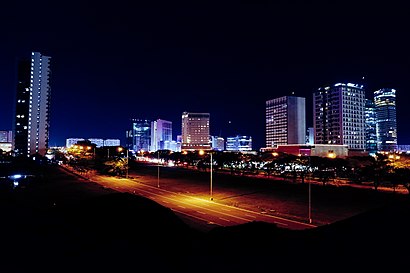
See Muntinlupa on the map
Directions to Muntinlupa with public transportation
The following transit lines have routes that pass near Muntinlupa
 Bus:
Bus: - Train:
How to get to Muntinlupa by bus?
Click on the bus route to see step by step directions with maps, line arrival times and updated time schedules.
How to get to Muntinlupa by train?
Click on the train route to see step by step directions with maps, line arrival times and updated time schedules.
Bus stations near Muntinlupa
- Nia Rd / National Hwy Intersection, Muntinlupa City, Manila,12 min walk,
- Susana Heights Access Rd, Muntinlupa City, Manila,30 min walk,
- Festival Mall, Montinlupa City,37 min walk,
Bus lines to Muntinlupa
- JEEP,Alabang - Muntinlupa Bilibid Prison via Katarungan Village,
- JEEP,ALABANG - MUNTINLUPA,
- JEEP,Alabang Binan via National Road,
- JEEP,ALABANG - KATARUNGAN VILLAGE via MUNTINLUPA NBP,
- JEEP,Binan Bicutan(Taguig) via Sucat SSH,
- JEEP,Alabang - Muntinlupa via National Rd. up to Bayan-bayanan, San Pedro,
- JEEP,ALABANG - LANGGAM SAN PEDRO,
- JEEP,Alabang - GMA via Carmona National Rd.,
- JEEP,ALABANG - CALAMBA via EXPRESSWAY,
- BUS,San Pedro College Of Business Administration, National Hwy, San Pedro, Manila,
- BUS,Genteral Luis / East Street Intersection, Caloocan City,
- BUS,Pacita Bus Terminal, Pacita Av, San Pedro, Manila,
- BUS,Plaza Pacita Bus Terminal, National Highway / Pacita Av, San Pedro, Manila,
- BUS,Robinsons Nova Supermarket, Quirino Highway, Caloocan City, Manila,
- BUS,Circimferential Road 4, Malabon City,
- JEEP,Centennial Road, Montinlupa City,
What are the closest stations to Muntinlupa?
The closest stations to Muntinlupa are:
- Nia Rd / National Hwy Intersection, Muntinlupa City, Manila is 868 meters away, 12 min walk.
- Susana Heights Access Rd, Muntinlupa City, Manila is 2193 meters away, 30 min walk.
- Festival Mall, Montinlupa City is 2766 meters away, 37 min walk.
Which bus lines stop near Muntinlupa?
These bus lines stop near Muntinlupa: BUS, JEEP.
Which train line stops near Muntinlupa?
PNR MC
What’s the nearest bus stop to Muntinlupa?
The nearest bus stop to Muntinlupa is Nia Rd / National Hwy Intersection, Muntinlupa City, Manila. It’s a 12 min walk away.
See Muntinlupa on the map
Public Transportation to Muntinlupa
Wondering how to get to Muntinlupa, Philippines? Moovit helps you find the best way to get to Muntinlupa with step-by-step directions from the nearest public transit station.
Moovit provides free maps and live directions to help you navigate through your city. View schedules, routes, timetables, and find out how long does it take to get to Muntinlupa in real time.
Looking for the nearest stop or station to Muntinlupa? Check out this list of stops closest to your destination: Nia Rd / National Hwy Intersection; Susana Heights Access Rd; Festival Mall.
Bus:Train:
Want to see if there’s another route that gets you there at an earlier time? Moovit helps you find alternative routes or times. Get directions from and directions to Muntinlupa easily from the Moovit App or Website.
We make riding to Muntinlupa easy, which is why over 1.5 million users, including users in Muntinlupa, trust Moovit as the best app for public transit. You don’t need to download an individual bus app or train app, Moovit is your all-in-one transit app that helps you find the best bus time or train time available.
For information on prices of bus and train, costs and ride fares to Muntinlupa, please check the Moovit app.
Use the app to navigate to popular places including to the airport, hospital, stadium, grocery store, mall, coffee shop, school, college, and university.
Muntinlupa Address: 1772 street in Muntinlupa
Attractions near Muntinlupa
Lazada Warehouse Soldiers Hills Putatan Muntinlupa,Tanguli St,SLEX,GMS,Lighthouse Apostolic Ministry of Pentecost,Rubis,Arciaga Compound,Soldiers Hills Commercial Center,SMB Hills Covered Court,G & M Trading,VM Townhomes,Mahogany,Rusty Lopez-Starmall Alabang,Vm Town Homes Soldiers Hills,SLEX / South Luzon Expy,South Crest School,RLT,Airspeed Ville,Pupa,Muntinlupa Poblacion MarketHow to get to popular attractions in Muntinlupa with public transit
The Coffee Bean & Tea Leaf, Manila,SM Bicutan Skyway Terminal, Parañaque,San Francisco del Monte, Quezon City,LRT 1 (Jose Abad Santos Station), Manila,Barangay Sto. Niño, Parañaque,J.CO Donuts & Coffee,Philippine Airlines Inflight Center, Parañaque,Commerce Avenue, Muntinlupa,J.CO Donuts & Coffee, Imus,GSIS Home Office,Causeway Seafood Restaurant, Quezon City,D'Cream, Makati City,PAGCOR Casino Filipino, Parañaque,Metrogate Complex Village, Bulacan,Kabihasnan, Parañaque,Paradise Village, Quezon City,Power Mac Center,Baywalk, Manila,Ace Water Spa and Ace Coffee Lounge, Quezon City,Nobu Hotel, ParañaqueGet around Muntinlupa by public transit!
Traveling around Muntinlupa has never been so easy. See step by step directions as you travel to any attraction, street or major public transit station. View bus and train schedules, arrival times, service alerts and detailed routes on a map, so you know exactly how to get to anywhere in Muntinlupa.
When traveling to any destination around Muntinlupa use Moovit's Live Directions with Get Off Notifications to know exactly where and how far to walk, how long to wait for your line, and how many stops are left. Moovit will alert you when it's time to get off — no need to constantly re-check whether yours is the next stop.
Wondering how to use public transit in Muntinlupa or how to pay for public transit in Muntinlupa? Moovit public transit app can help you navigate your way with public transit easily, and at minimum cost. It includes public transit fees, ticket prices, and costs. Looking for a map of Muntinlupa public transit lines? Moovit public transit app shows all public transit maps in Muntinlupa with all bus or train routes and stops on an interactive map.
Muntinlupa has 2 transit type(s), including: bus or train, operated by several transit agencies, including MRTC, LRTA, PNR, LTFRB, BGC Bus, P2P and UV Express