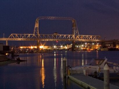
Directions to Murray Morgan Bridge (Tacoma) with public transportation
The following transit lines have routes that pass near Murray Morgan Bridge
How to get to Murray Morgan Bridge by bus?
Click on the bus route to see step by step directions with maps, line arrival times and updated time schedules.
How to get to Murray Morgan Bridge by train?
Click on the train route to see step by step directions with maps, line arrival times and updated time schedules.
Bus stations near Murray Morgan Bridge in Tacoma
- 11th St S & Pacific Ave,6 min walk,
- Pacific Ave & 11th St S,6 min walk,
- 10th & Commerce TC - Zone D,7 min walk,
- 10th & Commerce TC - Zone E,7 min walk,
- 10th & Commerce TC - Zone C,7 min walk,
- 10th & Commerce TC - Zone F,8 min walk,
- 10th & Commerce TC - Zone B,8 min walk,
Light Rail stations near Murray Morgan Bridge in Tacoma
- Theater District,8 min walk,
Bus lines to Murray Morgan Bridge in Tacoma
- 28,TCC Transit Center Via S 12th St,
- 1,6th Ave / Pacific Ave / Mountain Hwy Sr7,
- 500,Tacoma,
- 594,Lakewood / Tacoma,
- 11,Downtown Tacoma,
- 41,Downtown Tacoma Via 56th St,
- 42,72nd St TC Via Mckinley Ave,
- 2,Bridgeport / S 19th / Downtown Via TCC,
- 16,TCC Via Proctor District,
- 48,Downtown Tacoma / Sheridan / S M St,
- 57,Downtown Tacoma,
- 400,Puyallup Station,
- 3,Lakewood,
- 45,Parkland Via Yakima,
- 501,Milton / Federal Way Via 20th St E,
What are the closest stations to Murray Morgan Bridge?
The closest stations to Murray Morgan Bridge are:
- 11th St S & Pacific Ave is 430 yards away, 6 min walk.
- Pacific Ave & 11th St S is 458 yards away, 6 min walk.
- 10th & Commerce TC - Zone D is 531 yards away, 7 min walk.
- 10th & Commerce TC - Zone E is 564 yards away, 7 min walk.
- 10th & Commerce TC - Zone C is 568 yards away, 7 min walk.
- Theater District is 605 yards away, 8 min walk.
- 10th & Commerce TC - Zone F is 610 yards away, 8 min walk.
- 10th & Commerce TC - Zone B is 661 yards away, 8 min walk.
Which bus lines stop near Murray Morgan Bridge?
These bus lines stop near Murray Morgan Bridge: 2, 400, 42, 500, 594, 63.
Which train line stops near Murray Morgan Bridge?
S LINE
What’s the nearest light rail station to Murray Morgan Bridge in Tacoma?
The nearest light rail station to Murray Morgan Bridge in Tacoma is Theater District. It’s a 8 min walk away.
What’s the nearest bus stop to Murray Morgan Bridge in Tacoma?
The nearest bus stops to Murray Morgan Bridge in Tacoma are 11th St S & Pacific Ave and Pacific Ave & 11th St S. The closest one is a 6 min walk away.
What time is the first light rail to Murray Morgan Bridge in Tacoma?
The T LINE is the first light rail that goes to Murray Morgan Bridge in Tacoma. It stops nearby at 4:41 AM.
What time is the last light rail to Murray Morgan Bridge in Tacoma?
The T LINE is the last light rail that goes to Murray Morgan Bridge in Tacoma. It stops nearby at 10:50 PM.
What time is the first bus to Murray Morgan Bridge in Tacoma?
The 1 is the first bus that goes to Murray Morgan Bridge in Tacoma. It stops nearby at 4:39 AM.
What time is the last bus to Murray Morgan Bridge in Tacoma?
The 594 is the last bus that goes to Murray Morgan Bridge in Tacoma. It stops nearby at 12:52 AM.
How much is the bus fare to Murray Morgan Bridge?
The bus fare to Murray Morgan Bridge costs about $2.00.
See Murray Morgan Bridge, Tacoma, on the map
Public Transit to Murray Morgan Bridge in Tacoma
Wondering how to get to Murray Morgan Bridge in Tacoma, United States? Moovit helps you find the best way to get to Murray Morgan Bridge with step-by-step directions from the nearest public transit station.
Moovit provides free maps and live directions to help you navigate through your city. View schedules, routes, timetables, and find out how long does it take to get to Murray Morgan Bridge in real time.
Looking for the nearest stop or station to Murray Morgan Bridge? Check out this list of stops closest to your destination: 11th St S & Pacific Ave; Pacific Ave & 11th St S; 10th & Commerce TC - Zone D; 10th & Commerce TC - Zone E; 10th & Commerce TC - Zone C; Theater District; 10th & Commerce TC - Zone F; 10th & Commerce TC - Zone B.
Bus:240042500594632811141164857Train:S LINE
Want to see if there’s another route that gets you there at an earlier time? Moovit helps you find alternative routes or times. Get directions from and directions to Murray Morgan Bridge easily from the Moovit App or Website.
We make riding to Murray Morgan Bridge easy, which is why over 1.5 million users, including users in Tacoma, trust Moovit as the best app for public transit. You don’t need to download an individual bus app or train app, Moovit is your all-in-one transit app that helps you find the best bus time or train time available.
For information on prices of bus and train, costs and ride fares to Murray Morgan Bridge, please check the Moovit app.
Use the app to navigate to popular places including to the airport, hospital, stadium, grocery store, mall, coffee shop, school, college, and university.
Murray Morgan Bridge Address: South 11th Street street in Tacoma
Attractions near Murray Morgan Bridge
Washington Premier FC Soccer (Washington Premier Football Club),Peopleready,Tim Morris - Banner Bank Residential Loan Officer,ADT Home Security (Adt-Activations & New Sales),Project Trades Solutions,Dubin Law Group - Personal Injury Attorneys,Integrated NW Construction LLC,Russell Investment Group (Russell Australia High Dividnd Indx),Brett Willis - Heritage Bank,Chuck Folsom - Heritage Bank,Heath McLellan - Heritage Bank,USPS (Old Post Office District - Tacoma, Wa),South Sound Staffing,Peace Bus,Indigo Massage Studios,Ae Brow Design,Ladies Paint Night,Roofing Contractors Association of Washington,US Passport Agency,Court House Square (Theatre on the Square)How to get to popular attractions in Tacoma with public transit
Tulalip Casino Resort,King County Metro Bus Route 255, Bellevue,Northgate Mall, Seattle,PCC Community Markets - Edmonds, Edmonds,Upper Queen Anne, Seattle,Virginia Mason Hospital, Seattle,Olympia-Lacey Amtrak Station (OLW),Seattle-Tacoma International Airport, Seatac,City of Auburn, Auburn,Salty's on Alki, Seattle,PCC Community Markets - Issaquah, Issaquah,Seattle Premium Outlets,Bellevue College, Bellevue,Washington State Capital Campus, Olympia,Industrial District, Seattle,Costco Wholesale, Tacoma,Boeing Field / King County International Airport (BFI), Seattle,Starbucks, Seattle,I-5,Red Robin Gourmet Burgers, BothellGet around Tacoma by public transit!
Traveling around Tacoma has never been so easy. See step by step directions as you travel to any attraction, street or major public transit station. View bus and train schedules, arrival times, service alerts and detailed routes on a map, so you know exactly how to get to anywhere in Tacoma.
When traveling to any destination around Tacoma use Moovit's Live Directions with Get Off Notifications to know exactly where and how far to walk, how long to wait for your line, and how many stops are left. Moovit will alert you when it's time to get off — no need to constantly re-check whether yours is the next stop.
Wondering how to use public transit in Tacoma or how to pay for public transit in Tacoma? Moovit public transit app can help you navigate your way with public transit easily, and at minimum cost. It includes public transit fees, ticket prices, and costs. Looking for a map of Tacoma public transit lines? Moovit public transit app shows all public transit maps in Tacoma with all bus or train routes and stops on an interactive map.
Tacoma has 2 transit type(s), including: bus or train, operated by several transit agencies, including Sound Transit, Seattle Streetcar, Sound Transit, Metro Transit, Metro Transit, Sound Transit, Whatcom Transportation Authority, Mason Transit Authority, Snoqualmie Valley Transportation (SVT), Snoqualmie Valley Transportation, Amtrak, Island Transit, Kitsap Transit, Intercity Transit and Everett Transit