Directions to Musical Stairs (Boston) with public transportation
The following transit lines have routes that pass near Musical Stairs
 Bus: 111, 426, 43, 69, EZRIDE.
- Train: FITCHBURG, FRAMINGHAM/WORCESTER, NEEDHAM, HAVERHILL, LOWELL.
- Subway: GREEN LINE D, GREEN LINE E, ORANGE LINE, RED LINE, GREEN LINE B.
How to get to Musical Stairs by bus?
Click on the bus route to see step by step directions with maps, line arrival times and updated time schedules.
From Heartbreak Hill, Newton
81 minFrom McLean Hospital, Belmont
79 minFrom Morrissey Blvd, Boston
110 minFrom Roslindale Square, Boston
103 minFrom Market Basket, Revere
62 minFrom The Mall At Chestnut Hill, Newton
91 minFrom Revere Beach, Revere
71 minFrom Spaulding Rehabilitation Center, Boston
55 minFrom Jamaica Plain V.A., Boston
64 minFrom Newton, MA, Newton
81 min
How to get to Musical Stairs by train?
Click on the train route to see step by step directions with maps, line arrival times and updated time schedules.
How to get to Musical Stairs by subway?
Click on the subway route to see step by step directions with maps, line arrival times and updated time schedules.
Bus stops near Musical Stairs in Boston
Subway stations near Musical Stairs in Boston
Train station near Musical Stairs in Boston
- North Station, 9 min walk,VIEW
Bus lines to Musical Stairs in Boston
- GREEN LINE E SHUTTLE, Government Center - Medford/Tufts (Shuttle),VIEW
- GREEN LINE E SHUTTLE, Medford/Tufts - North Station,VIEW
- GREEN LINE E SHUTTLE, North Station - Medford/Tufts (Shuttle),VIEW
- GREEN LINE SHUTTLE, Union Square - North Station,VIEW
- GREEN LINE SHUTTLE, North Station - Sullivan Square via East Somerville,VIEW
- GREEN LINE SHUTTLE, Medford/Tufts - Government Center via Union Square,VIEW
- GREEN LINE SHUTTLE, Union Square - Government Center,VIEW
- GREEN LINE SHUTTLE, Lechmere - North Station,VIEW
- EZRIDE, Inbound To North Station From Erie St,VIEW
- EZRIDE, Outbound North Station To Erie St Via Lechmere And Kendall,VIEW
- EZRIDE, Outbound To Erie St From North Station,VIEW
- EZRIDE, Inbound To North Station Via Kendall And Lechmere,VIEW
- RED LINE SHUTTLE, Harvard - JFK/UMass via Congress Street,VIEW
- RED LINE SHUTTLE, Alewife - Park Street,VIEW
- RED LINE SHUTTLE, Harvard - Broadway,VIEW
- RED LINE SHUTTLE, Kendall/MIT - Park Street,VIEW
- RED LINE SHUTTLE, Kendall/MIT - JFK/UMass,VIEW
- RED LINE SHUTTLE, Kendall/MIT - Broadway via Pearl Street,VIEW
- RED LINE SHUTTLE, Harvard - JFK/UMass via State Street,VIEW
- RED LINE SHUTTLE, Harvard - South Station,VIEW
What are the closest stations to Musical Stairs?
The closest stations to Musical Stairs are:
- Science Park/West End - Martha Rd @ Amy Ct is 366 yards away, 5 min walk.
- Community Collge is 601 yards away, 8 min walk.
- North Station is 668 yards away, 9 min walk.
- Charles/Mgh is 705 yards away, 9 min walk.
- Charles/Mgh - Cambridge St @ Lindall Pl is 831 yards away, 10 min walk.
- Portland St @ Causeway St is 881 yards away, 11 min walk.
- First St. is 925 yards away, 12 min walk.
- Lechmere is 1542 yards away, 19 min walk.
Which bus lines stop near Musical Stairs?
These bus lines stop near Musical Stairs: 111, 426, 43, 69, EZRIDE.
Which train lines stop near Musical Stairs?
These train lines stop near Musical Stairs: FITCHBURG, FRAMINGHAM/WORCESTER, NEEDHAM.
Which subway lines stop near Musical Stairs?
These subway lines stop near Musical Stairs: GREEN LINE D, GREEN LINE E.
What’s the nearest subway station to Musical Stairs in Boston?
The nearest subway station to Musical Stairs in Boston is Community Collge. It’s a 8 min walk away.
What’s the nearest train station to Musical Stairs in Boston?
The nearest train station to Musical Stairs in Boston is North Station. It’s a 9 min walk away.
What’s the nearest bus station to Musical Stairs in Boston?
The nearest bus station to Musical Stairs in Boston is Science Park/West End - Martha Rd @ Amy Ct. It’s a 5 min walk away.
What time is the first subway to Musical Stairs in Boston?
The GREEN LINE E is the first subway that goes to Musical Stairs in Boston. It stops nearby at 4:55 AM.
What time is the last subway to Musical Stairs in Boston?
The GREEN LINE E is the last subway that goes to Musical Stairs in Boston. It stops nearby at 1:29 AM.
What time is the first train to Musical Stairs in Boston?
The LOWELL is the first train that goes to Musical Stairs in Boston. It stops nearby at 5:20 AM.
What time is the last train to Musical Stairs in Boston?
The FITCHBURG is the last train that goes to Musical Stairs in Boston. It stops nearby at 12:33 AM.
What time is the first bus to Musical Stairs in Boston?
The 80 is the first bus that goes to Musical Stairs in Boston. It stops nearby at 5:24 AM.
What time is the last bus to Musical Stairs in Boston?
The 87 is the last bus that goes to Musical Stairs in Boston. It stops nearby at 1:22 AM.
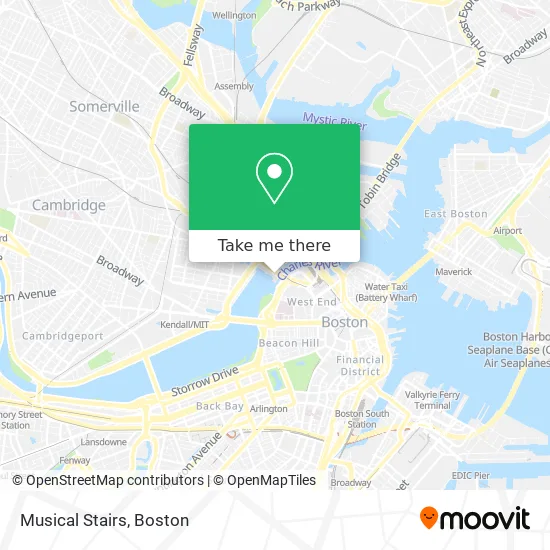
See Musical Stairs, Boston, on the map
Public Transit to Musical Stairs in Boston
Wondering how to get to Musical Stairs in Boston? Moovit helps you find the best way to get to Musical Stairs with step-by-step directions from the nearest public transit station.
Moovit provides free maps and live directions to help you navigate through your city. View schedules, routes, timetables, and find out how long does it take to get to Musical Stairs in real time.
Looking for the nearest stop or station to Musical Stairs? Check out this list of stops closest to your destination: Science Park/West End - Martha Rd @ Amy Ct; Community Collge; North Station; Charles/Mgh; Charles/Mgh - Cambridge St @ Lindall Pl; Portland St @ Causeway St; First St.; Lechmere.
Bus: 111, 426, 43, 69, EZRIDE, GREEN LINE E SHUTTLE, GREEN LINE E SHUTTLE, GREEN LINE E SHUTTLE, GREEN LINE SHUTTLE, GREEN LINE SHUTTLE.Train: FITCHBURG, FRAMINGHAM/WORCESTER, NEEDHAM, HAVERHILL, LOWELL, NEWBURYPORT/ROCKPORT, DOWNEASTER.Subway: GREEN LINE D, GREEN LINE E, ORANGE LINE, RED LINE, GREEN LINE B, GREEN LINE C.
Want to see if there’s another route that gets you there at an earlier time? Moovit helps you find alternative routes or times. Get directions from and directions to Musical Stairs easily from the Moovit App or Website.
We make riding to Musical Stairs easy, which is why over 1.7 million users, including users in Boston, trust Moovit as the best app for public transit. You don’t need to download an individual bus app or train app, Moovit is your all-in-one transit app that helps you find the best bus time or train time available.
For information on prices of bus, subway and train, costs and ride fares to Musical Stairs, please check the Moovit app.
Use the app to navigate to popular places including to the airport, hospital, stadium, grocery store, mall, coffee shop, school, college, and university.
Musical Stairs Address: 1 Science Park street in Boston
- MOS Discovery Center,
- Charles Hayden Planetarium,
- Mugar Omni IMAX Theatre,
- Charles River Dam Brg & Dr Paul Dudley White Bike Path,
- Hayden Planetarium,
- Hayden Planetarium MA USA,
- Museum of Science (Charles Hayden Planetarium),
- Museum Of Science,
- Gordon Current Science & Technology Center,
- Museum of Science Parking Garage,
- Museum of Science Parking Garage (The Msm of Sci Pking Garage),
- Charles River Esplanade,
- Northpoint Park,
- Nashua Street Jail (Suffolk County Jail),
- Leverett Circle,
- MBTA Science Park / West End Station,
- DanCyn Food Truck,
- 2 Education Circle,
- 10 Emerson Place,
- Hult International Business School
Places Near Musical Stairs (Boston)
- Faneuil Hall, Boston,
- North End, Boston,
- Cheers, Boston,
- Boston Children's Hospital, Boston,
- Castle Island, Boston,
- Isabella Stewart Gardner Museum, Boston,
- House Of Blues, Boston,
- Boston Convention & Exhibition Center, Boston,
- Td Garden, Boston,
- Massachusetts General Hospital, Boston,
- Wang Theater, Boston,
- Wilbur Theatre, Boston,
- Prudential Center, Boston,
- Mgm Music Hall, Boston,
- Quincy Market, Boston,
- Leader Bank Pavilion (Leader Bank Pavillion), Boston,
- Boston Medical Center, Boston,
- Boston Common, Boston,
- Museum Of Science, Boston,
- Seaport District, Boston
How to get to popular places in Boston with public transit
Get around Boston by public transit!
Traveling around Boston has never been so easy. See step by step directions as you travel to any attraction, street or major public transit station. View bus and train schedules, arrival times, service alerts and detailed routes on a map, so you know exactly how to get to anywhere in Boston.
When traveling to any destination around Boston use Moovit's Live Directions with Get Off Notifications to know exactly where and how far to walk, how long to wait for your line, and how many stops are left. Moovit will alert you when it's time to get off — no need to constantly re-check whether yours is the next stop.
Wondering how to use public transit in Boston or how to pay for public transit in Boston? Moovit public transit app can help you navigate your way with public transit easily, and at minimum cost. It includes public transit fees, ticket prices, and costs. Looking for a map of Boston public transit lines? Moovit public transit app shows all public transit maps in Boston with all Bus, Train, Subway and Ferry routes and stops on an interactive map.
Boston has 4 transit type(s), including: Bus, Train, Subway and Ferry, operated by several transit agencies, including MBTA, Southeastern Regional Transit Authority, MetroWest Regional Transit Authority, Rhode Island Public Transit Authority, WRTA, Lowell Regional Transit Authority, Merrimack Valley Transit, Montachusett Regional Transit Authority, Cape Cod Regional Transit Authority, Brockton Area Transit Authority, Martha's Vineyard Transit Authority, the WAVE - Nantucket Regional Transit Authority, GATRA, Cape Ann Transportation Authority and Massport