Directions to Mustang Mall (Medford) with public transportation
The following transit lines have routes that pass near Mustang Mall
 Bus: 134, 80, 95, 94, 101.
- Train: LOWELL.
- Subway: GREEN LINE E, GREEN LINE B, GREEN LINE C.
How to get to Mustang Mall by bus?
Click on the bus route to see step by step directions with maps, line arrival times and updated time schedules.
From One Beacon Street, Boston
41 minFrom Middlesex Superior Court, Woburn
32 minFrom Back Bay Station, Boston
66 minFrom The Capital Grille, Boston
71 minFrom Rental Car Center - Logan Airport, Boston
77 minFrom Cambridge Crossing, Cambridge
56 minFrom The Colonnade Hotel, Boston
71 minFrom The Salty Pig, Boston
66 minFrom John Hancock Tower, Boston
68 minFrom Financial District, Boston
44 min
How to get to Mustang Mall by train?
Click on the train route to see step by step directions with maps, line arrival times and updated time schedules.
How to get to Mustang Mall by subway?
Click on the subway route to see step by step directions with maps, line arrival times and updated time schedules.
From One Beacon Street, Boston
68 minFrom Back Bay Station, Boston
73 minFrom The Capital Grille, Boston
83 minFrom Rental Car Center - Logan Airport, Boston
77 minFrom Cambridge Crossing, Cambridge
60 minFrom The Colonnade Hotel, Boston
77 minFrom The Salty Pig, Boston
80 minFrom John Hancock Tower, Boston
79 minFrom Financial District, Boston
73 min
Train station near Mustang Mall in Medford
- Wedgemere, 4 min walk,VIEW
Bus stops near Mustang Mall in Medford
Subway station near Mustang Mall in Medford
- Medford/Tufts Station, 15 min walk,VIEW
Bus lines to Mustang Mall in Medford
What are the closest stations to Mustang Mall?
The closest stations to Mustang Mall are:
- Wedgemere is 271 yards away, 4 min walk.
- Winthrop St @ Medford Hs is 285 yards away, 5 min walk.
- Winthrop St @ Exeter St is 384 yards away, 5 min walk.
- Medford/Tufts Station is 1222 yards away, 15 min walk.
Which bus lines stop near Mustang Mall?
These bus lines stop near Mustang Mall: 134, 80, 95.
Which train line stops near Mustang Mall?
LOWELL (#323 | Lowell)
Which subway line stops near Mustang Mall?
GREEN LINE E (Lechmere)
What’s the nearest subway station to Mustang Mall in Medford?
The nearest subway station to Mustang Mall in Medford is Medford/Tufts Station. It’s a 15 min walk away.
What’s the nearest train station to Mustang Mall in Medford?
The nearest train station to Mustang Mall in Medford is Wedgemere. It’s a 4 min walk away.
What’s the nearest bus station to Mustang Mall in Medford?
The nearest bus stations to Mustang Mall in Medford are Winthrop St @ Medford Hs and Winthrop St @ Exeter St. The closest one is a 5 min walk away.
What time is the first subway to Mustang Mall in Medford?
The GREEN LINE E is the first subway that goes to Mustang Mall in Medford. It stops nearby at 4:55 AM.
What time is the last subway to Mustang Mall in Medford?
The GREEN LINE E is the last subway that goes to Mustang Mall in Medford. It stops nearby at 2:41 AM.
What time is the first train to Mustang Mall in Medford?
The LOWELL is the first train that goes to Mustang Mall in Medford. It stops nearby at 5:27 AM.
What time is the last train to Mustang Mall in Medford?
The LOWELL is the last train that goes to Mustang Mall in Medford. It stops nearby at 12:20 AM.
What time is the first bus to Mustang Mall in Medford?
The 95 is the first bus that goes to Mustang Mall in Medford. It stops nearby at 5:24 AM.
What time is the last bus to Mustang Mall in Medford?
The 95 is the last bus that goes to Mustang Mall in Medford. It stops nearby at 1:39 AM.
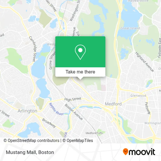
See Mustang Mall, Medford, on the map
Public Transit to Mustang Mall in Medford
Wondering how to get to Mustang Mall in Medford? Moovit helps you find the best way to get to Mustang Mall with step-by-step directions from the nearest public transit station.
Moovit provides free maps and live directions to help you navigate through your city. View schedules, routes, timetables, and find out how long does it take to get to Mustang Mall in real time.
Looking for the nearest stop or station to Mustang Mall? Check out this list of stops closest to your destination: Wedgemere; Winthrop St @ Medford Hs; Winthrop St @ Exeter St; Medford/Tufts Station.
Bus: 134, 80, 95, 94, 101.Train: LOWELL.Subway: GREEN LINE E, GREEN LINE B, GREEN LINE C.
Want to see if there’s another route that gets you there at an earlier time? Moovit helps you find alternative routes or times. Get directions from and directions to Mustang Mall easily from the Moovit App or Website.
We make riding to Mustang Mall easy, which is why over 1.7 million users, including users in Medford, trust Moovit as the best app for public transit. You don’t need to download an individual bus app or train app, Moovit is your all-in-one transit app that helps you find the best bus time or train time available.
For information on prices of bus, subway and train, costs and ride fares to Mustang Mall, please check the Moovit app.
Use the app to navigate to popular places including to the airport, hospital, stadium, grocery store, mall, coffee shop, school, college, and university.
Mustang Mall Address: 489 Winthrop St street in Medford
- Medford High,
- Medford High School (Medford Public Schools),
- Medford Community Media,
- Friends of the Medford Family Network,
- Bistro 489,
- Cunningham Super Steam Cleaning,
- Lad in A Battle,
- John H. McGill House,
- Kathryn I Vitiello DMD,
- TDM,
- AAA Transcription Specialists,
- Riverside Motorsports,
- USPS Collection Box - Blue Box,
- Pierce Properties Real Estate,
- Jonathan Fletcher House,
- Tony Woo, DDS,
- George Sousa,
- Premier Wood Flooring,
- Gilbert Carey Painting,
- Playstead Park
Places Near Mustang Mall (Medford)
- House Of Blues, Boston,
- Prudential Center, Boston,
- Boston Convention & Exhibition Center, Boston,
- Wang Theater, Boston,
- Seaport District, Boston,
- Td Garden, Boston,
- Leader Bank Pavilion (Leader Bank Pavillion), Boston,
- Museum Of Science, Boston,
- North End, Boston,
- Castle Island, Boston,
- Boston Medical Center, Boston,
- Boston Children's Hospital, Boston,
- Boston Common, Boston,
- Quincy Market, Boston,
- Massachusetts General Hospital, Boston,
- Faneuil Hall, Boston,
- Wilbur Theatre, Boston,
- Cheers, Boston,
- Isabella Stewart Gardner Museum, Boston,
- Mgm Music Hall, Boston
How to get to popular places in Boston with public transit
Get around Medford by public transit!
Traveling around Medford has never been so easy. See step by step directions as you travel to any attraction, street or major public transit station. View bus and train schedules, arrival times, service alerts and detailed routes on a map, so you know exactly how to get to anywhere in Medford.
When traveling to any destination around Medford use Moovit's Live Directions with Get Off Notifications to know exactly where and how far to walk, how long to wait for your line, and how many stops are left. Moovit will alert you when it's time to get off — no need to constantly re-check whether yours is the next stop.
Wondering how to use public transit in Medford or how to pay for public transit in Medford? Moovit public transit app can help you navigate your way with public transit easily, and at minimum cost. It includes public transit fees, ticket prices, and costs. Looking for a map of Medford public transit lines? Moovit public transit app shows all public transit maps in Medford with all Bus, Train, Subway and Ferry routes and stops on an interactive map.
Boston has 4 transit type(s), including: Bus, Train, Subway and Ferry, operated by several transit agencies, including MBTA, Southeastern Regional Transit Authority, MetroWest Regional Transit Authority, Rhode Island Public Transit Authority, WRTA, Lowell Regional Transit Authority, Merrimack Valley Transit, Montachusett Regional Transit Authority, Cape Cod Regional Transit Authority, Brockton Area Transit Authority, Martha's Vineyard Transit Authority, the WAVE - Nantucket Regional Transit Authority, GATRA, Cape Ann Transportation Authority and Massport