Directions to Mybenifit Insurance Llc. (Boston) with public transportation
The following transit lines have routes that pass near Mybenifit Insurance Llc.
 Bus: 35, 36, 37, 51, 38.
- Train: NEEDHAM, FRANKLIN/FOXBORO, ORANGE LINE, PROVIDENCE/STOUGHTON.
- Subway: ORANGE LINE.
How to get to Mybenifit Insurance Llc. by bus?
Click on the bus route to see step by step directions with maps, line arrival times and updated time schedules.
From Millennium Tower Boston, Boston
59 minFrom Beacon Hill, Boston
59 minFrom Peter Pan Bus Lines at South Station, Boston
61 minFrom The Freedom Trail, Boston
58 minFrom 75 / 101 Federal Street, Boston
59 minFrom Newton, MA, Newton
37 minFrom The Ritz-Carlton, Boston, Boston
54 minFrom The Liberty Hotel, Boston
67 minFrom Boston College, Boston
61 minFrom Calderwood Pavilion at the BCA, Boston
57 min
How to get to Mybenifit Insurance Llc. by train?
Click on the train route to see step by step directions with maps, line arrival times and updated time schedules.
From Millennium Tower Boston, Boston
35 minFrom Beacon Hill, Boston
38 minFrom Peter Pan Bus Lines at South Station, Boston
26 minFrom The Freedom Trail, Boston
36 minFrom 75 / 101 Federal Street, Boston
30 minFrom The Ritz-Carlton, Boston, Boston
36 minFrom The Liberty Hotel, Boston
46 minFrom Calderwood Pavilion at the BCA, Boston
28 min
How to get to Mybenifit Insurance Llc. by subway?
Click on the subway route to see step by step directions with maps, line arrival times and updated time schedules.
From Millennium Tower Boston, Boston
56 minFrom Beacon Hill, Boston
61 minFrom Peter Pan Bus Lines at South Station, Boston
58 minFrom The Freedom Trail, Boston
59 minFrom 75 / 101 Federal Street, Boston
59 minFrom Newton, MA, Newton
102 minFrom The Ritz-Carlton, Boston, Boston
56 minFrom The Liberty Hotel, Boston
64 minFrom Boston College, Boston
107 minFrom Calderwood Pavilion at the BCA, Boston
59 min
Bus stops near Mybenifit Insurance Llc. in Boston
Train stations near Mybenifit Insurance Llc. in Boston
Bus lines to Mybenifit Insurance Llc. in Boston
What are the closest stations to Mybenifit Insurance Llc.?
The closest stations to Mybenifit Insurance Llc. are:
- 5 Walter St Opp Hewlett St is 15 yards away, 1 min walk.
- Belgrade Ave Opp Aldrich St is 278 yards away, 4 min walk.
- Centre St @ Guernsey St is 418 yards away, 5 min walk.
- Roslindale Village/Belgrade Avenue 25 is 507 yards away, 7 min walk.
- Bellevue is 1355 yards away, 16 min walk.
- Forest Hills is 1589 yards away, 20 min walk.
Which bus lines stop near Mybenifit Insurance Llc.?
These bus lines stop near Mybenifit Insurance Llc.: 35, 36, 37, 51.
Which train line stops near Mybenifit Insurance Llc.?
NEEDHAM (#625 | Needham Heights)
Which subway line stops near Mybenifit Insurance Llc.?
ORANGE LINE (Forest Hills)
What’s the nearest train station to Mybenifit Insurance Llc. in Boston?
The nearest train station to Mybenifit Insurance Llc. in Boston is Bellevue. It’s a 16 min walk away.
What’s the nearest bus station to Mybenifit Insurance Llc. in Boston?
The nearest bus station to Mybenifit Insurance Llc. in Boston is 5 Walter St Opp Hewlett St. It’s a 1 min walk away.
What time is the first subway to Mybenifit Insurance Llc. in Boston?
The ORANGE LINE is the first subway that goes to Mybenifit Insurance Llc. in Boston. It stops nearby at 5:15 AM.
What time is the last subway to Mybenifit Insurance Llc. in Boston?
The ORANGE LINE is the last subway that goes to Mybenifit Insurance Llc. in Boston. It stops nearby at 1:58 AM.
What time is the first train to Mybenifit Insurance Llc. in Boston?
The NEEDHAM is the first train that goes to Mybenifit Insurance Llc. in Boston. It stops nearby at 7:22 AM.
What time is the last train to Mybenifit Insurance Llc. in Boston?
The PROVIDENCE/STOUGHTON is the last train that goes to Mybenifit Insurance Llc. in Boston. It stops nearby at 12:08 AM.
What time is the first bus to Mybenifit Insurance Llc. in Boston?
The 36 is the first bus that goes to Mybenifit Insurance Llc. in Boston. It stops nearby at 4:37 AM.
What time is the last bus to Mybenifit Insurance Llc. in Boston?
The 36 is the last bus that goes to Mybenifit Insurance Llc. in Boston. It stops nearby at 1:37 AM.
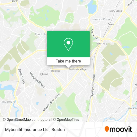
See Mybenifit Insurance Llc., Boston, on the map
Public Transit to Mybenifit Insurance Llc. in Boston
Wondering how to get to Mybenifit Insurance Llc. in Boston? Moovit helps you find the best way to get to Mybenifit Insurance Llc. with step-by-step directions from the nearest public transit station.
Moovit provides free maps and live directions to help you navigate through your city. View schedules, routes, timetables, and find out how long does it take to get to Mybenifit Insurance Llc. in real time.
Looking for the nearest stop or station to Mybenifit Insurance Llc.? Check out this list of stops closest to your destination: 5 Walter St Opp Hewlett St; Belgrade Ave Opp Aldrich St; Centre St @ Guernsey St; Roslindale Village/Belgrade Avenue 25; Bellevue; Forest Hills.
Bus: 35, 36, 37, 51, 38, 14, NEEDHAM LINE SHUTTLE, NEEDHAM LINE SHUTTLE.Train: NEEDHAM, FRANKLIN/FOXBORO, ORANGE LINE, PROVIDENCE/STOUGHTON.Subway: ORANGE LINE.
Want to see if there’s another route that gets you there at an earlier time? Moovit helps you find alternative routes or times. Get directions from and directions to Mybenifit Insurance Llc. easily from the Moovit App or Website.
We make riding to Mybenifit Insurance Llc. easy, which is why over 1.7 million users, including users in Boston, trust Moovit as the best app for public transit. You don’t need to download an individual bus app or train app, Moovit is your all-in-one transit app that helps you find the best bus time or train time available.
For information on prices of bus, subway and train, costs and ride fares to Mybenifit Insurance Llc., please check the Moovit app.
Use the app to navigate to popular places including to the airport, hospital, stadium, grocery store, mall, coffee shop, school, college, and university.
Mybenifit Insurance Llc. Address: 147 Belgrade Ave street in Boston
- Punta Cana Beer and Wi,
- Arbri Cafe,
- Fallon Field (Fallon Field, Roslindale),
- Fallon Field,
- Master Solutions Construction,
- Roslindale Village Commuter Rail Station,
- Roslindale MBTA Commuter Station,
- Foreign & Domestic Auto Services,
- Triple Crown Services,
- Valentini Landscaping,
- Roslindale,
- Delta Glass Service,
- Social Security,
- Roslindale Square,
- Boston for the Dogs,
- Lost & Found Treasures,
- Elpicha Barbershop (El Picha Barbershop),
- J B Edward Uniforms (JB Pride Uniforms - We),
- Botanica Patron Santiago (Botanica Parton Santiago),
- Metropolitan Hill / Beach Street, Massachusetts
Places Near Mybenifit Insurance Llc. (Boston)
- Massachusetts General Hospital, Boston,
- Boston Convention & Exhibition Center, Boston,
- Cheers, Boston,
- North End, Boston,
- Mgm Music Hall, Boston,
- Seaport District, Boston,
- Museum Of Science, Boston,
- Isabella Stewart Gardner Museum, Boston,
- Td Garden, Boston,
- Boston Children's Hospital, Boston,
- Castle Island, Boston,
- Prudential Center, Boston,
- Boston Common, Boston,
- Leader Bank Pavilion (Leader Bank Pavillion), Boston,
- Wang Theater, Boston,
- Faneuil Hall, Boston,
- Boston Medical Center, Boston,
- Quincy Market, Boston,
- House Of Blues, Boston,
- Wilbur Theatre, Boston
How to get to popular places in Boston with public transit
Get around Boston by public transit!
Traveling around Boston has never been so easy. See step by step directions as you travel to any attraction, street or major public transit station. View bus and train schedules, arrival times, service alerts and detailed routes on a map, so you know exactly how to get to anywhere in Boston.
When traveling to any destination around Boston use Moovit's Live Directions with Get Off Notifications to know exactly where and how far to walk, how long to wait for your line, and how many stops are left. Moovit will alert you when it's time to get off — no need to constantly re-check whether yours is the next stop.
Wondering how to use public transit in Boston or how to pay for public transit in Boston? Moovit public transit app can help you navigate your way with public transit easily, and at minimum cost. It includes public transit fees, ticket prices, and costs. Looking for a map of Boston public transit lines? Moovit public transit app shows all public transit maps in Boston with all Bus, Train, Subway and Ferry routes and stops on an interactive map.
Boston has 4 transit type(s), including: Bus, Train, Subway and Ferry, operated by several transit agencies, including MBTA, Southeastern Regional Transit Authority, MetroWest Regional Transit Authority, Rhode Island Public Transit Authority, WRTA, Lowell Regional Transit Authority, Merrimack Valley Transit, Montachusett Regional Transit Authority, Cape Cod Regional Transit Authority, Brockton Area Transit Authority, Martha's Vineyard Transit Authority, the WAVE - Nantucket Regional Transit Authority, GATRA, Cape Ann Transportation Authority and Massport