Directions to Myeyedr. (Boston) with public transportation
The following transit lines have routes that pass near Myeyedr.
 Bus: 31, B48, G73E, GREYHOUND US0255S, R44.
- Train: VERMONTER, VALLEY FLYER.
How to get to Myeyedr. by bus?
Click on the bus route to see step by step directions with maps, line arrival times and updated time schedules.
From Worcester, MA, Worcester
130 minFrom South High Community School, Worcester
227 minFrom Dcu Center, Worcester
132 minFrom Foxwoods, Worcester
159 minFrom Polar Park, Worcester
132 minFrom Gardner, MA, Gardner
194 minFrom Palladium, Worcester
135 minFrom Registry Of Motor Vehicles (Rmv) Branch Office, Worcester
134 min
How to get to Myeyedr. by train?
Click on the train route to see step by step directions with maps, line arrival times and updated time schedules.
Bus stops near Myeyedr. in Boston
- King/Merrick (Calvin Theatre), 2 min walk,VIEW
- Peter Pan Bus Terminal Northampton, 3 min walk,VIEW
- Northampton Court House, 3 min walk,VIEW
- Pleasant / Service Center, 4 min walk,VIEW
- Old South / Conz (Mcdonald House), 4 min walk,VIEW
- Northampton (Northampton Market), 5 min walk,VIEW
- Crafts Avenue / Peter Pan, 8 min walk,VIEW
Train station near Myeyedr. in Boston
- Northampton, 59 min walk,VIEW
Bus lines to Myeyedr. in Boston
- R44, Williamsburg Via Va Hospital,VIEW
- PETER PAN, Boston (South Station),VIEW
- PETER PAN, Springfield,VIEW
- PETER PAN, Northampton,VIEW
- PETER PAN, South Hadley,VIEW
- 904, Pittsfield Itc,VIEW
- B43, Northampton,VIEW
- B48, Holyoke Trans. Ctr. Via Rt. 5,VIEW
- G73E, Northampton Via Holyoke Mall,VIEW
- R41, Holyoke Mall Via Easthampton,VIEW
- G47, Southwick Via Westfield,VIEW
- NE, Southampton Big Y,VIEW
- GREYHOUND US0255S, New York Port Authority,VIEW
- R42, Williamsburg Via Va Hospital,VIEW
What are the closest stations to Myeyedr.?
The closest stations to Myeyedr. are:
- King/Merrick (Calvin Theatre) is 67 yards away, 2 min walk.
- Peter Pan Bus Terminal Northampton is 184 yards away, 3 min walk.
- Northampton Court House is 185 yards away, 3 min walk.
- Pleasant / Service Center is 282 yards away, 4 min walk.
- Old South / Conz (Mcdonald House) is 294 yards away, 4 min walk.
- Northampton (Northampton Market) is 335 yards away, 5 min walk.
- Crafts Avenue / Peter Pan is 574 yards away, 8 min walk.
- Northampton is 4969 yards away, 59 min walk.
Which bus lines stop near Myeyedr.?
These bus lines stop near Myeyedr.: 31, B48, G73E, GREYHOUND US0255S.
Which train line stops near Myeyedr.?
VERMONTER (St Albans)
What’s the nearest bus station to Myeyedr. in Boston?
The nearest bus station to Myeyedr. in Boston is King/Merrick (Calvin Theatre). It’s a 2 min walk away.
What time is the first train to Myeyedr. in Boston?
The VALLEY FLYER is the first train that goes to Myeyedr. in Boston. It stops nearby at 6:30 AM.
What time is the last train to Myeyedr. in Boston?
The VALLEY FLYER is the last train that goes to Myeyedr. in Boston. It stops nearby at 10:07 PM.
What time is the first bus to Myeyedr. in Boston?
The R44 is the first bus that goes to Myeyedr. in Boston. It stops nearby at 5:42 AM.
What time is the last bus to Myeyedr. in Boston?
The B43 is the last bus that goes to Myeyedr. in Boston. It stops nearby at 11:55 PM.
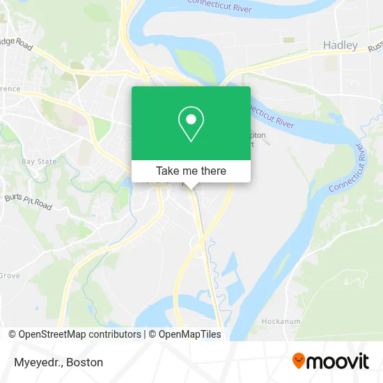
See Myeyedr., Boston, on the map
Public Transit to Myeyedr. in Boston
Wondering how to get to Myeyedr. in Boston? Moovit helps you find the best way to get to Myeyedr. with step-by-step directions from the nearest public transit station.
Moovit provides free maps and live directions to help you navigate through your city. View schedules, routes, timetables, and find out how long does it take to get to Myeyedr. in real time.
Looking for the nearest stop or station to Myeyedr.? Check out this list of stops closest to your destination: King/Merrick (Calvin Theatre); Peter Pan Bus Terminal Northampton; Northampton Court House; Pleasant / Service Center; Old South / Conz (Mcdonald House); Northampton (Northampton Market); Crafts Avenue / Peter Pan; Northampton.
Bus: 31, B48, G73E, GREYHOUND US0255S, R44, PETER PAN, PETER PAN, PETER PAN, PETER PAN, 904, B43, R41, G47, NE.Train: VERMONTER, VALLEY FLYER.
Want to see if there’s another route that gets you there at an earlier time? Moovit helps you find alternative routes or times. Get directions from and directions to Myeyedr. easily from the Moovit App or Website.
We make riding to Myeyedr. easy, which is why over 1.7 million users, including users in Boston, trust Moovit as the best app for public transit. You don’t need to download an individual bus app or train app, Moovit is your all-in-one transit app that helps you find the best bus time or train time available.
For information on prices of bus and train, costs and ride fares to Myeyedr., please check the Moovit app.
Use the app to navigate to popular places including to the airport, hospital, stadium, grocery store, mall, coffee shop, school, college, and university.
Myeyedr. Address: 274 Pleasant Street street in Boston
- Northampton Lumber Company,
- Keller Williams Realty,
- Northampton Bicycle,
- Hec Academy,
- Yes Computers,
- Hampshire Educational Collaborative,
- Curriculum Resource Center,
- Dgcr,
- Visiting Nurse Assn Plus of Western Mass,
- Tea Trekker,
- Century 21,
- Pizza Party,
- Progression Brewing Company,
- Roberto's,
- Hampton Court,
- Sylvester's,
- Commonwealth of Massachusetts,
- Daily Hampshire Gazette,
- Amherst Bulletin,
- Lucentini & Lucentini
Places Near Myeyedr. (Boston)
- Boston Convention & Exhibition Center, Boston,
- Quincy Market, Boston,
- North End, Boston,
- Museum Of Science, Boston,
- Massachusetts General Hospital, Boston,
- Wang Theater, Boston,
- Prudential Center, Boston,
- Mgm Music Hall, Boston,
- Wilbur Theatre, Boston,
- House Of Blues, Boston,
- Cheers, Boston,
- Isabella Stewart Gardner Museum, Boston,
- Seaport District, Boston,
- Td Garden, Boston,
- Boston Children's Hospital, Boston,
- Faneuil Hall, Boston,
- Boston Common, Boston,
- Castle Island, Boston,
- Leader Bank Pavilion (Leader Bank Pavillion), Boston,
- Boston Medical Center, Boston
How to get to popular places in Boston with public transit
Get around Boston by public transit!
Traveling around Boston has never been so easy. See step by step directions as you travel to any attraction, street or major public transit station. View bus and train schedules, arrival times, service alerts and detailed routes on a map, so you know exactly how to get to anywhere in Boston.
When traveling to any destination around Boston use Moovit's Live Directions with Get Off Notifications to know exactly where and how far to walk, how long to wait for your line, and how many stops are left. Moovit will alert you when it's time to get off — no need to constantly re-check whether yours is the next stop.
Wondering how to use public transit in Boston or how to pay for public transit in Boston? Moovit public transit app can help you navigate your way with public transit easily, and at minimum cost. It includes public transit fees, ticket prices, and costs. Looking for a map of Boston public transit lines? Moovit public transit app shows all public transit maps in Boston with all Bus, Train, Subway and Ferry routes and stops on an interactive map.
Boston has 4 transit type(s), including: Bus, Train, Subway and Ferry, operated by several transit agencies, including MBTA, Southeastern Regional Transit Authority, MetroWest Regional Transit Authority, Rhode Island Public Transit Authority, WRTA, Lowell Regional Transit Authority, Merrimack Valley Transit, Montachusett Regional Transit Authority, Cape Cod Regional Transit Authority, Brockton Area Transit Authority, Martha's Vineyard Transit Authority, the WAVE - Nantucket Regional Transit Authority, GATRA, Cape Ann Transportation Authority and Massport