Directions to Mystyleelevated (Melrose) with public transportation
The following transit lines have routes that pass near Mystyleelevated
 Bus: 132, 137, 131, HAVERHILL LINE SHUTTLE, HAVERHILL LINE SHUTTLE.
- Train: HAVERHILL, ORANGE LINE.
- Subway: ORANGE LINE.
How to get to Mystyleelevated by bus?
Click on the bus route to see step by step directions with maps, line arrival times and updated time schedules.
From Market Basket, Somerville
89 minFrom Museum Of Science, Boston
103 minFrom CambridgeSide (Cambridgeside Galleria), Cambridge
100 minFrom Chelsea District Court, Chelsea
65 minFrom Kimpton Marlowe Hotel, Cambridge
102 minFrom Chevalier Theatre (Chevalier Theater Show Line), Medford
53 minFrom USS Constitution, Boston
72 minFrom Assembly Square, Somerville
53 minFrom Cambridgeside, Cambridge
100 minFrom Royal Sonesta, Cambridge
101 min
How to get to Mystyleelevated by train?
Click on the train route to see step by step directions with maps, line arrival times and updated time schedules.
From Market Basket, Somerville
105 minFrom Museum Of Science, Boston
34 minFrom CambridgeSide (Cambridgeside Galleria), Cambridge
43 minFrom Chelsea District Court, Chelsea
59 minFrom Kimpton Marlowe Hotel, Cambridge
40 minFrom USS Constitution, Boston
42 minFrom Cambridgeside, Cambridge
42 minFrom Royal Sonesta, Cambridge
38 min
How to get to Mystyleelevated by subway?
Click on the subway route to see step by step directions with maps, line arrival times and updated time schedules.
From Market Basket, Somerville
77 minFrom Museum Of Science, Boston
61 minFrom CambridgeSide (Cambridgeside Galleria), Cambridge
62 minFrom Kimpton Marlowe Hotel, Cambridge
59 minFrom Chevalier Theatre (Chevalier Theater Show Line), Medford
93 minFrom USS Constitution, Boston
67 minFrom Assembly Square, Somerville
49 minFrom Cambridgeside, Cambridge
61 minFrom Royal Sonesta, Cambridge
58 min
Bus stops near Mystyleelevated in Melrose
Train station near Mystyleelevated in Melrose
- Oak Grove, 54 min walk,VIEW
Bus lines to Mystyleelevated in Melrose
- 137, Malden,VIEW
- 131, Malden Via Oak Grove,VIEW
- 132, Malden,VIEW
- HAVERHILL LINE SHUTTLE, Ballardvale - Malden Center,VIEW
- HAVERHILL LINE SHUTTLE, Reading - Oak Grove,VIEW
- HAVERHILL LINE SHUTTLE, Haverhill - Malden Center,VIEW
- HAVERHILL LINE SHUTTLE, Haverhill - North Station,VIEW
- HAVERHILL LINE SHUTTLE, Ballardvale - North Station,VIEW
- HAVERHILL, Haverhill,VIEW
What are the closest stations to Mystyleelevated?
The closest stations to Mystyleelevated are:
- Main St @ Emerson St is 171 yards away, 3 min walk.
- Main St @ E Emerson St is 171 yards away, 3 min walk.
- Wyoming Ave @ Cottage St is 270 yards away, 4 min walk.
- Melrose/Cedar Park is 659 yards away, 9 min walk.
- Oak Grove is 4567 yards away, 54 min walk.
Which bus lines stop near Mystyleelevated?
These bus lines stop near Mystyleelevated: 132, 137.
Which train line stops near Mystyleelevated?
HAVERHILL (#223 | Haverhill)
Which subway line stops near Mystyleelevated?
ORANGE LINE (Oak Grove)
What’s the nearest bus station to Mystyleelevated in Melrose?
The nearest bus stations to Mystyleelevated in Melrose are Main St @ Emerson St and Main St @ E Emerson St. The closest one is a 3 min walk away.
What time is the first subway to Mystyleelevated in Melrose?
The ORANGE LINE is the first subway that goes to Mystyleelevated in Melrose. It stops nearby at 5:15 AM.
What time is the last subway to Mystyleelevated in Melrose?
The ORANGE LINE is the last subway that goes to Mystyleelevated in Melrose. It stops nearby at 1:59 AM.
What time is the first train to Mystyleelevated in Melrose?
The HAVERHILL is the first train that goes to Mystyleelevated in Melrose. It stops nearby at 5:31 AM.
What time is the last train to Mystyleelevated in Melrose?
The HAVERHILL is the last train that goes to Mystyleelevated in Melrose. It stops nearby at 11:57 PM.
What time is the first bus to Mystyleelevated in Melrose?
The 137 is the first bus that goes to Mystyleelevated in Melrose. It stops nearby at 5:00 AM.
What time is the last bus to Mystyleelevated in Melrose?
The 132 is the last bus that goes to Mystyleelevated in Melrose. It stops nearby at 11:37 PM.
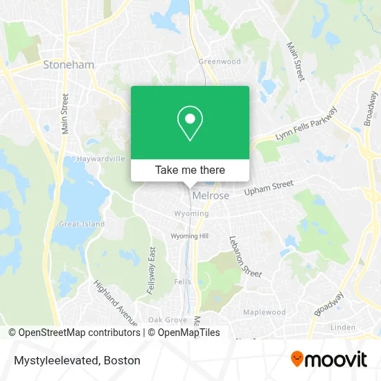
See Mystyleelevated, Melrose, on the map
Public Transit to Mystyleelevated in Melrose
Wondering how to get to Mystyleelevated in Melrose? Moovit helps you find the best way to get to Mystyleelevated with step-by-step directions from the nearest public transit station.
Moovit provides free maps and live directions to help you navigate through your city. View schedules, routes, timetables, and find out how long does it take to get to Mystyleelevated in real time.
Looking for the nearest stop or station to Mystyleelevated? Check out this list of stops closest to your destination: Main St @ Emerson St; Main St @ E Emerson St; Wyoming Ave @ Cottage St; Melrose/Cedar Park; Oak Grove.
Bus: 132, 137, 131, HAVERHILL LINE SHUTTLE, HAVERHILL LINE SHUTTLE, HAVERHILL LINE SHUTTLE, HAVERHILL LINE SHUTTLE, HAVERHILL LINE SHUTTLE.Train: HAVERHILL, ORANGE LINE.Subway: ORANGE LINE.
Want to see if there’s another route that gets you there at an earlier time? Moovit helps you find alternative routes or times. Get directions from and directions to Mystyleelevated easily from the Moovit App or Website.
We make riding to Mystyleelevated easy, which is why over 1.7 million users, including users in Melrose, trust Moovit as the best app for public transit. You don’t need to download an individual bus app or train app, Moovit is your all-in-one transit app that helps you find the best bus time or train time available.
For information on prices of bus, subway and train, costs and ride fares to Mystyleelevated, please check the Moovit app.
Use the app to navigate to popular places including to the airport, hospital, stadium, grocery store, mall, coffee shop, school, college, and university.
Mystyleelevated Address: 223 Essex St Apt 32 street in Melrose
- MBTA Melrose Cedar Park Station,
- USPS Collection Box - Blue Box,
- Trinity Episcopal Church (Trinity Church Thrift Shop),
- RZN,
- Marilyn Bozzuto,
- Journal of Abdominal Surgery,
- Lewis Monk Field,
- Krux Athletics,
- ADT,
- Melrose MA USA,
- Northeast School Of Ballet,
- City of Melrose,
- West Emerson,
- Jornal dos Sports,
- Hanna Yapikhina, PMHNP,
- Julie A Ventola Attorney,
- Coinstar,
- Melrose, Massachusetts,
- Global Express Tours (Montreal Express),
- Grace and Faith Christian Church
Places Near Mystyleelevated (Melrose)
- Td Garden, Boston,
- Boston Children's Hospital, Boston,
- Faneuil Hall, Boston,
- Wang Theater, Boston,
- Seaport District, Boston,
- North End, Boston,
- Cheers, Boston,
- Boston Medical Center, Boston,
- Isabella Stewart Gardner Museum, Boston,
- Quincy Market, Boston,
- Castle Island, Boston,
- House Of Blues, Boston,
- Leader Bank Pavilion (Leader Bank Pavillion), Boston,
- Prudential Center, Boston,
- Wilbur Theatre, Boston,
- Massachusetts General Hospital, Boston,
- Museum Of Science, Boston,
- Boston Convention & Exhibition Center, Boston,
- Mgm Music Hall, Boston,
- Boston Common, Boston
How to get to popular places in Boston with public transit
Get around Melrose by public transit!
Traveling around Melrose has never been so easy. See step by step directions as you travel to any attraction, street or major public transit station. View bus and train schedules, arrival times, service alerts and detailed routes on a map, so you know exactly how to get to anywhere in Melrose.
When traveling to any destination around Melrose use Moovit's Live Directions with Get Off Notifications to know exactly where and how far to walk, how long to wait for your line, and how many stops are left. Moovit will alert you when it's time to get off — no need to constantly re-check whether yours is the next stop.
Wondering how to use public transit in Melrose or how to pay for public transit in Melrose? Moovit public transit app can help you navigate your way with public transit easily, and at minimum cost. It includes public transit fees, ticket prices, and costs. Looking for a map of Melrose public transit lines? Moovit public transit app shows all public transit maps in Melrose with all Bus, Train, Subway and Ferry routes and stops on an interactive map.
Boston has 4 transit type(s), including: Bus, Train, Subway and Ferry, operated by several transit agencies, including MBTA, Southeastern Regional Transit Authority, MetroWest Regional Transit Authority, Rhode Island Public Transit Authority, WRTA, Lowell Regional Transit Authority, Merrimack Valley Transit, Montachusett Regional Transit Authority, Cape Cod Regional Transit Authority, Brockton Area Transit Authority, Martha's Vineyard Transit Authority, the WAVE - Nantucket Regional Transit Authority, GATRA, Cape Ann Transportation Authority and Massport