How to get to Myths by bus?
Click on the bus route to see step by step directions with maps, line arrival times and updated time schedules.
From Courtyard by Marriott Brookline, Brookline
93 minFrom Ac Hotel Cambridge, Cambridge
100 minFrom Downtown, Boston
33 minFrom Allston, Boston
84 minFrom Holiday Inn Express Boston Hotel Boston, Boston
70 minFrom AC Hotel Boston Cambridge, Cambridge
106 minFrom Wegmans, Medford
36 minFrom New England Baptist Hospital, Boston
79 minFrom Boston Marriott Copley Place, Boston
60 minFrom Allston, Boston
80 min
How to get to Myths by train?
Click on the train route to see step by step directions with maps, line arrival times and updated time schedules.
How to get to Myths by subway?
Click on the subway route to see step by step directions with maps, line arrival times and updated time schedules.
From Courtyard by Marriott Brookline, Brookline
80 minFrom Ac Hotel Cambridge, Cambridge
88 minFrom Downtown, Boston
54 minFrom Allston, Boston
84 minFrom Holiday Inn Express Boston Hotel Boston, Boston
75 minFrom AC Hotel Boston Cambridge, Cambridge
95 minFrom Wegmans, Medford
83 minFrom New England Baptist Hospital, Boston
90 minFrom Boston Marriott Copley Place, Boston
69 minFrom Allston, Boston
95 min
Bus stops near Myths in Chelsea
Train station near Myths in Chelsea
- Chelsea, 14 min walk,VIEW
Subway station near Myths in Chelsea
- Wood Island, 30 min walk,VIEW
Bus lines to Myths in Chelsea
What are the closest stations to Myths?
The closest stations to Myths are:
- Broadway @ Cary Ave is 73 yards away, 1 min walk.
- Washington Ave Opp Carmel St is 302 yards away, 4 min walk.
- Summit Ave @ Lafayette Ave is 772 yards away, 10 min walk.
- Chelsea is 1119 yards away, 14 min walk.
- Wood Island is 2503 yards away, 30 min walk.
Which bus lines stop near Myths?
These bus lines stop near Myths: 104, 111, 112, SL3.
Which train line stops near Myths?
NEWBURYPORT/ROCKPORT (#125 | Newburyport)
Which subway line stops near Myths?
BLUE LINE (Wonderland)
What’s the nearest subway station to Myths in Chelsea?
The nearest subway station to Myths in Chelsea is Wood Island. It’s a 30 min walk away.
What’s the nearest train station to Myths in Chelsea?
The nearest train station to Myths in Chelsea is Chelsea. It’s a 14 min walk away.
What’s the nearest bus station to Myths in Chelsea?
The nearest bus station to Myths in Chelsea is Broadway @ Cary Ave. It’s a 1 min walk away.
What time is the first subway to Myths in Chelsea?
The BLUE LINE is the first subway that goes to Myths in Chelsea. It stops nearby at 5:08 AM.
What time is the last subway to Myths in Chelsea?
The BLUE LINE is the last subway that goes to Myths in Chelsea. It stops nearby at 2:03 AM.
What time is the first train to Myths in Chelsea?
The NEWBURYPORT/ROCKPORT is the first train that goes to Myths in Chelsea. It stops nearby at 5:40 AM.
What time is the last train to Myths in Chelsea?
The NEWBURYPORT/ROCKPORT is the last train that goes to Myths in Chelsea. It stops nearby at 12:06 AM.
What time is the first bus to Myths in Chelsea?
The 116 is the first bus that goes to Myths in Chelsea. It stops nearby at 4:32 AM.
What time is the last bus to Myths in Chelsea?
The 111 is the last bus that goes to Myths in Chelsea. It stops nearby at 2:30 AM.
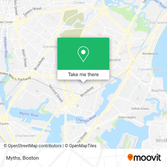
See Myths, Chelsea, on the map
Public Transit to Myths in Chelsea
Wondering how to get to Myths in Chelsea? Moovit helps you find the best way to get to Myths with step-by-step directions from the nearest public transit station.
Moovit provides free maps and live directions to help you navigate through your city. View schedules, routes, timetables, and find out how long does it take to get to Myths in real time.
Looking for the nearest stop or station to Myths? Check out this list of stops closest to your destination: Broadway @ Cary Ave; Washington Ave Opp Carmel St; Summit Ave @ Lafayette Ave; Chelsea; Wood Island.
Bus: 104, 111, 112, SL3, 116.Train: NEWBURYPORT/ROCKPORT.Subway: BLUE LINE.
Want to see if there’s another route that gets you there at an earlier time? Moovit helps you find alternative routes or times. Get directions from and directions to Myths easily from the Moovit App or Website.
We make riding to Myths easy, which is why over 1.7 million users, including users in Chelsea, trust Moovit as the best app for public transit. You don’t need to download an individual bus app or train app, Moovit is your all-in-one transit app that helps you find the best bus time or train time available.
For information on prices of bus, subway and train, costs and ride fares to Myths, please check the Moovit app.
Use the app to navigate to popular places including to the airport, hospital, stadium, grocery store, mall, coffee shop, school, college, and university.
Myths Address: 11 Sturgis St street in Chelsea
- Massachusetts Soldiers Home,
- Cary Square,
- Iglesia La Luz De Cristo,
- MBTA Bus Route 117,
- Palomares Painting,
- Spencer Ave Building 113,
- Family Dollar,
- Canobie Lake Park,
- The Home Depot,
- Chelsea, MA,
- Chelsea Station,
- Camilas Fashion,
- Santander,
- Cabot St & Revere Beach Pkwy,
- Novelty Bias Binding,
- Parkway Plaza Shopping Center,
- Revere Beach Parkway & Washington Avenue,
- Bispo Paulo Tenorio Ap Boston,
- Interport Freight,
- Chelsea MBTA commuter rail tracks
Places Near Myths (Chelsea)
- Prudential Center, Boston,
- Boston Children's Hospital, Boston,
- Museum Of Science, Boston,
- Seaport District, Boston,
- Boston Convention & Exhibition Center, Boston,
- Cheers, Boston,
- Leader Bank Pavilion (Leader Bank Pavillion), Boston,
- Mgm Music Hall, Boston,
- Castle Island, Boston,
- Isabella Stewart Gardner Museum, Boston,
- House Of Blues, Boston,
- Boston Common, Boston,
- Wilbur Theatre, Boston,
- Td Garden, Boston,
- Massachusetts General Hospital, Boston,
- Wang Theater, Boston,
- Faneuil Hall, Boston,
- North End, Boston,
- Boston Medical Center, Boston,
- Quincy Market, Boston
How to get to popular places in Boston with public transit
Get around Chelsea by public transit!
Traveling around Chelsea has never been so easy. See step by step directions as you travel to any attraction, street or major public transit station. View bus and train schedules, arrival times, service alerts and detailed routes on a map, so you know exactly how to get to anywhere in Chelsea.
When traveling to any destination around Chelsea use Moovit's Live Directions with Get Off Notifications to know exactly where and how far to walk, how long to wait for your line, and how many stops are left. Moovit will alert you when it's time to get off — no need to constantly re-check whether yours is the next stop.
Wondering how to use public transit in Chelsea or how to pay for public transit in Chelsea? Moovit public transit app can help you navigate your way with public transit easily, and at minimum cost. It includes public transit fees, ticket prices, and costs. Looking for a map of Chelsea public transit lines? Moovit public transit app shows all public transit maps in Chelsea with all Bus, Train, Subway and Ferry routes and stops on an interactive map.
Boston has 4 transit type(s), including: Bus, Train, Subway and Ferry, operated by several transit agencies, including MBTA, Southeastern Regional Transit Authority, MetroWest Regional Transit Authority, Rhode Island Public Transit Authority, WRTA, Lowell Regional Transit Authority, Merrimack Valley Transit, Montachusett Regional Transit Authority, Cape Cod Regional Transit Authority, Brockton Area Transit Authority, Martha's Vineyard Transit Authority, the WAVE - Nantucket Regional Transit Authority, GATRA, Cape Ann Transportation Authority and Massport