See NYC Health Hospitals Elmhurst, Queens, on the map
Directions to NYC Health Hospitals Elmhurst (Queens) with public transportation
The following transit lines have routes that pass near NYC Health Hospitals Elmhurst
 Bus:
Bus: - Train:
- Subway:
How to get to NYC Health Hospitals Elmhurst by bus?
Click on the bus route to see step by step directions with maps, line arrival times and updated time schedules.
How to get to NYC Health Hospitals Elmhurst by train?
Click on the train route to see step by step directions with maps, line arrival times and updated time schedules.
How to get to NYC Health Hospitals Elmhurst by subway?
Click on the subway route to see step by step directions with maps, line arrival times and updated time schedules.
Bus stations near NYC Health Hospitals Elmhurst in Queens
- Broadway/78 St, 5 min walk,
- Roosevelt Av/78 St, 5 min walk,
- Hampton St/Baxter Av, 6 min walk,
Subway stations near NYC Health Hospitals Elmhurst in Queens
- 82 St - Jackson Hts [7], 6 min walk,
- Elmhurst Av [E,M,R], 7 min walk,
- Jackson Hts - Roosevelt Av - 74 St [E,F,M,R,7], 8 min walk,
Bus lines to NYC Health Hospitals Elmhurst in Queens
- Q53-SBS, +Select Bus Rockaway Pk B. 116 St Via Woodhaven Bl Via Cross Bay Bl,
- Q32, Jackson Hts Northern-81 St Via Roosevelt,
- Q33, Jackson Heights 74 St-Roosvlt Av Sta Via 82 St,
- Q29, Jackson Heights 82 St Sta,
What are the closest stations to NYC Health Hospitals Elmhurst?
The closest stations to NYC Health Hospitals Elmhurst are:
- Broadway/78 St is 288 yards away, 5 min walk.
- Roosevelt Av/78 St is 324 yards away, 5 min walk.
- Hampton St/Baxter Av is 348 yards away, 6 min walk.
- 82 St - Jackson Hts [7] is 393 yards away, 6 min walk.
- Elmhurst Av [E,M,R] is 446 yards away, 7 min walk.
- Jackson Hts - Roosevelt Av - 74 St [E,F,M,R,7] is 554 yards away, 8 min walk.
Which bus line stops near NYC Health Hospitals Elmhurst?
Q32
Which train lines stop near NYC Health Hospitals Elmhurst?
These train lines stop near NYC Health Hospitals Elmhurst: BABYLON, PORT JEFFERSON, PORT WASHINGTON, RONKONKOMA.
Which subway lines stop near NYC Health Hospitals Elmhurst?
These subway lines stop near NYC Health Hospitals Elmhurst: E, F, M, R.
What’s the nearest subway station to NYC Health Hospitals Elmhurst in Queens?
The nearest subway station to NYC Health Hospitals Elmhurst in Queens is 82 St - Jackson Hts [7]. It’s a 6 min walk away.
What’s the nearest bus stop to NYC Health Hospitals Elmhurst in Queens?
The nearest bus stops to NYC Health Hospitals Elmhurst in Queens are Broadway/78 St and Roosevelt Av/78 St. The closest one is a 5 min walk away.
See NYC Health Hospitals Elmhurst, Queens, on the map
Public Transit to NYC Health Hospitals Elmhurst in Queens
Wondering how to get to NYC Health Hospitals Elmhurst in Queens, United States? Moovit helps you find the best way to get to NYC Health Hospitals Elmhurst with step-by-step directions from the nearest public transit station.
Moovit provides free maps and live directions to help you navigate through your city. View schedules, routes, timetables, and find out how long does it take to get to NYC Health Hospitals Elmhurst in real time.
Looking for the nearest stop or station to NYC Health Hospitals Elmhurst? Check out this list of stops closest to your destination: Broadway/78 St; Roosevelt Av/78 St; Hampton St/Baxter Av; 82 St - Jackson Hts [7]; Elmhurst Av [E,M,R]; Jackson Hts - Roosevelt Av - 74 St [E,F,M,R,7].
Bus:Train:Subway:
Want to see if there’s another route that gets you there at an earlier time? Moovit helps you find alternative routes or times. Get directions from and directions to NYC Health Hospitals Elmhurst easily from the Moovit App or Website.
We make riding to NYC Health Hospitals Elmhurst easy, which is why over 1.5 million users, including users in Queens, trust Moovit as the best app for public transit. You don’t need to download an individual bus app or train app, Moovit is your all-in-one transit app that helps you find the best bus time or train time available.
For information on prices of subway, train and bus, costs and ride fares to NYC Health Hospitals Elmhurst, please check the Moovit app.
Use the app to navigate to popular places including to the airport, hospital, stadium, grocery store, mall, coffee shop, school, college, and university.
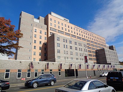
NYC Health Hospitals Elmhurst Address: 79-01 Broadway street in Queens
Attractions near NYC Health Hospitals Elmhurst
Queens Colombia Lions Club,Zachary L. Hickman,Covid-19 Testing Site: Elmhurst Hospital (Coronavirus Testing Site),New York Public Schools Elementary School 75,Elmhurst Hospital,Elmhurst Hospital Center,Nyc Health + Hospitals / Elmhurst,41st Ave (80th 41st avenue),41st / 80th,80th St (80th st & 41st ave),80th St (41st 80th street),79-01 Broadway,7911 41st Avenue,Broadway (broadway and 79th st),79th St and Bro,79th / Broadway,Broadway @ 79th,Libreria Barco de Papel,Elmhurst Hospital ER (NYC EMS Hospital 32),41st Ave 79th StHow to get to popular attractions in Queens with public transit
Nassau Community College, East Garden City, Ny,Jackson Heights, NY, Queens,SoHo, Manhattan,LIRR - Babylon Station, Babylon, Ny,The Park, Manhattan,Food Gallery 32, Manhattan,New Jersey Turnpike - Newark, Newark, Nj,Doughnut Plant, Manhattan,Joe's Shanghai 鹿嗚春, Manhattan,Great Lawn, Manhattan,Ritz Bar & Lounge, Manhattan,Café Habana, Manhattan,Wingate by Wyndham Manhattan Midtown, Manhattan,The Dutch, Manhattan,The Kunjip, Manhattan,Barrage, Manhattan,Hill Country Chicken, Manhattan,Virgin America Ticket Counter, Elizabeth, Nj,NJT - New Brunswick Station (NEC), New Brunswick, Nj,Veselka, ManhattanGet around Queens by public transit!
Traveling around Queens has never been so easy. See step by step directions as you travel to any attraction, street or major public transit station. View bus and train schedules, arrival times, service alerts and detailed routes on a map, so you know exactly how to get to anywhere in Queens.
When traveling to any destination around Queens use Moovit's Live Directions with Get Off Notifications to know exactly where and how far to walk, how long to wait for your line, and how many stops are left. Moovit will alert you when it's time to get off — no need to constantly re-check whether yours is the next stop.
Wondering how to use public transit in Queens or how to pay for public transit in Queens? Moovit public transit app can help you navigate your way with public transit easily, and at minimum cost. It includes public transit fees, ticket prices, and costs. Looking for a map of Queens public transit lines? Moovit public transit app shows all public transit maps in Queens with all subway, train or bus routes and stops on an interactive map.
Queens has 3 transit type(s), including: subway, train or bus, operated by several transit agencies, including MTA Subway, Metro-North Railroad, LIRR, PATH, Shore Line East, MTA Bus Company, MTA New York City Transit - Express routes, MTA Bus, NJ Transit, NYC Ferry, NICE bus, Bee-Line Bus, NJ Transit Rail, NJ Transit Rail and Norwalk Transit District