Directions to N Twelve Technologies (Cambridge) with public transportation
The following transit lines have routes that pass near N Twelve Technologies
 Bus: 74, 76, 77, 78, 83.
- Train: FITCHBURG, RED LINE.
- Subway: RED LINE, GREEN LINE B, GREEN LINE C, GREEN LINE E.
How to get to N Twelve Technologies by bus?
Click on the bus route to see step by step directions with maps, line arrival times and updated time schedules.
From Intercontinental-Boston (Intercontinental Hotel), Boston
74 minFrom Boston Park Plaza, Boston
58 minFrom Woburn, MA, Woburn
62 minFrom Franklin Park Zoo, Boston
91 minFrom Spaulding Rehab, Boston
93 minFrom Forest Hills Station MBTA, Boston
95 minFrom Td Garden, Boston
52 minFrom Lexington, MA, Lexington
43 minFrom Financial District, Boston
69 minFrom Boston Temple, Boston
65 min
How to get to N Twelve Technologies by train?
Click on the train route to see step by step directions with maps, line arrival times and updated time schedules.
How to get to N Twelve Technologies by subway?
Click on the subway route to see step by step directions with maps, line arrival times and updated time schedules.
From Intercontinental-Boston (Intercontinental Hotel), Boston
49 minFrom Boston Park Plaza, Boston
50 minFrom Franklin Park Zoo, Boston
83 minFrom Spaulding Rehab, Boston
86 minFrom Forest Hills Station MBTA, Boston
61 minFrom Td Garden, Boston
52 minFrom Financial District, Boston
48 minFrom Boston Temple, Boston
69 min
Bus stops near N Twelve Technologies in Cambridge
Train station near N Twelve Technologies in Cambridge
- Porter, 19 min walk,VIEW
Subway station near N Twelve Technologies in Cambridge
- Ball Square Station, 44 min walk,VIEW
What are the closest stations to N Twelve Technologies?
The closest stations to N Twelve Technologies are:
- Massachusetts Ave @ Dover St is 247 yards away, 3 min walk.
- Rindge Ave Opp Middlesex St is 268 yards away, 4 min walk.
- Porter is 1566 yards away, 19 min walk.
- Ball Square Station is 3675 yards away, 44 min walk.
Which bus lines stop near N Twelve Technologies?
These bus lines stop near N Twelve Technologies: 74, 76, 77, 78, 83, 88, 90.
Which train line stops near N Twelve Technologies?
FITCHBURG (#409 | Wachusett)
Which subway line stops near N Twelve Technologies?
RED LINE (Alewife)
What’s the nearest train station to N Twelve Technologies in Cambridge?
The nearest train station to N Twelve Technologies in Cambridge is Porter. It’s a 19 min walk away.
What’s the nearest bus station to N Twelve Technologies in Cambridge?
The nearest bus station to N Twelve Technologies in Cambridge is Massachusetts Ave @ Dover St. It’s a 3 min walk away.
What time is the first subway to N Twelve Technologies in Cambridge?
The GREEN LINE E is the first subway that goes to N Twelve Technologies in Cambridge. It stops nearby at 4:53 AM.
What time is the last subway to N Twelve Technologies in Cambridge?
The GREEN LINE E is the last subway that goes to N Twelve Technologies in Cambridge. It stops nearby at 2:39 AM.
What time is the first train to N Twelve Technologies in Cambridge?
The FITCHBURG is the first train that goes to N Twelve Technologies in Cambridge. It stops nearby at 5:47 AM.
What time is the last train to N Twelve Technologies in Cambridge?
The FITCHBURG is the last train that goes to N Twelve Technologies in Cambridge. It stops nearby at 12:17 AM.
What time is the first bus to N Twelve Technologies in Cambridge?
The 77 is the first bus that goes to N Twelve Technologies in Cambridge. It stops nearby at 5:02 AM.
What time is the last bus to N Twelve Technologies in Cambridge?
The 83 is the last bus that goes to N Twelve Technologies in Cambridge. It stops nearby at 1:27 AM.
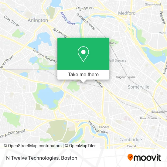
See N Twelve Technologies, Cambridge, on the map
Public Transit to N Twelve Technologies in Cambridge
Wondering how to get to N Twelve Technologies in Cambridge? Moovit helps you find the best way to get to N Twelve Technologies with step-by-step directions from the nearest public transit station.
Moovit provides free maps and live directions to help you navigate through your city. View schedules, routes, timetables, and find out how long does it take to get to N Twelve Technologies in real time.
Looking for the nearest stop or station to N Twelve Technologies? Check out this list of stops closest to your destination: Massachusetts Ave @ Dover St; Rindge Ave Opp Middlesex St; Porter; Ball Square Station.
Bus: 74, 76, 77, 78, 83, 88, 90.Train: FITCHBURG, RED LINE.Subway: RED LINE, GREEN LINE B, GREEN LINE C, GREEN LINE E.
Want to see if there’s another route that gets you there at an earlier time? Moovit helps you find alternative routes or times. Get directions from and directions to N Twelve Technologies easily from the Moovit App or Website.
We make riding to N Twelve Technologies easy, which is why over 1.7 million users, including users in Cambridge, trust Moovit as the best app for public transit. You don’t need to download an individual bus app or train app, Moovit is your all-in-one transit app that helps you find the best bus time or train time available.
For information on prices of bus, subway and train, costs and ride fares to N Twelve Technologies, please check the Moovit app.
Use the app to navigate to popular places including to the airport, hospital, stadium, grocery store, mall, coffee shop, school, college, and university.
N Twelve Technologies Address: 85 Bolton St street in Cambridge
- Slips Technologies,
- Catholic Charities,
- Efgb Cambridge,
- Repco Limited,
- CQ International Co. Inc.,
- Yaro-Dsi,
- Gran Gusto (Grangusto At The Brickyard),
- Bourbon Coffee Cafe Barada Cafe Zing,
- Mcmath Park Community Garden,
- Noca Glass School (Noca Glassschool),
- Art Class,
- Susi M & Sons,
- Cadbury Commons,
- Peabody School,
- Theatrical Theatre,
- Avest Home Repair & Painting,
- Judy Polacheck,
- Danehy Park St. Peters Baseball Field,
- Center for Families of North Cambridge,
- Simmons John
Places Near N Twelve Technologies (Cambridge)
- North End, Boston,
- Boston Medical Center, Boston,
- Wilbur Theatre, Boston,
- Leader Bank Pavilion (Leader Bank Pavillion), Boston,
- Isabella Stewart Gardner Museum, Boston,
- Cheers, Boston,
- Mgm Music Hall, Boston,
- Prudential Center, Boston,
- Massachusetts General Hospital, Boston,
- Td Garden, Boston,
- Wang Theater, Boston,
- Castle Island, Boston,
- Boston Children's Hospital, Boston,
- Quincy Market, Boston,
- Faneuil Hall, Boston,
- House Of Blues, Boston,
- Boston Convention & Exhibition Center, Boston,
- Museum Of Science, Boston,
- Boston Common, Boston,
- Seaport District, Boston
How to get to popular places in Boston with public transit
Get around Cambridge by public transit!
Traveling around Cambridge has never been so easy. See step by step directions as you travel to any attraction, street or major public transit station. View bus and train schedules, arrival times, service alerts and detailed routes on a map, so you know exactly how to get to anywhere in Cambridge.
When traveling to any destination around Cambridge use Moovit's Live Directions with Get Off Notifications to know exactly where and how far to walk, how long to wait for your line, and how many stops are left. Moovit will alert you when it's time to get off — no need to constantly re-check whether yours is the next stop.
Wondering how to use public transit in Cambridge or how to pay for public transit in Cambridge? Moovit public transit app can help you navigate your way with public transit easily, and at minimum cost. It includes public transit fees, ticket prices, and costs. Looking for a map of Cambridge public transit lines? Moovit public transit app shows all public transit maps in Cambridge with all Bus, Train, Subway and Ferry routes and stops on an interactive map.
Boston has 4 transit type(s), including: Bus, Train, Subway and Ferry, operated by several transit agencies, including MBTA, Southeastern Regional Transit Authority, MetroWest Regional Transit Authority, Rhode Island Public Transit Authority, WRTA, Lowell Regional Transit Authority, Merrimack Valley Transit, Montachusett Regional Transit Authority, Cape Cod Regional Transit Authority, Brockton Area Transit Authority, Martha's Vineyard Transit Authority, the WAVE - Nantucket Regional Transit Authority, GATRA, Cape Ann Transportation Authority and Massport