See Namdaemun Market, 중구, 서울시, on the map
Directions to Namdaemun Market (중구, 서울시) with public transportation
The following transit lines have routes that pass near Namdaemun Market
 Bus:
Bus: - Subway:
How to get to Namdaemun Market by bus?
Click on the bus route to see step by step directions with maps, line arrival times and updated time schedules.
How to get to Namdaemun Market by subway?
Click on the subway route to see step by step directions with maps, line arrival times and updated time schedules.
Bus stations near Namdaemun Market in 중구, 서울시
- 남대문시장,1 min walk,
- 북창동.남대문시장,1 min walk,
- 시청앞,4 min walk,
- 신세계앞,5 min walk,
- 프레이저플레이스남대문,5 min walk,
- 신한은행본점,5 min walk,
- 삼성프라자,6 min walk,
- 남대문시장.회현역,7 min walk,
Subway stations near Namdaemun Market in 중구, 서울시
- 회현 Hoehyeon (Namdaemun Market),4 min walk,
- 시청 City Hall,8 min walk,
- 서울 Seoul,11 min walk,
Bus lines to Namdaemun Market in 중구, 서울시
- 6001,인천공항,
- 6015,충무로역,
- N15,우이동 - 사당역,
- 100,하계동 - 용산구청,
- 151,우이동 - 중앙대,
- 152,화계사 - 삼막사사거리,
- 162,정릉 - 여의도,
- 163,월계동 - 목동,
- 201,수택동 - 서울역,
- 202,불암동 - 후암동,
- 261,장위동 - 여의도,
- 262,중랑공영차고지 - 여의도,
- 405,염곡동 - 종로1가,
- 421,염곡동 - 옥수동,
- 463,염곡동 - 국회의사당,
- 501,서울대 - 종로2가,
- 505,노온사동 - 서울역,
- 506,신림2동차고지 - 종로1가,
- 507,석수역 - 동대문역사문화공원,
- 701,진관공영차고지 - 종로2가,
What are the closest stations to Namdaemun Market?
The closest stations to Namdaemun Market are:
- 남대문시장 is 20 meters away, 1 min walk.
- 북창동.남대문시장 is 49 meters away, 1 min walk.
- 시청앞 is 267 meters away, 4 min walk.
- 회현 Hoehyeon (Namdaemun Market) is 289 meters away, 4 min walk.
- 신세계앞 is 318 meters away, 5 min walk.
- 프레이저플레이스남대문 is 326 meters away, 5 min walk.
- 신한은행본점 is 333 meters away, 5 min walk.
- 삼성프라자 is 430 meters away, 6 min walk.
- 남대문시장.회현역 is 522 meters away, 7 min walk.
- 시청 City Hall is 615 meters away, 8 min walk.
- 서울 Seoul is 823 meters away, 11 min walk.
Which bus lines stop near Namdaemun Market?
These bus lines stop near Namdaemun Market: 151, 162, 163, 1900고양, 500, 6001, 701, 7011, 7017, 7021, 705.
Which subway lines stop near Namdaemun Market?
These subway lines stop near Namdaemun Market: 2, 4, 공항철도 (AREX).
What’s the nearest subway station to Namdaemun Market in 중구, 서울시?
The nearest subway station to Namdaemun Market in 중구, 서울시 is 회현 Hoehyeon (Namdaemun Market). It’s a 4 min walk away.
What’s the nearest bus stop to Namdaemun Market in 중구, 서울시?
The nearest bus stops to Namdaemun Market in 중구, 서울시 are 남대문시장 and 북창동.남대문시장. The closest one is a 1 min walk away.
What time is the first subway to Namdaemun Market in 중구, 서울시?
The 1 is the first subway that goes to Namdaemun Market in 중구, 서울시. It stops nearby at 5:20 AM.
What time is the last subway to Namdaemun Market in 중구, 서울시?
The 공항철도 (AREX) is the last subway that goes to Namdaemun Market in 중구, 서울시. It stops nearby at 12:40 AM.
What time is the first bus to Namdaemun Market in 중구, 서울시?
The N16 is the first bus that goes to Namdaemun Market in 중구, 서울시. It stops nearby at 3:08 AM.
What time is the last bus to Namdaemun Market in 중구, 서울시?
The 9710파주 is the last bus that goes to Namdaemun Market in 중구, 서울시. It stops nearby at 1:12 AM.
See Namdaemun Market, 중구, 서울시, on the map
Public Transit to Namdaemun Market in 중구, 서울시
Wondering how to get to Namdaemun Market in 중구, 서울시, South Korea? Moovit helps you find the best way to get to Namdaemun Market with step-by-step directions from the nearest public transit station.
Moovit provides free maps and live directions to help you navigate through your city. View schedules, routes, timetables, and find out how long does it take to get to Namdaemun Market in real time.
Looking for the nearest stop or station to Namdaemun Market? Check out this list of stops closest to your destination: 남대문시장; 북창동.남대문시장; 시청앞; 회현 Hoehyeon (Namdaemun Market); 신세계앞; 프레이저플레이스남대문; 신한은행본점; 삼성프라자; 남대문시장.회현역; 시청 City Hall; 서울 Seoul.
Bus:Subway:
Want to see if there’s another route that gets you there at an earlier time? Moovit helps you find alternative routes or times. Get directions from and directions to Namdaemun Market easily from the Moovit App or Website.
We make riding to Namdaemun Market easy, which is why over 1.5 million users, including users in 중구, 서울시, trust Moovit as the best app for public transit. You don’t need to download an individual bus app or train app, Moovit is your all-in-one transit app that helps you find the best bus time or train time available.
For information on prices of bus and subway, costs and ride fares to Namdaemun Market, please check the Moovit app.
Use the app to navigate to popular places including to the airport, hospital, stadium, grocery store, mall, coffee shop, school, college, and university.
Location: 중구, 서울시, Seoul
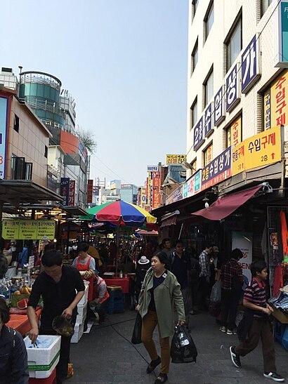
Attractions near Namdaemun Market
양미옥,시청역 9번출구 계단참 김밥,북창동 버스 정류장,남대문 버스 정류장,북창동, 남대문시장 (ID: 02-127),니콘카메라 남대문센터,그릇도매상가,남대문 지하 쇼핑센터,남대문시장 북창동(02-217),장호왕곱창 북창동,파나소닉 서비스센터 남대문점,남시약국,94-20 북창동,다이소,신촌서서갈비 북창동점,오픈시네마,Hotel 8 Hours Seoul,대성안경콘택트,고추장 불고기 39년 동굴집,코트야드 메리어트 서울 남대문How to get to popular attractions in 중구, 서울시 with public transit
전대·에버랜드역, 용인시, 경기도,서울창포원, 도봉구, 서울시,현대백화점, 고양시, 경기도,헤이리예술마을, 파주시, 경기도,경기영어마을 파주캠프, 파주시, 경기도,부평모두몰, 부평구, 인천시,CGV 상암, 마포구, 서울시,LG디스플레이 파주공장 A동, 파주시, 경기도,차세대융합기술연구원, 수원시, 경기도,삼성 디지털시티 중앙문, 수원시, 경기도,D zone, 12th Fl. @ SR3, 화성시, 경기도,영종대교휴게소, 서구, 인천시,정왕역, 시흥시, 경기도,성균관대학교 기숙사신관, 수원시, 경기도,가양대교, 마포구, 서울시,엠블호텔 고양, 고양시, 경기도,평촌IC, 안양시, 경기도,관문체육공원, 과천시, 경기도,대한항공 본사, 강서구, 서울시,양주자이6단지, 양주시, 경기도Get around 중구, 서울시 by public transit!
Traveling around 중구, 서울시 has never been so easy. See step by step directions as you travel to any attraction, street or major public transit station. View bus and train schedules, arrival times, service alerts and detailed routes on a map, so you know exactly how to get to anywhere in 중구, 서울시.
When traveling to any destination around 중구, 서울시 use Moovit's Live Directions with Get Off Notifications to know exactly where and how far to walk, how long to wait for your line, and how many stops are left. Moovit will alert you when it's time to get off — no need to constantly re-check whether yours is the next stop.
Wondering how to use public transit in 중구, 서울시 or how to pay for public transit in 중구, 서울시? Moovit public transit app can help you navigate your way with public transit easily, and at minimum cost. It includes public transit fees, ticket prices, and costs. Looking for a map of 중구, 서울시 public transit lines? Moovit public transit app shows all public transit maps in 중구, 서울시 with all bus or subway routes and stops on an interactive map.
중구, 서울시 has 2 transit type(s), including: bus or subway, operated by several transit agencies, including 서울교통공사, 인천교통공사, 네오트랜스, 한국철도공사, 네오트랜스, 경기, 공항, 간선, 지선, 순환, 광역, 인천, 김포 도시철도, 경기고속 and 대원고속