Directions to Nannybag Luggage Storage - Boston Common with public transportation
The following transit lines have routes that pass near Nannybag Luggage Storage - Boston Common
 Bus: 111, 354, 504, 92, 93.
- Train: FITCHBURG, FRAMINGHAM/WORCESTER, GREENBUSH, LOWELL.
- Subway: BLUE LINE, GREEN LINE B, GREEN LINE D, ORANGE LINE, RED LINE.
How to get to Nannybag Luggage Storage - Boston Common by bus?
Click on the bus route to see step by step directions with maps, line arrival times and updated time schedules.
From Boston University Track and Tennis Center
64 minFrom Arlington, MA
81 minFrom FOUR POINTS BY SHERATON Boston Newton
31 minFrom Revere Beach
71 minFrom Homewood Suites by Hilton Boston Brookline-Longwood Medical
56 minFrom The Mall At Chestnut Hill
73 minFrom Regent Theatre
70 minFrom JFK Library
55 minFrom Qea
99 minFrom Sommerville Theatre
58 min
How to get to Nannybag Luggage Storage - Boston Common by train?
Click on the train route to see step by step directions with maps, line arrival times and updated time schedules.
How to get to Nannybag Luggage Storage - Boston Common by subway?
Click on the subway route to see step by step directions with maps, line arrival times and updated time schedules.
Bus stops near Nannybag Luggage Storage - Boston Common
- Devonshire St @ Milk St, 1 min walk,VIEW
- Milk St @ Devonshire St, 1 min walk,VIEW
- Tremont St Opp Temple Pl, 1 min walk,VIEW
- Devonshire St @ Water St, 2 min walk,VIEW
- Temple Pl @ Washington St, 2 min walk,VIEW
- Park Street - Tremont St @ Winter St, 2 min walk,VIEW
- Park Street - Tremont St Opp Hamilton Pl, 2 min walk,VIEW
- Otis St @ Summer St, 5 min walk,VIEW
- Chauncy St @ Summer St, 5 min walk,VIEW
Subway stations near Nannybag Luggage Storage - Boston Common
Bus lines to Nannybag Luggage Storage - Boston Common
- 92, Sullivan,VIEW
- 93, Sullivan Via Navy Yard,VIEW
- 15, Haymarket Via Fields Corner & Nubian,VIEW
- 39, Haymarket Via Forest Hills,VIEW
- 57, Haymarket Via Kenmore,VIEW
- 43, Park St & Tremont St - Ruggles,VIEW
- GREEN LINE E SHUTTLE, Heath Street - Park Street,VIEW
- GREEN LINE SHUTTLE, Boston University East - Park Street,VIEW
- RED LINE SHUTTLE, Harvard - South Station,VIEW
- RED LINE SHUTTLE, Ashmont - Park Street via Post Office,VIEW
- RED LINE SHUTTLE, JFK/UMass - Park Street via Post Office,VIEW
- 4, Design Center,VIEW
- SL5, Downtown,VIEW
- RED LINE SHUTTLE, Kendall/MIT - Park Street,VIEW
- RED LINE SHUTTLE, Kendall/MIT - Broadway via Pearl Street,VIEW
- RED LINE SHUTTLE, Kendall/MIT - Broadway via Downtown Crossing,VIEW
- RED LINE SHUTTLE, Alewife - Park Street,VIEW
- RED LINE SHUTTLE, JFK/UMass - Park Street,VIEW
- RED LINE SHUTTLE, Harvard - Park Street,VIEW
- 7, Otis & Summer - City Point,VIEW
What are the closest stations to Nannybag Luggage Storage - Boston Common?
The closest stations to Nannybag Luggage Storage - Boston Common are:
- Devonshire St @ Milk St is 26 yards away, 1 min walk.
- Milk St @ Devonshire St is 38 yards away, 1 min walk.
- Tremont St Opp Temple Pl is 54 yards away, 1 min walk.
- Devonshire St @ Water St is 91 yards away, 2 min walk.
- Temple Pl @ Washington St is 94 yards away, 2 min walk.
- Park Street - Tremont St @ Winter St is 118 yards away, 2 min walk.
- Park Street - Tremont St Opp Hamilton Pl is 157 yards away, 2 min walk.
- Downtown Crossing is 252 yards away, 4 min walk.
- Otis St @ Summer St is 384 yards away, 5 min walk.
- Boylston is 410 yards away, 5 min walk.
- Chauncy St @ Summer St is 422 yards away, 5 min walk.
- Government Center is 452 yards away, 6 min walk.
Which bus lines stop near Nannybag Luggage Storage - Boston Common?
These bus lines stop near Nannybag Luggage Storage - Boston Common: 111, 354, 504, 92, 93, SL4, SL5.
Which train lines stop near Nannybag Luggage Storage - Boston Common?
These train lines stop near Nannybag Luggage Storage - Boston Common: FITCHBURG, FRAMINGHAM/WORCESTER, GREENBUSH, LOWELL.
Which subway lines stop near Nannybag Luggage Storage - Boston Common?
These subway lines stop near Nannybag Luggage Storage - Boston Common: BLUE LINE, GREEN LINE B, GREEN LINE D, ORANGE LINE, RED LINE.
What’s the nearest subway station to Nannybag Luggage Storage - Boston Common?
The nearest subway station to Nannybag Luggage Storage - Boston Common is Downtown Crossing. It’s a 4 min walk away.
What’s the nearest bus station to Nannybag Luggage Storage - Boston Common?
The nearest bus stations to Nannybag Luggage Storage - Boston Common are Devonshire St @ Milk St, Milk St @ Devonshire St and Tremont St Opp Temple Pl. The closest one is a 1 min walk away.
What time is the first subway to Nannybag Luggage Storage - Boston Common?
The GREEN LINE E is the first subway that goes to Nannybag Luggage Storage - Boston Common. It stops nearby at 5:05 AM.
What time is the last subway to Nannybag Luggage Storage - Boston Common?
The GREEN LINE E is the last subway that goes to Nannybag Luggage Storage - Boston Common. It stops nearby at 2:20 AM.
What time is the first bus to Nannybag Luggage Storage - Boston Common?
The 57 is the first bus that goes to Nannybag Luggage Storage - Boston Common. It stops nearby at 5:00 AM.
What time is the last bus to Nannybag Luggage Storage - Boston Common?
The 11 is the last bus that goes to Nannybag Luggage Storage - Boston Common. It stops nearby at 1:15 AM.
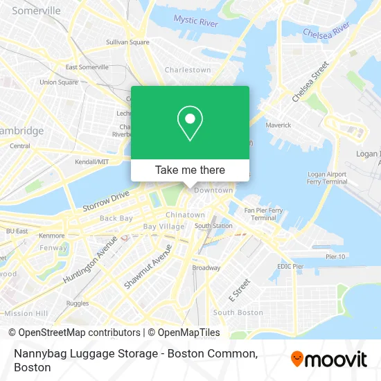
See Nannybag Luggage Storage - Boston Common on the map
Public Transportation to Nannybag Luggage Storage - Boston Common
Wondering how to get to Nannybag Luggage Storage - Boston Common? Moovit helps you find the best way to get to Nannybag Luggage Storage - Boston Common with step-by-step directions from the nearest public transit station.
Moovit provides free maps and live directions to help you navigate through your city. View schedules, routes, timetables, and find out how long does it take to get to Nannybag Luggage Storage - Boston Common in real time.
Looking for the nearest stop or station to Nannybag Luggage Storage - Boston Common? Check out this list of stops closest to your destination: Devonshire St @ Milk St; Milk St @ Devonshire St; Tremont St Opp Temple Pl; Devonshire St @ Water St; Temple Pl @ Washington St; Park Street - Tremont St @ Winter St; Park Street - Tremont St Opp Hamilton Pl; Downtown Crossing; Otis St @ Summer St; Boylston; Chauncy St @ Summer St; Government Center.
Bus: 111, 354, 504, 92, 93, SL4, SL5, 43, GREEN LINE E SHUTTLE, GREEN LINE SHUTTLE, RED LINE SHUTTLE, RED LINE SHUTTLE, 15, 39, 57.Train: FITCHBURG, FRAMINGHAM/WORCESTER, GREENBUSH, LOWELL.Subway: BLUE LINE, GREEN LINE B, GREEN LINE D, ORANGE LINE, RED LINE, GREEN LINE C, GREEN LINE E.
Want to see if there’s another route that gets you there at an earlier time? Moovit helps you find alternative routes or times. Get directions from and directions to Nannybag Luggage Storage - Boston Common easily from the Moovit App or Website.
We make riding to Nannybag Luggage Storage - Boston Common easy, which is why over 1.7 million users, including users in Boston, trust Moovit as the best app for public transit. You don’t need to download an individual bus app or train app, Moovit is your all-in-one transit app that helps you find the best bus time or train time available.
For information on prices of bus, subway and train, costs and ride fares to Nannybag Luggage Storage - Boston Common, please check the Moovit app.
Use the app to navigate to popular places including to the airport, hospital, stadium, grocery store, mall, coffee shop, school, college, and university.
Nannybag Luggage Storage - Boston Common Address: 31 Winter St street in Boston
- Planet Fitness,
- Downtown Crossing (Hamilton Crossing Apartments by the Hamilton Company),
- Health Law Advocates (Ad Hoc Committee To Defend Health Care),
- Yvonne's,
- GameStop,
- CeX Boston,
- Citadel Martial Arts,
- Repairs World @CEX,
- Mojito's Latin Night Club,
- Orpheum Theatre,
- Briggs,
- Corner Mall,
- Robyn,
- Temple Place Silver Line Bus Stop,
- Cafe 26 (Temple Place Cafe),
- Gentle Dental (Gentle Communications),
- Boston Psychic Center (Park Street Psychic Palm Readings Tarot Card Readi),
- Boston Jewelers Building,
- Promote Concert, Music, Magic, Festival, Nightlife Shows,
- Summer St & Winter St
Places Near Nannybag Luggage Storage - Boston Common
- Wang Theater, Boston,
- Boston Children's Hospital, Boston,
- Seaport District, Boston,
- Faneuil Hall, Boston,
- Cheers, Boston,
- Massachusetts General Hospital, Boston,
- Td Garden, Boston,
- Boston Common, Boston,
- Museum Of Science, Boston,
- Isabella Stewart Gardner Museum, Boston,
- North End, Boston,
- Mgm Music Hall, Boston,
- Wilbur Theatre, Boston,
- House Of Blues, Boston,
- Boston Convention & Exhibition Center, Boston,
- Boston Medical Center, Boston,
- Castle Island, Boston,
- Quincy Market, Boston,
- Prudential Center, Boston,
- Leader Bank Pavilion (Leader Bank Pavillion), Boston
How to get to popular places in Boston with public transit
Get around Boston by public transit!
Traveling around Boston has never been so easy. See step by step directions as you travel to any attraction, street or major public transit station. View bus and train schedules, arrival times, service alerts and detailed routes on a map, so you know exactly how to get to anywhere in Boston.
When traveling to any destination around Boston use Moovit's Live Directions with Get Off Notifications to know exactly where and how far to walk, how long to wait for your line, and how many stops are left. Moovit will alert you when it's time to get off — no need to constantly re-check whether yours is the next stop.
Wondering how to use public transit in Boston or how to pay for public transit in Boston? Moovit public transit app can help you navigate your way with public transit easily, and at minimum cost. It includes public transit fees, ticket prices, and costs. Looking for a map of Boston public transit lines? Moovit public transit app shows all public transit maps in Boston with all Bus, Train, Subway and Ferry routes and stops on an interactive map.
Boston has 4 transit type(s), including: Bus, Train, Subway and Ferry, operated by several transit agencies, including MBTA, Southeastern Regional Transit Authority, MetroWest Regional Transit Authority, Rhode Island Public Transit Authority, WRTA, Lowell Regional Transit Authority, Merrimack Valley Transit, Montachusett Regional Transit Authority, Cape Cod Regional Transit Authority, Brockton Area Transit Authority, Martha's Vineyard Transit Authority, the WAVE - Nantucket Regional Transit Authority, GATRA, Cape Ann Transportation Authority and Massport