See Naples Airport, Napoli, on the map
Directions to Naples Airport (Napoli) with public transportation
The following transit lines have routes that pass near Naples Airport
 Bus:
Bus: - Train:
How to get to Naples Airport by bus?
Click on the bus route to see step by step directions with maps, line arrival times and updated time schedules.
How to get to Naples Airport by train?
Click on the train route to see step by step directions with maps, line arrival times and updated time schedules.
Bus stations near Naples Airport in Napoli
- Ruffo Di Calabria - Aeroporto,1 min walk,
- Ruffo Fulco Di Calabria,2 min walk,
- Capodichino Terminal,2 min walk,
- Aeroporto Capodichino,3 min walk,
- Capodichino Aeroporto,5 min walk,
- Com. Maddalena,6 min walk,
- Riposo,6 min walk,
- Nuova Poggioreale,51 min walk,
Light Rail stations near Naples Airport in Napoli
- Nazionale,42 min walk,
- Nuova Poggioreale - Biscardi,57 min walk,
Bus lines to Naples Airport in Napoli
- C68,Ruffo Di Calabria - Carbone,
- 180,Zuccarini - M1 - Piscinola,
- NA-AV,Napoli Metropark,
- EBN001,Benevento,
- 04-NA,Caserta FS (> Tarì),
- 10-UC,Caserta - Stazione FS,
- 32-AV,S. Giorgio Del Sannio,
- ATC,Caserta FS (> Tarì),
- CILENTOBUS,Napoli Capodichino,
- CURCIO,Policastro,
- CURRERI,Sorrento Stazione,
- ALIBUS,Alibus | Aeroporto Capodichino - Stazione Centrale - Porto,
- 1,Via Nenni - Napoli Afragola AV,
- 2,Via Nenni - Napoli Afragola AV,
- 3,Via Nenni - Napoli Afragola AV,
- 4,Napoli Afragola AV - P.za Mazzini - Napoli Afragola AV,
- 5,Napoli Afragola AV - P.za Mazzini - Napoli Afragola AV,
- 6,Napoli Afragola AV - P.za Mazzini - Napoli Afragola AV,
- 7,Napoli Afragola AV - P.za Mazzini - Napoli Afragola AV,
- 8,Napoli Afragola AV - P.za Mazzini - Napoli Afragola AV,
What are the closest stations to Naples Airport?
The closest stations to Naples Airport are:
- Ruffo Di Calabria - Aeroporto is 42 meters away, 1 min walk.
- Ruffo Fulco Di Calabria is 109 meters away, 2 min walk.
- Capodichino Terminal is 110 meters away, 2 min walk.
- Aeroporto Capodichino is 154 meters away, 3 min walk.
- Capodichino Aeroporto is 324 meters away, 5 min walk.
- Com. Maddalena is 427 meters away, 6 min walk.
- Riposo is 437 meters away, 6 min walk.
- Nazionale is 3251 meters away, 42 min walk.
- Nuova Poggioreale is 3989 meters away, 51 min walk.
- Nuova Poggioreale - Biscardi is 4414 meters away, 57 min walk.
Which bus lines stop near Naples Airport?
These bus lines stop near Naples Airport: 180, 3, 928, 930, ALIBUS, ATC, EBN001, NA-AV.
Which train lines stop near Naples Airport?
These train lines stop near Naples Airport: L4, R.
What’s the nearest bus stop to Naples Airport in Napoli?
The nearest bus stop to Naples Airport in Napoli is Ruffo Di Calabria - Aeroporto. It’s a 1 min walk away.
What time is the first light rail to Naples Airport in Napoli?
The 412 is the first light rail that goes to Naples Airport in Napoli. It stops nearby at 6:25 AM.
What time is the last light rail to Naples Airport in Napoli?
The 421 is the last light rail that goes to Naples Airport in Napoli. It stops nearby at 11:59 PM.
What time is the first bus to Naples Airport in Napoli?
The 03-NA is the first bus that goes to Naples Airport in Napoli. It stops nearby at 4:33 AM.
What time is the last bus to Naples Airport in Napoli?
The 03-NA is the last bus that goes to Naples Airport in Napoli. It stops nearby at 12:04 AM.
See Naples Airport, Napoli, on the map
Public Transit to Naples Airport in Napoli
Wondering how to get to Naples Airport in Napoli, Italy? Moovit helps you find the best way to get to Naples Airport with step-by-step directions from the nearest public transit station.
Moovit provides free maps and live directions to help you navigate through your city. View schedules, routes, timetables, and find out how long does it take to get to Naples Airport in real time.
Looking for the nearest stop or station to Naples Airport? Check out this list of stops closest to your destination: Ruffo Di Calabria - Aeroporto; Ruffo Fulco Di Calabria; Capodichino Terminal; Aeroporto Capodichino; Capodichino Aeroporto; Com. Maddalena; Riposo; Nazionale; Nuova Poggioreale; Nuova Poggioreale - Biscardi.
Bus:Train:
Want to see if there’s another route that gets you there at an earlier time? Moovit helps you find alternative routes or times. Get directions from and directions to Naples Airport easily from the Moovit App or Website.
We make riding to Naples Airport easy, which is why over 1.5 million users, including users in Napoli, trust Moovit as the best app for public transit. You don’t need to download an individual bus app or train app, Moovit is your all-in-one transit app that helps you find the best bus time or train time available.
For information on prices of bus and train, costs and ride fares to Naples Airport, please check the Moovit app.
Use the app to navigate to popular places including to the airport, hospital, stadium, grocery store, mall, coffee shop, school, college, and university.
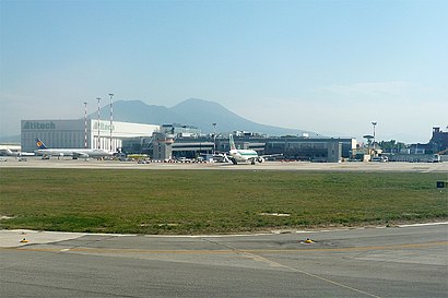
Naples Airport Address: Viale Fulco Ruffo di Calabria, 87 street in Napoli
Attractions near Naples Airport
Naples, Napoli Airport,Capodichino-P1 Sosta Lunga Low Cost,Sixt Rent Car,Europcar Naples Capodichino Airport,Ruffo di Calabria - Aeroporto,Aeroporto Capodichino (NAP) (Capodichino Airport),Flixbus (Napoli Capodichino Aeroporto),Napoli Capodichino Aeroporto,Naples Airport Italy,Viale Fulco Ruffo di Calabria 15,Cantiere Stazione Capodichino Aeroporto - Metropolitana Linea 1,Ministero Interno Dipartimento della Ps.,CRAI,Ente Militare Alleato USA NATO-Us Navy Napoli,Ortopedica Ospedaliera Societa' Cooperativa,Aero Club di Napoli,Terminal 1 Guest House,Sicily by Car,Europcar,Alibus Anm-CapodichinoHow to get to popular attractions in Napoli with public transit
Stazione Marittima - Molo Manfredi, Salerno,Piazza Giacomo Matteotti, Napoli,San Martino, Napoli,Manzoni, Napoli,Bb Napoli Stazione, Napoli,Agropoli, Agropoli,Biblioteca "E.R. Caianiello" Unisa, Fisciano,Chiesa Di Santa Maria Di Costantinopoli, Napoli,Baronissi, Baronissi,Aeroporto Internazionale di Napoli Capodichino "Ugo Niutta" (NAP), Napoli,Villaggio Coppola-Pinetamare, Castel Volturno,Piazza Del Plebiscito, Napoli,Costa Amalfitana, Amalfi,Ospedale San Giovanni Bosco, Napoli,Isola di Capri, Capri,Cardito, Cardito,Piazzetta Cariati, Napoli,Castel Sant'Elmo, Napoli,Piazza Principe Umberto, Napoli,Piave, NapoliGet around Napoli by public transit!
Traveling around Napoli has never been so easy. See step by step directions as you travel to any attraction, street or major public transit station. View bus and train schedules, arrival times, service alerts and detailed routes on a map, so you know exactly how to get to anywhere in Napoli.
When traveling to any destination around Napoli use Moovit's Live Directions with Get Off Notifications to know exactly where and how far to walk, how long to wait for your line, and how many stops are left. Moovit will alert you when it's time to get off — no need to constantly re-check whether yours is the next stop.
Wondering how to use public transit in Napoli or how to pay for public transit in Napoli? Moovit public transit app can help you navigate your way with public transit easily, and at minimum cost. It includes public transit fees, ticket prices, and costs. Looking for a map of Napoli public transit lines? Moovit public transit app shows all public transit maps in Napoli with all bus or train routes and stops on an interactive map.
Napoli has 2 transit type(s), including: bus or train, operated by several transit agencies, including ANM, EAV, ANM, EAV, ANM, ANM, EAV, ANM, Curreri Viaggi, Busitalia Campania, SITA Sud, Trenitalia, AIR - Linee Provinciali Caserta, AIR - Servizi Città Metropolitana di Napoli and AIR Campania (ex CTI-ATI)