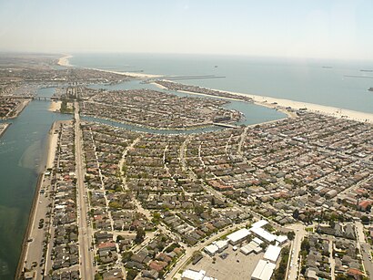
See Naples Island, Long Beach, on the map
Directions to Naples Island (Long Beach) with public transportation
The following transit lines have routes that pass near Naples Island
 Bus:
Bus:
How to get to Naples Island by bus?
Click on the bus route to see step by step directions with maps, line arrival times and updated time schedules.
Bus stations near Naples Island in Long Beach
- 2nd & E. Campo SW,5 min walk,
- Pacific Coast-Ent 6285 Golden Sail,38 min walk,
Bus lines to Naples Island in Long Beach
- 121,121 Belmont Shore to PCH at Clark via,
- 131,131 Redondo Ave to Alamitos Bay,
- 1,Long Beach - Cal State Long Beach,
What are the closest stations to Naples Island?
The closest stations to Naples Island are:
- 2nd & E. Campo SW is 407 yards away, 5 min walk.
- Pacific Coast-Ent 6285 Golden Sail is 3135 yards away, 38 min walk.
Which bus lines stop near Naples Island?
These bus lines stop near Naples Island: 1, 121, 131, 171.
What’s the nearest bus stop to Naples Island in Long Beach?
The nearest bus stop to Naples Island in Long Beach is 2nd & E. Campo SW. It’s a 5 min walk away.
What time is the first bus to Naples Island in Long Beach?
The 121 is the first bus that goes to Naples Island in Long Beach. It stops nearby at 5:24 AM.
What time is the last bus to Naples Island in Long Beach?
The 121 is the last bus that goes to Naples Island in Long Beach. It stops nearby at 11:33 PM.
How much is the bus fare to Naples Island?
The bus fare to Naples Island costs about $1.25.
See Naples Island, Long Beach, on the map
Public Transit to Naples Island in Long Beach
Wondering how to get to Naples Island in Long Beach, United States? Moovit helps you find the best way to get to Naples Island with step-by-step directions from the nearest public transit station.
Moovit provides free maps and live directions to help you navigate through your city. View schedules, routes, timetables, and find out how long does it take to get to Naples Island in real time.
Looking for the nearest stop or station to Naples Island? Check out this list of stops closest to your destination: 2nd & E. Campo SW; Pacific Coast-Ent 6285 Golden Sail.
Bus:
Want to see if there’s another route that gets you there at an earlier time? Moovit helps you find alternative routes or times. Get directions from and directions to Naples Island easily from the Moovit App or Website.
We make riding to Naples Island easy, which is why over 1.5 million users, including users in Long Beach, trust Moovit as the best app for public transit. You don’t need to download an individual bus app or train app, Moovit is your all-in-one transit app that helps you find the best bus time or train time available.
For information on prices of bus, costs and ride fares to Naples Island, please check the Moovit app.
Use the app to navigate to popular places including to the airport, hospital, stadium, grocery store, mall, coffee shop, school, college, and university.
Naples Island Address: 61 The Colonnade (The Toledo) street in Long Beach
Attractions near Naples Island
Naples, California,Mother's Beach,Island Cleaners,Caught in the Moment,Stephanie Oliver - Exp Realty,Chabad of Belmont Shore,Farmers Insurance - Robert Hickey,Free Meditation & Qigong Class,The European Prive' Academy,Jack Dunster Marine Biological Reserve,Clinical Care Services,Marina Pacifica,Franklin Thomas,Colonnade Park,Palm & Ridge Real Estate,Naples Canal,Moving Forward Fitness,2nd Street Bridge,Best Buy,Barnes & NobleHow to get to popular attractions in Long Beach with public transit
Hyatt Regency Orange County, Garden Grove,City of Brea, Brea,Hyatt Regency Century Plaza, Century City, La,Pomona Fairplex, Pomona,Citadel Outlets, Commerce,Costco Wholesale, Fountain Valley,Tomorrowland, Anaheim,The NOVO by Microsoft, Downtown, La,Roscoe's House of Chicken and Waffles - Long Beach, Long Beach,Fontana, CA, Fontana,Fry's Electronics, Anaheim,Diamond Jamboree Shopping Center, Irvine,Saddleback Community College, Mission Viejo,Pomona, CA, Pomona,Eagle Rock, Eagle Rock, La,Radiator Springs Racers, Anaheim,24 Hour Fitness, Orange,Disneyland Monorail, Anaheim,Honda Center, Anaheim,City of Calabasas, CalabasasGet around Long Beach by public transit!
Traveling around Long Beach has never been so easy. See step by step directions as you travel to any attraction, street or major public transit station. View bus and train schedules, arrival times, service alerts and detailed routes on a map, so you know exactly how to get to anywhere in Long Beach.
When traveling to any destination around Long Beach use Moovit's Live Directions with Get Off Notifications to know exactly where and how far to walk, how long to wait for your line, and how many stops are left. Moovit will alert you when it's time to get off — no need to constantly re-check whether yours is the next stop.
Wondering how to use public transit in Long Beach or how to pay for public transit in Long Beach? Moovit public transit app can help you navigate your way with public transit easily, and at minimum cost. It includes public transit fees, ticket prices, and costs. Looking for a map of Long Beach public transit lines? Moovit public transit app shows all public transit maps in Long Beach with all bus routes and stops on an interactive map.
Long Beach has 1 transit type(s), including: bus, operated by several transit agencies, including Metro - Los Angeles, Metro - Los Angeles, Metrolink Trains, METRO, Long Beach Transit, LADOT, OCTA, Foothill Transit, Big Blue Bus, Riverside Transit Agency, LAX FlyAway, Airporter Shuttle, Playa Vista Shuttle, Amtrak and OMNITRANS