Directions to Narragansett Brewing Co. (Boston) with public transportation
The following transit lines have routes that pass near Narragansett Brewing Co.
 Bus: 1, 35, 54, 58, 51.
- Train: PROVIDENCE/STOUGHTON, ACELA, NORTHEAST REGIONAL, PROVIDENCE LINE SHUTTLE, PROVIDENCE LINE SHUTTLE.
How to get to Narragansett Brewing Co. by bus?
Click on the bus route to see step by step directions with maps, line arrival times and updated time schedules.
How to get to Narragansett Brewing Co. by train?
Click on the train route to see step by step directions with maps, line arrival times and updated time schedules.
Bus stops near Narragansett Brewing Co. in Boston
Train stations near Narragansett Brewing Co. in Boston
- Providence, 20 min walk,VIEW
Bus lines to Narragansett Brewing Co. in Boston
- 51, Hospital District Via Charles St,VIEW
- 54, Hospital District,VIEW
- 58, E-Cubed Academy,VIEW
- 72, Hospital District (Providence),VIEW
- 50, Bryant University,VIEW
- 55, Kennedy Plaza,VIEW
- 56, Kennedy Plaza Via Chalkstone Ave,VIEW
- 57, Kennedy Plaza Via Smith St,VIEW
- FLIXBUS 2610, NYC - Boston,VIEW
- FLIXBUS 2616, NYC - Providence,VIEW
- FLIXBUS 2681, DC - NYC - Providence,VIEW
- GREYHOUND US0230, Boston - New York (Express Service),VIEW
What are the closest stations to Narragansett Brewing Co.?
The closest stations to Narragansett Brewing Co. are:
- N Main After Church is 312 yards away, 4 min walk.
- Gaspee & Smith (After Smith) is 327 yards away, 5 min walk.
- Canal After Smith is 443 yards away, 6 min walk.
- Providence is 1686 yards away, 21 min walk.
Which bus lines stop near Narragansett Brewing Co.?
These bus lines stop near Narragansett Brewing Co.: 1, 35, 54, 58.
Which train line stops near Narragansett Brewing Co.?
PROVIDENCE/STOUGHTON (#825 | Providence)
What’s the nearest train station to Narragansett Brewing Co. in Boston?
The nearest train station to Narragansett Brewing Co. in Boston is Providence. It’s a 21 min walk away.
What’s the nearest bus station to Narragansett Brewing Co. in Boston?
The nearest bus station to Narragansett Brewing Co. in Boston is N Main After Church. It’s a 4 min walk away.
What time is the first train to Narragansett Brewing Co. in Boston?
The PROVIDENCE/STOUGHTON is the first train that goes to Narragansett Brewing Co. in Boston. It stops nearby at 4:10 AM.
What time is the last train to Narragansett Brewing Co. in Boston?
The NORTHEAST REGIONAL is the last train that goes to Narragansett Brewing Co. in Boston. It stops nearby at 9:17 AM.
What time is the first bus to Narragansett Brewing Co. in Boston?
The 54 is the first bus that goes to Narragansett Brewing Co. in Boston. It stops nearby at 5:17 AM.
What time is the last bus to Narragansett Brewing Co. in Boston?
The 54 is the last bus that goes to Narragansett Brewing Co. in Boston. It stops nearby at 12:46 AM.
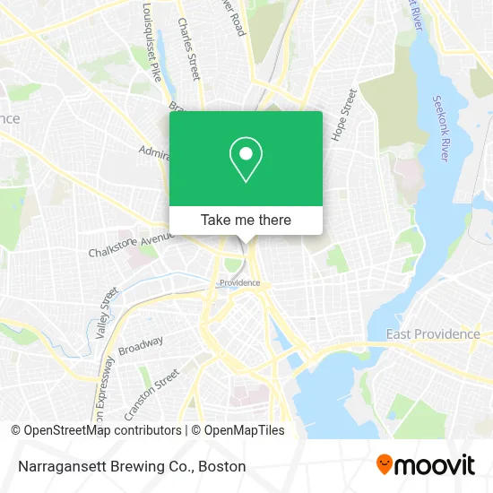
See Narragansett Brewing Co., Boston, on the map
Public Transit to Narragansett Brewing Co. in Boston
Wondering how to get to Narragansett Brewing Co. in Boston? Moovit helps you find the best way to get to Narragansett Brewing Co. with step-by-step directions from the nearest public transit station.
Moovit provides free maps and live directions to help you navigate through your city. View schedules, routes, timetables, and find out how long does it take to get to Narragansett Brewing Co. in real time.
Looking for the nearest stop or station to Narragansett Brewing Co.? Check out this list of stops closest to your destination: N Main After Church; Gaspee & Smith (After Smith); Canal After Smith; Providence.
Bus: 1, 35, 54, 58, 51, 72, 50, 55, 56, 57, FLIXBUS 2610, FLIXBUS 2616, FLIXBUS 2681, GREYHOUND US0230.Train: PROVIDENCE/STOUGHTON, ACELA, NORTHEAST REGIONAL, PROVIDENCE LINE SHUTTLE, PROVIDENCE LINE SHUTTLE, PROVIDENCE LINE SHUTTLE, FOXBORO EVENT SERVICE.
Want to see if there’s another route that gets you there at an earlier time? Moovit helps you find alternative routes or times. Get directions from and directions to Narragansett Brewing Co. easily from the Moovit App or Website.
We make riding to Narragansett Brewing Co. easy, which is why over 1.7 million users, including users in Boston, trust Moovit as the best app for public transit. You don’t need to download an individual bus app or train app, Moovit is your all-in-one transit app that helps you find the best bus time or train time available.
For information on prices of bus and train, costs and ride fares to Narragansett Brewing Co., please check the Moovit app.
Use the app to navigate to popular places including to the airport, hospital, stadium, grocery store, mall, coffee shop, school, college, and university.
Narragansett Brewing Co. Address: 10 Charles St street in Boston
- Delta Dental of Ri,
- Chamber of Commerce,
- Deloitte,
- Spherion Providence, Ri,
- Piper Brown Photography,
- Sonny Angel USA,
- Strauss, Factor, Laing & Lyons,
- US Department of Agriculture,
- Tyler Technologies,
- Acela Express 2250,
- One Smith Hill,
- Aarp Rhode Island,
- Reliable Local Locksmith,
- Monroe Staffing - Uxbridge, Ma,
- Rhode Island State Library,
- GoBus - NYC,
- Providence RI,
- Youth Action Council,
- Equal Housing Opportunity,
- 41agv Ga Chimney
Places Near Narragansett Brewing Co. (Boston)
- Castle Island, Boston,
- Boston Convention & Exhibition Center, Boston,
- Seaport District, Boston,
- Prudential Center, Boston,
- Wilbur Theatre, Boston,
- Museum Of Science, Boston,
- Mgm Music Hall, Boston,
- Wang Theater, Boston,
- Faneuil Hall, Boston,
- Td Garden, Boston,
- Quincy Market, Boston,
- Massachusetts General Hospital, Boston,
- Boston Medical Center, Boston,
- North End, Boston,
- Leader Bank Pavilion (Leader Bank Pavillion), Boston,
- Cheers, Boston,
- Boston Children's Hospital, Boston,
- House Of Blues, Boston,
- Boston Common, Boston,
- Isabella Stewart Gardner Museum, Boston
How to get to popular places in Boston with public transit
Get around Boston by public transit!
Traveling around Boston has never been so easy. See step by step directions as you travel to any attraction, street or major public transit station. View bus and train schedules, arrival times, service alerts and detailed routes on a map, so you know exactly how to get to anywhere in Boston.
When traveling to any destination around Boston use Moovit's Live Directions with Get Off Notifications to know exactly where and how far to walk, how long to wait for your line, and how many stops are left. Moovit will alert you when it's time to get off — no need to constantly re-check whether yours is the next stop.
Wondering how to use public transit in Boston or how to pay for public transit in Boston? Moovit public transit app can help you navigate your way with public transit easily, and at minimum cost. It includes public transit fees, ticket prices, and costs. Looking for a map of Boston public transit lines? Moovit public transit app shows all public transit maps in Boston with all Bus, Train, Subway and Ferry routes and stops on an interactive map.
Boston has 4 transit type(s), including: Bus, Train, Subway and Ferry, operated by several transit agencies, including MBTA, Southeastern Regional Transit Authority, MetroWest Regional Transit Authority, Rhode Island Public Transit Authority, WRTA, Lowell Regional Transit Authority, Merrimack Valley Transit, Montachusett Regional Transit Authority, Cape Cod Regional Transit Authority, Brockton Area Transit Authority, Martha's Vineyard Transit Authority, the WAVE - Nantucket Regional Transit Authority, GATRA, Cape Ann Transportation Authority and Massport