Directions to Nasdaq (Boston) with public transportation
The following transit lines have routes that pass near Nasdaq
 Bus: 4, SL2, SL3, SL4, 11.
- Train: FRAMINGHAM/WORCESTER, LOWELL, COMMUTER RAIL SHUTTLE, FAIRMOUNT LINE SHUTTLE, FRANKLIN LINE SHUTTLE.
- Subway: RED LINE.
- Ferry: HINGHAM FERRY, FAST FERRY, QUINCY FERRY, WINTHROP FERRY, WINTHROP/QUINCY FERRY.
How to get to Nasdaq by bus?
Click on the bus route to see step by step directions with maps, line arrival times and updated time schedules.
From Milton Academy, Milton
106 minFrom Sonia, Boston
75 minFrom Chestnut Hill, Boston
75 minFrom Watertown, MA, Watertown Town
57 minFrom Homewood Suites by Hilton Boston Brookline-Longwood Medical, Brookline
71 minFrom Boston College, Boston
73 minFrom Astrazeneca Hope Lodge, Boston
51 minFrom VA Medical Center, Boston (Jamaica Plain), Boston
52 minFrom Regent Theatre, Arlington
72 minFrom Alumni Stadium, Newton
77 min
How to get to Nasdaq by train?
Click on the train route to see step by step directions with maps, line arrival times and updated time schedules.
How to get to Nasdaq by subway?
Click on the subway route to see step by step directions with maps, line arrival times and updated time schedules.
From Milton Academy, Milton
59 minFrom Sonia, Boston
68 minFrom Chestnut Hill, Boston
72 minFrom Homewood Suites by Hilton Boston Brookline-Longwood Medical, Brookline
48 minFrom Boston College, Boston
70 minFrom Astrazeneca Hope Lodge, Boston
47 minFrom VA Medical Center, Boston (Jamaica Plain), Boston
48 minFrom Alumni Stadium, Newton
73 min
Bus stops near Nasdaq in Boston
Train station near Nasdaq in Boston
- South Station, 3 min walk,VIEW
Ferry stations near Nasdaq in Boston
Bus lines to Nasdaq in Boston
- 11, City Point,VIEW
- 4, Design Center - North Station via South Station,VIEW
- 7, Otis & Summer - City Point,VIEW
- RED LINE SHUTTLE, Kendall/MIT - JFK/UMass,VIEW
- RED LINE SHUTTLE, Kendall/MIT - Broadway via Pearl Street,VIEW
- RED LINE SHUTTLE, Harvard - South Station,VIEW
- RED LINE SHUTTLE, Kendall/MIT - Broadway via Downtown Crossing,VIEW
- RED LINE SHUTTLE, Harvard - JFK/UMass via Congress Street,VIEW
- RED LINE SHUTTLE, JFK/UMass - Park Street via Post Office,VIEW
- RED LINE SHUTTLE, Harvard - Broadway,VIEW
- RED LINE SHUTTLE, JFK/UMass - Park Street,VIEW
- RED LINE SHUTTLE, JFK/UMass - Kendall/MIT (Shuttle),VIEW
- RED LINE SHUTTLE, Ashmont - Park Street via Post Office,VIEW
What are the closest stations to Nasdaq?
The closest stations to Nasdaq are:
- A St @ Mt Washington Ave is 163 yards away, 3 min walk.
- South Station is 185 yards away, 3 min walk.
- Rowes Wharf is 227 yards away, 4 min walk.
- Summer St @ South Station - Red Line Entrance is 291 yards away, 4 min walk.
- World Trade Center Pier, Boston, MA is 1876 yards away, 23 min walk.
- Seaport (Fan Pier) is 2321 yards away, 28 min walk.
Which bus lines stop near Nasdaq?
These bus lines stop near Nasdaq: 4, SL2, SL3, SL4.
Which train lines stop near Nasdaq?
These train lines stop near Nasdaq: FRAMINGHAM/WORCESTER, LOWELL.
Which subway line stops near Nasdaq?
RED LINE (Alewife)
What’s the nearest train station to Nasdaq in Boston?
The nearest train station to Nasdaq in Boston is South Station. It’s a 3 min walk away.
What’s the nearest bus station to Nasdaq in Boston?
The nearest bus station to Nasdaq in Boston is A St @ Mt Washington Ave. It’s a 3 min walk away.
What’s the nearest ferry station to Nasdaq in Boston?
The nearest ferry station to Nasdaq in Boston is Rowes Wharf. It’s a 4 min walk away.
What time is the first subway to Nasdaq in Boston?
The RED LINE is the first subway that goes to Nasdaq in Boston. It stops nearby at 5:30 AM.
What time is the last subway to Nasdaq in Boston?
The RED LINE is the last subway that goes to Nasdaq in Boston. It stops nearby at 1:49 AM.
What time is the first train to Nasdaq in Boston?
The PROVIDENCE/STOUGHTON is the first train that goes to Nasdaq in Boston. It stops nearby at 4:20 AM.
What time is the last train to Nasdaq in Boston?
The LAKE SHORE LIMITED is the last train that goes to Nasdaq in Boston. It stops nearby at 8:32 PM.
What time is the first bus to Nasdaq in Boston?
The SLW is the first bus that goes to Nasdaq in Boston. It stops nearby at 4:15 AM.
What time is the last bus to Nasdaq in Boston?
The 11 is the last bus that goes to Nasdaq in Boston. It stops nearby at 1:20 AM.
What time is the first ferry to Nasdaq in Boston?
The EAST is the first ferry that goes to Nasdaq in Boston. It stops nearby at 6:01 AM.
What time is the last ferry to Nasdaq in Boston?
The FAST FERRY is the last ferry that goes to Nasdaq in Boston. It stops nearby at 9:05 PM.
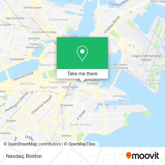
See Nasdaq, Boston, on the map
Public Transit to Nasdaq in Boston
Wondering how to get to Nasdaq in Boston? Moovit helps you find the best way to get to Nasdaq with step-by-step directions from the nearest public transit station.
Moovit provides free maps and live directions to help you navigate through your city. View schedules, routes, timetables, and find out how long does it take to get to Nasdaq in real time.
Looking for the nearest stop or station to Nasdaq? Check out this list of stops closest to your destination: A St @ Mt Washington Ave; South Station; Rowes Wharf; Summer St @ South Station - Red Line Entrance; World Trade Center Pier; Seaport (Fan Pier).
Bus: 4, SL2, SL3, SL4, 11, 7, RED LINE SHUTTLE, RED LINE SHUTTLE, RED LINE SHUTTLE.Train: FRAMINGHAM/WORCESTER, LOWELL, COMMUTER RAIL SHUTTLE, FAIRMOUNT LINE SHUTTLE, FRANKLIN LINE SHUTTLE, KINGSTON LINE SHUTTLE, SL1.Subway: RED LINE.Ferry: HINGHAM FERRY, FAST FERRY, QUINCY FERRY, WINTHROP FERRY, WINTHROP/QUINCY FERRY, EAST, LOVEJOY - FAN PIER - PIER 10.
Want to see if there’s another route that gets you there at an earlier time? Moovit helps you find alternative routes or times. Get directions from and directions to Nasdaq easily from the Moovit App or Website.
We make riding to Nasdaq easy, which is why over 1.7 million users, including users in Boston, trust Moovit as the best app for public transit. You don’t need to download an individual bus app or train app, Moovit is your all-in-one transit app that helps you find the best bus time or train time available.
For information on prices of bus, subway and train, costs and ride fares to Nasdaq, please check the Moovit app.
Use the app to navigate to popular places including to the airport, hospital, stadium, grocery store, mall, coffee shop, school, college, and university.
Nasdaq Address: 11 Farnsworth St street in Boston
- Flour Bakery,
- Sportello,
- Grand Circle Gallery,
- Ember,
- Grace Loves Lace,
- Bartaco,
- Lucky's Lounge,
- Smoke Shop BBQ,
- Caffe Nero,
- City Tap House,
- Trader Joe's,
- New Balance Hubway,
- Residence Inn by Marriott Boston Downtown Seaport,
- Boston Children's Museum,
- Trillium Brewing,
- JSGD,
- Sweetgreen (Sweet Green),
- The Artist Building at 300 Summer Street,
- Komyuniti at Yotel (Yotel Boston First Floor),
- Residence Inn-Boston Seaport
Places Near Nasdaq (Boston)
- Wilbur Theatre, Boston,
- Prudential Center, Boston,
- Wang Theater, Boston,
- Faneuil Hall, Boston,
- Museum Of Science, Boston,
- Massachusetts General Hospital, Boston,
- Quincy Market, Boston,
- Mgm Music Hall, Boston,
- Boston Convention & Exhibition Center, Boston,
- Boston Children's Hospital, Boston,
- Boston Common, Boston,
- Seaport District, Boston,
- Boston Medical Center, Boston,
- Isabella Stewart Gardner Museum, Boston,
- Leader Bank Pavilion (Leader Bank Pavillion), Boston,
- Castle Island, Boston,
- North End, Boston,
- Td Garden, Boston,
- House Of Blues, Boston,
- Cheers, Boston
How to get to popular places in Boston with public transit
Get around Boston by public transit!
Traveling around Boston has never been so easy. See step by step directions as you travel to any attraction, street or major public transit station. View bus and train schedules, arrival times, service alerts and detailed routes on a map, so you know exactly how to get to anywhere in Boston.
When traveling to any destination around Boston use Moovit's Live Directions with Get Off Notifications to know exactly where and how far to walk, how long to wait for your line, and how many stops are left. Moovit will alert you when it's time to get off — no need to constantly re-check whether yours is the next stop.
Wondering how to use public transit in Boston or how to pay for public transit in Boston? Moovit public transit app can help you navigate your way with public transit easily, and at minimum cost. It includes public transit fees, ticket prices, and costs. Looking for a map of Boston public transit lines? Moovit public transit app shows all public transit maps in Boston with all Bus, Train, Subway and Ferry routes and stops on an interactive map.
Boston has 4 transit type(s), including: Bus, Train, Subway and Ferry, operated by several transit agencies, including MBTA, Southeastern Regional Transit Authority, MetroWest Regional Transit Authority, Rhode Island Public Transit Authority, WRTA, Lowell Regional Transit Authority, Merrimack Valley Transit, Montachusett Regional Transit Authority, Cape Cod Regional Transit Authority, Brockton Area Transit Authority, Martha's Vineyard Transit Authority, the WAVE - Nantucket Regional Transit Authority, GATRA, Cape Ann Transportation Authority and Massport