How to get to Nathan Howlett, Do by bus?
Click on the bus route to see step by step directions with maps, line arrival times and updated time schedules.
Bus stop near Nathan Howlett, Do in Boston
- Main Before Robinson, 2 min walk,VIEW
Bus lines to Nathan Howlett, Do in Boston
- 69, Uri Kingston,VIEW
What are the closest stations to Nathan Howlett, Do?
The closest stations to Nathan Howlett, Do are:
- Main Before Robinson is 165 yards away, 2 min walk.
Which bus lines stop near Nathan Howlett, Do?
These bus lines stop near Nathan Howlett, Do: 65X, 69.
What’s the nearest bus station to Nathan Howlett, Do in Boston?
The nearest bus station to Nathan Howlett, Do in Boston is Main Before Robinson. It’s a 2 min walk away.
What time is the first bus to Nathan Howlett, Do in Boston?
The 69 is the first bus that goes to Nathan Howlett, Do in Boston. It stops nearby at 6:13 AM.
What time is the last bus to Nathan Howlett, Do in Boston?
The 69 is the last bus that goes to Nathan Howlett, Do in Boston. It stops nearby at 10:30 PM.
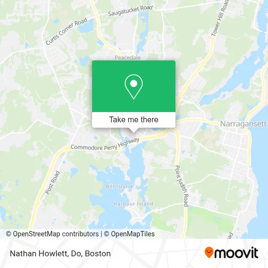
See Nathan Howlett, Do, Boston, on the map
Public Transit to Nathan Howlett, Do in Boston
Wondering how to get to Nathan Howlett, Do in Boston? Moovit helps you find the best way to get to Nathan Howlett, Do with step-by-step directions from the nearest public transit station.
Moovit provides free maps and live directions to help you navigate through your city. View schedules, routes, timetables, and find out how long does it take to get to Nathan Howlett, Do in real time.
Looking for the nearest stop or station to Nathan Howlett, Do? Check out this list of stops closest to your destination: Main Before Robinson.
Bus: 65X, 69.
Want to see if there’s another route that gets you there at an earlier time? Moovit helps you find alternative routes or times. Get directions from and directions to Nathan Howlett, Do easily from the Moovit App or Website.
We make riding to Nathan Howlett, Do easy, which is why over 1.7 million users, including users in Boston, trust Moovit as the best app for public transit. You don’t need to download an individual bus app or train app, Moovit is your all-in-one transit app that helps you find the best bus time or train time available.
For information on prices of bus, costs and ride fares to Nathan Howlett, Do, please check the Moovit app.
Use the app to navigate to popular places including to the airport, hospital, stadium, grocery store, mall, coffee shop, school, college, and university.
Nathan Howlett, Do Address: 70 Kenyon Ave Ste 100 street in Boston
- Hebert Jordan F do - Hebert, Jordan F do,
- Joseph, Sarah Emergency Physician Associates,
- Guidera Rachel A NP - Guidera, Rachel A NP,
- South County Health,
- John Graham MD,
- Federico Osvaldo Rivera,
- Damage Restoration Services,
- H Jefferson Melish Attorney,
- J Groh Photo,
- Manic Training Wakefield,
- Gorham Hall,
- Experience Real Estate,
- Sights Family Eyecare,
- Dr Elissa Contillo,
- Rarities Books & Bindery,
- Sabled and Smithed,
- Ascension Wakefield,
- Loafing Around LLC,
- Terri Maine, Aprn,
- Dewetron
Places Near Nathan Howlett, Do (Boston)
- Wang Theater, Boston,
- Td Garden, Boston,
- Quincy Market, Boston,
- Prudential Center, Boston,
- Cheers, Boston,
- North End, Boston,
- Boston Common, Boston,
- Faneuil Hall, Boston,
- Boston Children's Hospital, Boston,
- Isabella Stewart Gardner Museum, Boston,
- Leader Bank Pavilion (Leader Bank Pavillion), Boston,
- Boston Convention & Exhibition Center, Boston,
- Boston Medical Center, Boston,
- Massachusetts General Hospital, Boston,
- Wilbur Theatre, Boston,
- Mgm Music Hall, Boston,
- Castle Island, Boston,
- Museum Of Science, Boston,
- House Of Blues, Boston,
- Seaport District, Boston
How to get to popular places in Boston with public transit
Get around Boston by public transit!
Traveling around Boston has never been so easy. See step by step directions as you travel to any attraction, street or major public transit station. View bus and train schedules, arrival times, service alerts and detailed routes on a map, so you know exactly how to get to anywhere in Boston.
When traveling to any destination around Boston use Moovit's Live Directions with Get Off Notifications to know exactly where and how far to walk, how long to wait for your line, and how many stops are left. Moovit will alert you when it's time to get off — no need to constantly re-check whether yours is the next stop.
Wondering how to use public transit in Boston or how to pay for public transit in Boston? Moovit public transit app can help you navigate your way with public transit easily, and at minimum cost. It includes public transit fees, ticket prices, and costs. Looking for a map of Boston public transit lines? Moovit public transit app shows all public transit maps in Boston with all Bus, Train, Subway and Ferry routes and stops on an interactive map.
Boston has 4 transit type(s), including: Bus, Train, Subway and Ferry, operated by several transit agencies, including MBTA, Southeastern Regional Transit Authority, MetroWest Regional Transit Authority, Rhode Island Public Transit Authority, WRTA, Lowell Regional Transit Authority, Merrimack Valley Transit, Montachusett Regional Transit Authority, Cape Cod Regional Transit Authority, Brockton Area Transit Authority, Martha's Vineyard Transit Authority, the WAVE - Nantucket Regional Transit Authority, GATRA, Cape Ann Transportation Authority and Massport