How to get to Natillera.Com by bus?
Click on the bus route to see step by step directions with maps, line arrival times and updated time schedules.
How to get to Natillera.Com by train?
Click on the train route to see step by step directions with maps, line arrival times and updated time schedules.
Bus stops near Natillera.Com in Lowell
Bus lines to Natillera.Com in Lowell
- 1, Christian Hill,VIEW
- 8, Centralville,VIEW
- 9, Lowell Circulator,VIEW
- 10, Dracut/Tyngsboro,VIEW
- 18, Downtown Shuttle,VIEW
- 2, White Dove Plaza,VIEW
- 3, North Billerica Train Station,VIEW
- 4, Lowell High School,VIEW
- 5, Paige And Kirk Streets,VIEW
- 7, Kennedy Center,VIEW
- 13, Gorham Street,VIEW
- 16, Cross Point Tower,VIEW
- 17, Walmart,VIEW
- 6, Umass,VIEW
- 20, Kennedy Center,VIEW
What are the closest stations to Natillera.Com?
The closest stations to Natillera.Com are:
- Merrimack St & John St is 9 yards away, 1 min walk.
- Paige St And Kirk St - Lowell High School is 295 yards away, 4 min walk.
- Merrimack St & Dutton St is 317 yards away, 4 min walk.
- Dutton St & Market St is 365 yards away, 5 min walk.
Which bus lines stop near Natillera.Com?
These bus lines stop near Natillera.Com: 12, 24.
Which train line stops near Natillera.Com?
LOWELL (#331 | Lowell)
What’s the nearest bus station to Natillera.Com in Lowell?
The nearest bus station to Natillera.Com in Lowell is Merrimack St & John St. It’s a 1 min walk away.
What time is the first bus to Natillera.Com in Lowell?
The 7 is the first bus that goes to Natillera.Com in Lowell. It stops nearby at 5:53 AM.
What time is the last bus to Natillera.Com in Lowell?
The 7 is the last bus that goes to Natillera.Com in Lowell. It stops nearby at 8:08 PM.
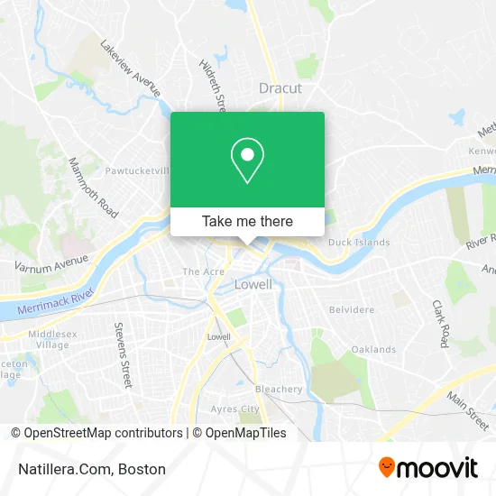
See Natillera.Com, Lowell, on the map
Public Transit to Natillera.Com in Lowell
Wondering how to get to Natillera.Com in Lowell? Moovit helps you find the best way to get to Natillera.Com with step-by-step directions from the nearest public transit station.
Moovit provides free maps and live directions to help you navigate through your city. View schedules, routes, timetables, and find out how long does it take to get to Natillera.Com in real time.
Looking for the nearest stop or station to Natillera.Com? Check out this list of stops closest to your destination: Merrimack St & John St; Paige St And Kirk St - Lowell High School; Merrimack St & Dutton St; Dutton St & Market St.
Bus: 12, 24, 1, 8, 9, 10, 18, 2, 3, 4, 5, 7, 6, 20.Train: LOWELL.
Want to see if there’s another route that gets you there at an earlier time? Moovit helps you find alternative routes or times. Get directions from and directions to Natillera.Com easily from the Moovit App or Website.
We make riding to Natillera.Com easy, which is why over 1.7 million users, including users in Lowell, trust Moovit as the best app for public transit. You don’t need to download an individual bus app or train app, Moovit is your all-in-one transit app that helps you find the best bus time or train time available.
For information on prices of bus and train, costs and ride fares to Natillera.Com, please check the Moovit app.
Use the app to navigate to popular places including to the airport, hospital, stadium, grocery store, mall, coffee shop, school, college, and university.
Location: Lowell, Boston
- Bambu Vault,
- Mill City Environmental Corporation,
- Lavoie Industries,
- Terracorps,
- Stitchdx,
- Superior Hvac & Sanitation Services Massachusetts,
- The Lowell Folk Festival,
- Lowell Wic Program,
- Drica Fashion,
- Energy Performance Services,
- Lowell Five Headquarters,
- Diamond Team Garage Repair,
- Chess Engineering,
- Tabashir Health,
- Parking Garage,
- Lowell National Historical Park Library,
- Addiction Rehab Lowell,
- Toxics Use Reduction Institute,
- Winn Co.,
- USPS Collection Box - Blue Box
Places Near Natillera.Com (Lowell)
- North End, Boston,
- Cheers, Boston,
- Quincy Market, Boston,
- Wang Theater, Boston,
- Isabella Stewart Gardner Museum, Boston,
- House Of Blues, Boston,
- Leader Bank Pavilion (Leader Bank Pavillion), Boston,
- Boston Medical Center, Boston,
- Massachusetts General Hospital, Boston,
- Boston Common, Boston,
- Td Garden, Boston,
- Wilbur Theatre, Boston,
- Mgm Music Hall, Boston,
- Boston Children's Hospital, Boston,
- Castle Island, Boston,
- Museum Of Science, Boston,
- Faneuil Hall, Boston,
- Prudential Center, Boston,
- Seaport District, Boston,
- Boston Convention & Exhibition Center, Boston
How to get to popular places in Boston with public transit
Get around Lowell by public transit!
Traveling around Lowell has never been so easy. See step by step directions as you travel to any attraction, street or major public transit station. View bus and train schedules, arrival times, service alerts and detailed routes on a map, so you know exactly how to get to anywhere in Lowell.
When traveling to any destination around Lowell use Moovit's Live Directions with Get Off Notifications to know exactly where and how far to walk, how long to wait for your line, and how many stops are left. Moovit will alert you when it's time to get off — no need to constantly re-check whether yours is the next stop.
Wondering how to use public transit in Lowell or how to pay for public transit in Lowell? Moovit public transit app can help you navigate your way with public transit easily, and at minimum cost. It includes public transit fees, ticket prices, and costs. Looking for a map of Lowell public transit lines? Moovit public transit app shows all public transit maps in Lowell with all Bus, Train, Subway and Ferry routes and stops on an interactive map.
Boston has 4 transit type(s), including: Bus, Train, Subway and Ferry, operated by several transit agencies, including MBTA, Southeastern Regional Transit Authority, MetroWest Regional Transit Authority, Rhode Island Public Transit Authority, WRTA, Lowell Regional Transit Authority, Merrimack Valley Transit, Montachusett Regional Transit Authority, Cape Cod Regional Transit Authority, Brockton Area Transit Authority, Martha's Vineyard Transit Authority, the WAVE - Nantucket Regional Transit Authority, GATRA, Cape Ann Transportation Authority and Massport