Directions to National Computer Center @ SSA (Baltimore County) with public transportation
The following transit lines have routes that pass near National Computer Center @ SSA
 Bus: 37, 79, CITYLINK BLUE, 40, 34.
How to get to National Computer Center @ SSA by bus?
Click on the bus route to see step by step directions with maps, line arrival times and updated time schedules.
From Federal Hill, Baltimore
52 minFrom Maryland, Baltimore
49 minFrom Guinness Open Gate Brewery & Barrel House, Baltimore County
84 minFrom Giant Food Stores, Baltimore
70 minFrom Enoch Pratt Free Library - Central Library, Baltimore
42 minFrom B&O Railroad Museum, Baltimore
51 minFrom National Aquarium-Baltimore, Baltimore
54 minFrom Hippodrome Theatre, Baltimore
43 minFrom City Hall Fields, Baltimore
47 minFrom Inner Harbor, Baltimore
55 min
Bus stops near National Computer Center @ SSA in Baltimore County
Bus lines to National Computer Center @ SSA in Baltimore County
What are the closest stations to National Computer Center @ SSA?
The closest stations to National Computer Center @ SSA are:
- Security Blvd & Perimeter Dr Wb is 1040 yards away, 13 min walk.
- Woodlawn Dr & Parallel Dr Sb is 1262 yards away, 15 min walk.
- Security Blvd & Gwynn Oak Ave Eb is 1289 yards away, 16 min walk.
- Ingleside Ave & Parallel Dr Eb is 1324 yards away, 16 min walk.
- Social Security Terminial is 1394 yards away, 17 min walk.
Which bus lines stop near National Computer Center @ SSA?
These bus lines stop near National Computer Center @ SSA: 37, 79, CITYLINK BLUE.
What’s the nearest bus station to National Computer Center @ SSA in Baltimore County?
The nearest bus station to National Computer Center @ SSA in Baltimore County is Security Blvd & Perimeter Dr Wb. It’s a 13 min walk away.
What time is the first bus to National Computer Center @ SSA in Baltimore County?
The CITYLINK BLUE is the first bus that goes to National Computer Center @ SSA in Baltimore County. It stops nearby at 4:23 AM.
What time is the last bus to National Computer Center @ SSA in Baltimore County?
The 37 is the last bus that goes to National Computer Center @ SSA in Baltimore County. It stops nearby at 1:27 AM.
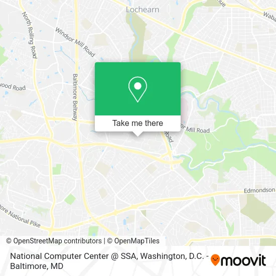
See National Computer Center @ SSA, Baltimore County, on the map
Public Transit to National Computer Center @ SSA in Baltimore County
Wondering how to get to National Computer Center @ SSA in Baltimore County? Moovit helps you find the best way to get to National Computer Center @ SSA with step-by-step directions from the nearest public transit station.
Moovit provides free maps and live directions to help you navigate through your city. View schedules, routes, timetables, and find out how long does it take to get to National Computer Center @ SSA in real time.
Looking for the nearest stop or station to National Computer Center @ SSA? Check out this list of stops closest to your destination: Security Blvd & Perimeter Dr Wb; Woodlawn Dr & Parallel Dr Sb; Security Blvd & Gwynn Oak Ave Eb; Ingleside Ave & Parallel Dr Eb; Social Security Terminial.
Bus: 37, 79, CITYLINK BLUE, 40, 34, 31.
Want to see if there’s another route that gets you there at an earlier time? Moovit helps you find alternative routes or times. Get directions from and directions to National Computer Center @ SSA easily from the Moovit App or Website.
We make riding to National Computer Center @ SSA easy, which is why over 1.5 million users, including users in Baltimore County, trust Moovit as the best app for public transit. You don’t need to download an individual bus app or train app, Moovit is your all-in-one transit app that helps you find the best bus time or train time available.
For information on prices of bus and train, costs and ride fares to National Computer Center @ SSA, please check the Moovit app.
Use the app to navigate to popular places including to the airport, hospital, stadium, grocery store, mall, coffee shop, school, college, and university.
National Computer Center @ SSA Address: 6401 Security Blvd street in Baltimore County
- SSA LOTTO STAND,
- Picnic Area,
- Social Security Administration - Headquarters - East High,
- Mason's Variety Home Improvements,
- Courtyard,
- Lucky Irish Plumbing,
- AMF Woodlawn Lanes,
- Baltimore Virginia Pl,
- Social Security Administration - Headquarters - Robert M. Ball Building,
- Rohleder R & C,
- Cameo Construction,
- Hkmccsc,
- SSA Starbucks,
- Catholic Charities Programs,
- Social Security Headquarters, Woodlawn, MD.,
- Ssa Baltimore Federal Credit Union,
- Brock & Company,
- Gwynn Oak Ave,
- Security Blvd & Gwynn Oak Ave Eb (Security Blvd & Gwynn Oak Ave FS WB),
- Catholic Charities
Places Near National Computer Center @ SSA (Baltimore County)
- Westfield Montgomery Mall, Montgomery County,
- Washington National Cathedral, Washington,
- Capital One Arena, Washington,
- Sibley Memorial Hospital, Washington,
- Georgetown, Washington,
- Museum Of The Bible, Washington,
- Pennsylvania Ave NW (3rd st and pennsylvania), Washington,
- Basilica of the National Shrine, Washington,
- Amazon Hq2, Arlington County,
- PG Mall, Prince George's County,
- National Zoo, Washington,
- The Anthem, Washington,
- Washington DC VA Medical Center, Washington,
- Rock Creek Tennis Center, Washington,
- M&T Bank Stadium, Baltimore,
- National Theatre, Washington,
- Warner Theatre, Washington,
- National Museum of African American History and Culture, Washington,
- Marriott Marquis Washington, DC, Washington,
- Camden Yards, Baltimore
How to get to popular places in Washington, D.C. - Baltimore, MD with public transit
Get around Baltimore County by public transit!
Traveling around Baltimore County has never been so easy. See step by step directions as you travel to any attraction, street or major public transit station. View bus and train schedules, arrival times, service alerts and detailed routes on a map, so you know exactly how to get to anywhere in Baltimore County.
When traveling to any destination around Baltimore County use Moovit's Live Directions with Get Off Notifications to know exactly where and how far to walk, how long to wait for your line, and how many stops are left. Moovit will alert you when it's time to get off — no need to constantly re-check whether yours is the next stop.
Wondering how to use public transit in Baltimore County or how to pay for public transit in Baltimore County? Moovit public transit app can help you navigate your way with public transit easily, and at minimum cost. It includes public transit fees, ticket prices, and costs. Looking for a map of Baltimore County public transit lines? Moovit public transit app shows all public transit maps in Baltimore County with all Bus, Train, Metro, Light Rail and Ferry routes and stops on an interactive map.
Washington, D.C. - Baltimore, MD has 5 transit type(s), including: Bus, Train, Metro, Light Rail and Ferry, operated by several transit agencies, including WMATA, Montgomery County Ride On, Fairfax Connector, TheBus, PRTC, DASH - Alexandria, Arlington Transit (ART), RTA of Central Maryland, MDOT MTA, MDOT MTA Light RailLink, MDOT MTA Commuter Bus, MDOT MTA Local Bus, FXBGO!, Virginia Railway Express (VRE) and MARC