Directions to National Grid (Lynn) with public transportation
The following transit lines have routes that pass near National Grid
 Bus: 426, 435, 436, 442, 429.
- Train: NEWBURYPORT/ROCKPORT.
- Ferry: LYNN FERRY.
How to get to National Grid by bus?
Click on the bus route to see step by step directions with maps, line arrival times and updated time schedules.
From Boda Borg, Malden
67 minFrom Liberty Tree Mall, Danvers
63 minFrom Everett, MA, Everett
55 minFrom North Shore Mall, Peabody
54 minFrom Courtyard by Marriott Boston Logan Airport, Boston
47 minFrom Massachusetts Water Resource Authority (MWRA), Chelsea
52 minFrom Hampton Inn Boston Logan Airport Chelsea, Chelsea
61 minFrom TownePlace Suites Boston Logan Airport/Chelsea, Chelsea
54 minFrom Malden, MA, Malden
67 min
How to get to National Grid by train?
Click on the train route to see step by step directions with maps, line arrival times and updated time schedules.
Bus stops near National Grid in Lynn
Train station near National Grid in Lynn
- Lynn Interim, 7 min walk,VIEW
Ferry station near National Grid in Lynn
- Blossom Street Pier, 19 min walk,VIEW
Bus lines to National Grid in Lynn
- 429, Kings Lynn,VIEW
- 435, Central Square Via Malls,VIEW
- 436, Central Square,VIEW
- 426, Haymarket Via Cliftondale,VIEW
- 442, West Lynn Garage Via Central Square & Humphrey St,VIEW
- 455, West Lynn Garage Via Central Square,VIEW
- 441, Wonderland Via Paradise Rd & Central Square,VIEW
- 439, Nahant,VIEW
- 441/442, Ocean St Via Central Square,VIEW
- 456, Central Square,VIEW
- NEWBURYPORT LINE SHUTTLE, Oak Grove (Local Shuttle),VIEW
- NEWBURYPORT/ROCKPORT LINE SHUTTLE, Swampscott (Shuttle),VIEW
- NEWBURYPORT/ROCKPORT LINE SHUTTLE, Beverly (Shuttle),VIEW
What are the closest stations to National Grid?
The closest stations to National Grid are:
- Neptune Blvd @ Blossom St is 47 yards away, 1 min walk.
- Market St @ Commuter Rail is 386 yards away, 5 min walk.
- Market St @ Tremont St is 401 yards away, 5 min walk.
- Lynnway Opp Shepard St is 428 yards away, 6 min walk.
- Market Street @ Lynn Commuter Rail is 433 yards away, 6 min walk.
- Lynn Interim is 505 yards away, 7 min walk.
- Blossom Street Pier is 1601 yards away, 19 min walk.
Which bus lines stop near National Grid?
These bus lines stop near National Grid: 426, 435, 436, 442.
Which train line stops near National Grid?
NEWBURYPORT/ROCKPORT (#27 | Rockport)
What’s the nearest train station to National Grid in Lynn?
The nearest train station to National Grid in Lynn is Lynn Interim. It’s a 7 min walk away.
What’s the nearest bus station to National Grid in Lynn?
The nearest bus station to National Grid in Lynn is Neptune Blvd @ Blossom St. It’s a 1 min walk away.
What’s the nearest ferry station to National Grid in Lynn?
The nearest ferry station to National Grid in Lynn is Blossom Street Pier. It’s a 19 min walk away.
What time is the first train to National Grid in Lynn?
The NEWBURYPORT/ROCKPORT is the first train that goes to National Grid in Lynn. It stops nearby at 5:27 AM.
What time is the last train to National Grid in Lynn?
The NEWBURYPORT/ROCKPORT is the last train that goes to National Grid in Lynn. It stops nearby at 12:20 AM.
What time is the first bus to National Grid in Lynn?
The 455 is the first bus that goes to National Grid in Lynn. It stops nearby at 4:45 AM.
What time is the last bus to National Grid in Lynn?
The 426 is the last bus that goes to National Grid in Lynn. It stops nearby at 1:46 AM.
What time is the first ferry to National Grid in Lynn?
The LYNN FERRY is the first ferry that goes to National Grid in Lynn. It stops nearby at 6:00 AM.
What time is the last ferry to National Grid in Lynn?
The LYNN FERRY is the last ferry that goes to National Grid in Lynn. It stops nearby at 7:55 PM.
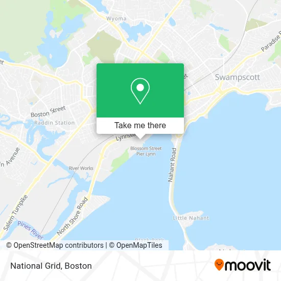
See National Grid, Lynn, on the map
Public Transit to National Grid in Lynn
Wondering how to get to National Grid in Lynn? Moovit helps you find the best way to get to National Grid with step-by-step directions from the nearest public transit station.
Moovit provides free maps and live directions to help you navigate through your city. View schedules, routes, timetables, and find out how long does it take to get to National Grid in real time.
Looking for the nearest stop or station to National Grid? Check out this list of stops closest to your destination: Neptune Blvd @ Blossom St; Market St @ Commuter Rail; Market St @ Tremont St; Lynnway Opp Shepard St; Market Street @ Lynn Commuter Rail; Lynn Interim; Blossom Street Pier.
Bus: 426, 435, 436, 442, 429, 455, 441, 439, 441/442.Train: NEWBURYPORT/ROCKPORT.Ferry: LYNN FERRY.
Want to see if there’s another route that gets you there at an earlier time? Moovit helps you find alternative routes or times. Get directions from and directions to National Grid easily from the Moovit App or Website.
We make riding to National Grid easy, which is why over 1.7 million users, including users in Lynn, trust Moovit as the best app for public transit. You don’t need to download an individual bus app or train app, Moovit is your all-in-one transit app that helps you find the best bus time or train time available.
For information on prices of bus, train and subway, costs and ride fares to National Grid, please check the Moovit app.
Use the app to navigate to popular places including to the airport, hospital, stadium, grocery store, mall, coffee shop, school, college, and university.
National Grid Address: 255 Blossom St Ext street in Lynn
- Blink,
- Lynnway Auto Auction,
- Clocktower Self-Storage,
- Ides Church,
- Popi's Productions,
- Greater Lynn Senior Services (GLSS)Transportation,
- Lynn Spanish Branch,
- Fleetwood Onsite Conference Recording,
- Dollar Rent A Car,
- Law Office Of Horrigan And Norman,
- Lynn Ferry Dock,
- Walsh's Deep Sea Fishing,
- Lpt,
- Pro Luxe Esthetics,
- Jose's Garage,
- New American Association Of MA,
- Alex Auto Inc,
- Number One Gadaa Driving School,
- Boston Wholesale Lobster Corporation,
- Shepard St / Lynnway
Places Near National Grid (Lynn)
- Boston Common, Boston,
- Seaport District, Boston,
- Isabella Stewart Gardner Museum, Boston,
- Leader Bank Pavilion (Leader Bank Pavillion), Boston,
- Mgm Music Hall, Boston,
- Cheers, Boston,
- Boston Children's Hospital, Boston,
- Castle Island, Boston,
- North End, Boston,
- Td Garden, Boston,
- Boston Convention & Exhibition Center, Boston,
- Wang Theater, Boston,
- Boston Medical Center, Boston,
- Museum Of Science, Boston,
- Massachusetts General Hospital, Boston,
- Faneuil Hall, Boston,
- Prudential Center, Boston,
- House Of Blues, Boston,
- Quincy Market, Boston,
- Wilbur Theatre, Boston
How to get to popular places in Boston with public transit
Get around Lynn by public transit!
Traveling around Lynn has never been so easy. See step by step directions as you travel to any attraction, street or major public transit station. View bus and train schedules, arrival times, service alerts and detailed routes on a map, so you know exactly how to get to anywhere in Lynn.
When traveling to any destination around Lynn use Moovit's Live Directions with Get Off Notifications to know exactly where and how far to walk, how long to wait for your line, and how many stops are left. Moovit will alert you when it's time to get off — no need to constantly re-check whether yours is the next stop.
Wondering how to use public transit in Lynn or how to pay for public transit in Lynn? Moovit public transit app can help you navigate your way with public transit easily, and at minimum cost. It includes public transit fees, ticket prices, and costs. Looking for a map of Lynn public transit lines? Moovit public transit app shows all public transit maps in Lynn with all Bus, Train, Subway and Ferry routes and stops on an interactive map.
Boston has 4 transit type(s), including: Bus, Train, Subway and Ferry, operated by several transit agencies, including MBTA, Southeastern Regional Transit Authority, MetroWest Regional Transit Authority, Rhode Island Public Transit Authority, WRTA, Lowell Regional Transit Authority, Merrimack Valley Transit, Montachusett Regional Transit Authority, Cape Cod Regional Transit Authority, Brockton Area Transit Authority, Martha's Vineyard Transit Authority, the WAVE - Nantucket Regional Transit Authority, GATRA, Cape Ann Transportation Authority and Massport