Directions to Nationwide Insurance (Anne Arundel County) with public transportation
The following transit lines have routes that pass near Nationwide Insurance
 Bus: 921, FREE ANNAPOLIS DOWNTOWN SHUTTLE, GREEN, PURPLE, 220.
How to get to Nationwide Insurance by bus?
Click on the bus route to see step by step directions with maps, line arrival times and updated time schedules.
From Bowie Town Center, Prince George's County
93 minFrom Brazzers, Prince George's County
110 minFrom Bowie, MD, Prince George's County
84 minFrom Anne Arundel Community College, Anne Arundel County
39 minFrom Archbishop Spalding High School, Severn
115 minFrom Glen Burnie, MD, Anne Arundel County
82 minFrom Pasadena, Maryland, Anne Arundel County
58 min
Bus stops near Nationwide Insurance in Anne Arundel County
Bus lines to Nationwide Insurance in Anne Arundel County
What are the closest stations to Nationwide Insurance?
The closest stations to Nationwide Insurance are:
- West St. And Brewer Ave. is 141 yards away, 2 min walk.
- West St. And Russell St. is 229 yards away, 3 min walk.
- West St & Russell St Opp Wb is 231 yards away, 3 min walk.
- Spa Rd. And Carraway Ln. is 406 yards away, 5 min walk.
- Park Place is 662 yards away, 8 min walk.
Which bus lines stop near Nationwide Insurance?
These bus lines stop near Nationwide Insurance: 921, FREE ANNAPOLIS DOWNTOWN SHUTTLE, GREEN.
What’s the nearest bus station to Nationwide Insurance in Anne Arundel County?
The nearest bus station to Nationwide Insurance in Anne Arundel County is West St. And Brewer Ave.. It’s a 2 min walk away.
What time is the first bus to Nationwide Insurance in Anne Arundel County?
The 220 is the first bus that goes to Nationwide Insurance in Anne Arundel County. It stops nearby at 5:00 AM.
What time is the last bus to Nationwide Insurance in Anne Arundel County?
The FREE ANNAPOLIS DOWNTOWN SHUTTLE is the last bus that goes to Nationwide Insurance in Anne Arundel County. It stops nearby at 11:10 PM.
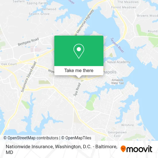
See Nationwide Insurance, Anne Arundel County, on the map
Public Transit to Nationwide Insurance in Anne Arundel County
Wondering how to get to Nationwide Insurance in Anne Arundel County? Moovit helps you find the best way to get to Nationwide Insurance with step-by-step directions from the nearest public transit station.
Moovit provides free maps and live directions to help you navigate through your city. View schedules, routes, timetables, and find out how long does it take to get to Nationwide Insurance in real time.
Looking for the nearest stop or station to Nationwide Insurance? Check out this list of stops closest to your destination: West St. And Brewer Ave.; West St. And Russell St.; West St & Russell St Opp Wb; Spa Rd. And Carraway Ln.; Park Place.
Bus: 921, FREE ANNAPOLIS DOWNTOWN SHUTTLE, GREEN, PURPLE, 220, 230, PURPLE, ORANGE.
Want to see if there’s another route that gets you there at an earlier time? Moovit helps you find alternative routes or times. Get directions from and directions to Nationwide Insurance easily from the Moovit App or Website.
We make riding to Nationwide Insurance easy, which is why over 1.7 million users, including users in Anne Arundel County, trust Moovit as the best app for public transit. You don’t need to download an individual bus app or train app, Moovit is your all-in-one transit app that helps you find the best bus time or train time available.
For information on prices of bus and train, costs and ride fares to Nationwide Insurance, please check the Moovit app.
Use the app to navigate to popular places including to the airport, hospital, stadium, grocery store, mall, coffee shop, school, college, and university.
Nationwide Insurance Address: 929 West St street in Anne Arundel County
- Annapolis Women's Clinic,
- Pink Pastry,
- Antojitos Three Brothers Food Truck,
- Bp,
- Koons Annapolis Toyota Service Center,
- Wild Orchid Cafe,
- Toyota_Sam,
- Rxnt,
- Koons Annapolis Toyota Service Center,
- Easy-E Car Sales,
- The Annapolis Blend,
- Tuwa Temple No. 228,
- Best Connection Travel,
- Smith Investigative Agency,
- Kiesett's Home Selling Team,
- Arrowssolution,
- Annapolis Digital Impact,
- Lets Qbo,
- Comfort on the Severn Home Care & Senior Living,
- Abask Marketing
Places Near Nationwide Insurance (Anne Arundel County)
- Washington DC VA Medical Center, Washington,
- Marriott Marquis Washington, DC, Washington,
- Washington National Cathedral, Washington,
- Pennsylvania Ave NW (3rd st and pennsylvania), Washington,
- PG Mall, Prince George's County,
- Amazon Hq2, Arlington County,
- Sibley Memorial Hospital, Washington,
- Westfield Montgomery Mall, Montgomery County,
- Capital One Arena, Washington,
- M&T Bank Stadium, Baltimore,
- National Museum of African American History and Culture, Washington,
- Camden Yards, Baltimore,
- Rock Creek Tennis Center, Washington,
- National Theatre, Washington,
- Basilica of the National Shrine, Washington,
- The Anthem, Washington,
- National Zoo, Washington,
- Warner Theatre, Washington,
- Georgetown, Washington,
- Museum Of The Bible, Washington
How to get to popular places in Washington, D.C. - Baltimore, MD with public transit
Get around Anne Arundel County by public transit!
Traveling around Anne Arundel County has never been so easy. See step by step directions as you travel to any attraction, street or major public transit station. View bus and train schedules, arrival times, service alerts and detailed routes on a map, so you know exactly how to get to anywhere in Anne Arundel County.
When traveling to any destination around Anne Arundel County use Moovit's Live Directions with Get Off Notifications to know exactly where and how far to walk, how long to wait for your line, and how many stops are left. Moovit will alert you when it's time to get off — no need to constantly re-check whether yours is the next stop.
Wondering how to use public transit in Anne Arundel County or how to pay for public transit in Anne Arundel County? Moovit public transit app can help you navigate your way with public transit easily, and at minimum cost. It includes public transit fees, ticket prices, and costs. Looking for a map of Anne Arundel County public transit lines? Moovit public transit app shows all public transit maps in Anne Arundel County with all Bus, Train, Metro, Light Rail and Ferry routes and stops on an interactive map.
Washington, D.C. - Baltimore, MD has 5 transit type(s), including: Bus, Train, Metro, Light Rail and Ferry, operated by several transit agencies, including WMATA, Montgomery County Ride On, Fairfax Connector, TheBus, PRTC, DASH - Alexandria, Arlington Transit (ART), RTA of Central Maryland, MDOT MTA, MDOT MTA Light RailLink, MDOT MTA Commuter Bus, MDOT MTA Local Bus, FXBGO!, Virginia Railway Express (VRE) and MARC