Directions to Natural Ai Photography (Boston) with public transportation
The following transit lines have routes that pass near Natural Ai Photography
 Bus: 14, 19, 23, 28, 45.
- Train: FAIRMOUNT, FRANKLIN/FOXBORO, PROVIDENCE/STOUGHTON.
- Subway: ORANGE LINE, RED LINE.
How to get to Natural Ai Photography by bus?
Click on the bus route to see step by step directions with maps, line arrival times and updated time schedules.
From Hampton Inn-Cambridge, Cambridge
65 minFrom The Burren, Somerville
78 minFrom Cruiseport Boston's Black Falcon Cruise Terminal, Boston
61 minFrom The Westin Boston Waterfront, Boston
53 minFrom crown Colony Shuttle, Quincy
83 minFrom Constitution Beach, Boston
87 minFrom Courtyard by Marriott Boston Logan Airport, Boston
77 minFrom Castle Island, Boston
67 minFrom Massachusetts Water Resource Authority (MWRA), Chelsea
76 minFrom DoubleTree by Hilton Boston Logan Airport Chelsea, Chelsea
79 min
How to get to Natural Ai Photography by train?
Click on the train route to see step by step directions with maps, line arrival times and updated time schedules.
How to get to Natural Ai Photography by subway?
Click on the subway route to see step by step directions with maps, line arrival times and updated time schedules.
From Hampton Inn-Cambridge, Cambridge
59 minFrom The Burren, Somerville
66 minFrom The Westin Boston Waterfront, Boston
65 minFrom crown Colony Shuttle, Quincy
78 minFrom Constitution Beach, Boston
67 minFrom Courtyard by Marriott Boston Logan Airport, Boston
70 minFrom Massachusetts Water Resource Authority (MWRA), Chelsea
80 min
Bus stops near Natural Ai Photography in Boston
Subway station near Natural Ai Photography in Boston
- Jackson Square, 11 min walk,VIEW
Train station near Natural Ai Photography in Boston
- Uphams Corner, 11 min walk,VIEW
Bus lines to Natural Ai Photography in Boston
What are the closest stations to Natural Ai Photography?
The closest stations to Natural Ai Photography are:
- Blue Hill Ave Opp Warren St is 68 yards away, 1 min walk.
- Geneva Ave @ Blue Hill Ave is 86 yards away, 2 min walk.
- Warren St @ Gaston St is 94 yards away, 2 min walk.
- Warren St @ Waumbeck St is 120 yards away, 2 min walk.
- Jackson Square is 867 yards away, 11 min walk.
- Uphams Corner is 924 yards away, 11 min walk.
Which bus lines stop near Natural Ai Photography?
These bus lines stop near Natural Ai Photography: 14, 19, 23, 28.
Which train line stops near Natural Ai Photography?
FAIRMOUNT (#1619 | Fairmount)
Which subway lines stop near Natural Ai Photography?
These subway lines stop near Natural Ai Photography: ORANGE LINE, RED LINE.
What’s the nearest subway station to Natural Ai Photography in Boston?
The nearest subway station to Natural Ai Photography in Boston is Jackson Square. It’s a 11 min walk away.
What’s the nearest train station to Natural Ai Photography in Boston?
The nearest train station to Natural Ai Photography in Boston is Uphams Corner. It’s a 11 min walk away.
What’s the nearest bus station to Natural Ai Photography in Boston?
The nearest bus station to Natural Ai Photography in Boston is Blue Hill Ave Opp Warren St. It’s a 1 min walk away.
What time is the first subway to Natural Ai Photography in Boston?
The ORANGE LINE is the first subway that goes to Natural Ai Photography in Boston. It stops nearby at 5:18 AM.
What time is the last subway to Natural Ai Photography in Boston?
The ORANGE LINE is the last subway that goes to Natural Ai Photography in Boston. It stops nearby at 1:54 AM.
What time is the first train to Natural Ai Photography in Boston?
The FAIRMOUNT is the first train that goes to Natural Ai Photography in Boston. It stops nearby at 4:47 AM.
What time is the last train to Natural Ai Photography in Boston?
The FAIRMOUNT is the last train that goes to Natural Ai Photography in Boston. It stops nearby at 12:00 AM.
What time is the first bus to Natural Ai Photography in Boston?
The 28 is the first bus that goes to Natural Ai Photography in Boston. It stops nearby at 3:17 AM.
What time is the last bus to Natural Ai Photography in Boston?
The 23 is the last bus that goes to Natural Ai Photography in Boston. It stops nearby at 2:34 AM.
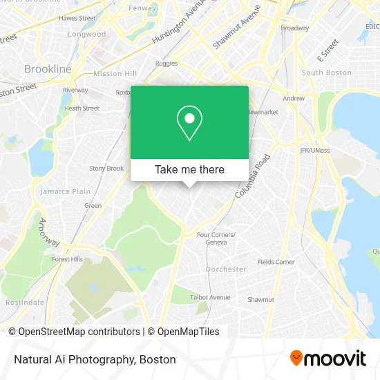
See Natural Ai Photography, Boston, on the map
Public Transit to Natural Ai Photography in Boston
Wondering how to get to Natural Ai Photography in Boston? Moovit helps you find the best way to get to Natural Ai Photography with step-by-step directions from the nearest public transit station.
Moovit provides free maps and live directions to help you navigate through your city. View schedules, routes, timetables, and find out how long does it take to get to Natural Ai Photography in real time.
Looking for the nearest stop or station to Natural Ai Photography? Check out this list of stops closest to your destination: Blue Hill Ave Opp Warren St; Geneva Ave @ Blue Hill Ave; Warren St @ Gaston St; Warren St @ Waumbeck St; Jackson Square; Uphams Corner.
Bus: 14, 19, 23, 28, 45, 10, 22.Train: FAIRMOUNT, FRANKLIN/FOXBORO, PROVIDENCE/STOUGHTON.Subway: ORANGE LINE, RED LINE.
Want to see if there’s another route that gets you there at an earlier time? Moovit helps you find alternative routes or times. Get directions from and directions to Natural Ai Photography easily from the Moovit App or Website.
We make riding to Natural Ai Photography easy, which is why over 1.7 million users, including users in Boston, trust Moovit as the best app for public transit. You don’t need to download an individual bus app or train app, Moovit is your all-in-one transit app that helps you find the best bus time or train time available.
For information on prices of bus, subway and train, costs and ride fares to Natural Ai Photography, please check the Moovit app.
Use the app to navigate to popular places including to the airport, hospital, stadium, grocery store, mall, coffee shop, school, college, and university.
Natural Ai Photography Address: 27 Brunswick St # 1 street in Boston
- Abcd,
- Charles Street Ame Church (The Historic Charles Street African Methodist Episcopal Church),
- Commercial Property Management Company in Massachusetts,
- Redefining Lighting,
- Sunny Hill Garden Suites,
- Blue Hill Ave & Georgia St,
- Dorchester,
- Woods Real Estate,
- Redbox,
- Ramzo African Market,
- Walaikum's Burger,
- Online Roofing Contractors Boston,
- Gorgeous Lil Things,
- Future Chefs,
- Travelers Inn,
- Boston Public Library Grove Hall Branch,
- Overall Construction,
- 176 Humboldt Avenue Condominium Association,
- CBHM Research Committee,
- Ill. City Records
Places Near Natural Ai Photography (Boston)
- Boston Medical Center, Boston,
- Prudential Center, Boston,
- House Of Blues, Boston,
- Quincy Market, Boston,
- Boston Common, Boston,
- Museum Of Science, Boston,
- Isabella Stewart Gardner Museum, Boston,
- Seaport District, Boston,
- Leader Bank Pavilion (Leader Bank Pavillion), Boston,
- Castle Island, Boston,
- North End, Boston,
- Boston Children's Hospital, Boston,
- Boston Convention & Exhibition Center, Boston,
- Massachusetts General Hospital, Boston,
- Wilbur Theatre, Boston,
- Faneuil Hall, Boston,
- Cheers, Boston,
- Mgm Music Hall, Boston,
- Wang Theater, Boston,
- Td Garden, Boston
How to get to popular places in Boston with public transit
Get around Boston by public transit!
Traveling around Boston has never been so easy. See step by step directions as you travel to any attraction, street or major public transit station. View bus and train schedules, arrival times, service alerts and detailed routes on a map, so you know exactly how to get to anywhere in Boston.
When traveling to any destination around Boston use Moovit's Live Directions with Get Off Notifications to know exactly where and how far to walk, how long to wait for your line, and how many stops are left. Moovit will alert you when it's time to get off — no need to constantly re-check whether yours is the next stop.
Wondering how to use public transit in Boston or how to pay for public transit in Boston? Moovit public transit app can help you navigate your way with public transit easily, and at minimum cost. It includes public transit fees, ticket prices, and costs. Looking for a map of Boston public transit lines? Moovit public transit app shows all public transit maps in Boston with all Bus, Train, Subway and Ferry routes and stops on an interactive map.
Boston has 4 transit type(s), including: Bus, Train, Subway and Ferry, operated by several transit agencies, including MBTA, Southeastern Regional Transit Authority, MetroWest Regional Transit Authority, Rhode Island Public Transit Authority, WRTA, Lowell Regional Transit Authority, Merrimack Valley Transit, Montachusett Regional Transit Authority, Cape Cod Regional Transit Authority, Brockton Area Transit Authority, Martha's Vineyard Transit Authority, the WAVE - Nantucket Regional Transit Authority, GATRA, Cape Ann Transportation Authority and Massport