Directions to Nature Conservancy (Boston) with public transportation
The following transit lines have routes that pass near Nature Conservancy
 Bus: 1, 21, 35, 54, R.
- Train: PROVIDENCE/STOUGHTON, ACELA, NORTHEAST REGIONAL, PROVIDENCE LINE SHUTTLE, PROVIDENCE LINE SHUTTLE.
How to get to Nature Conservancy by bus?
Click on the bus route to see step by step directions with maps, line arrival times and updated time schedules.
How to get to Nature Conservancy by train?
Click on the train route to see step by step directions with maps, line arrival times and updated time schedules.
Bus stops near Nature Conservancy in Boston
Train stations near Nature Conservancy in Boston
- Providence, 31 min walk,VIEW
Bus lines to Nature Conservancy in Boston
- 50, Bryant University,VIEW
- 55, Kennedy Plaza,VIEW
- 56, Kennedy Plaza Via Chalkstone Ave,VIEW
- 57, Kennedy Plaza Via Smith St,VIEW
- 6, Kennedy Plaza,VIEW
- 27, Centerdale Via Woonasquatucket Ave,VIEW
- 28, Amazon Fulfillment Center (Johnston),VIEW
- 92, Ri College Via Mt Pleasant Hs,VIEW
- PETER PAN, CAPE COD - PROVIDENCE - NEW YORK,VIEW
- PETER PAN, PROVIDENCE - NEW YORK Express Service,VIEW
- PETER PAN, PROVIDENCE - BOSTON - BOSTON LOGAN AIRPORT,VIEW
- PETER PAN, BOSTON LOGAN AIRPORT - BOSTON - PROVIDENCE,VIEW
- PETER PAN, NEW YORK - PROVIDENCE Express Service,VIEW
- 3, Oakland Beach,VIEW
- 4, Warwick Neck,VIEW
- 51, Hospital District Via Charles St,VIEW
- 54, Hospital District,VIEW
- 58, E-Cubed Academy,VIEW
- 66, Uri Kingston,VIEW
- 72, Hospital District (Providence),VIEW
What are the closest stations to Nature Conservancy?
The closest stations to Nature Conservancy are:
- Providence Place Mall is 96 yards away, 2 min walk.
- Fountain Before Union is 210 yards away, 3 min walk.
- Convention Center Providence Ri is 227 yards away, 4 min walk.
- Providence Station (Park Row W Before Exchange) is 355 yards away, 5 min walk.
- Memorial After Exchange is 556 yards away, 8 min walk.
- Rhode Island Convention Center (Sabin) is 601 yards away, 8 min walk.
- Providence is 2620 yards away, 32 min walk.
Which bus lines stop near Nature Conservancy?
These bus lines stop near Nature Conservancy: 1, 21, 35, 54, R.
Which train line stops near Nature Conservancy?
PROVIDENCE/STOUGHTON (#827 | Wickford Junction)
What’s the nearest bus station to Nature Conservancy in Boston?
The nearest bus station to Nature Conservancy in Boston is Providence Place Mall. It’s a 2 min walk away.
What time is the first train to Nature Conservancy in Boston?
The PROVIDENCE/STOUGHTON is the first train that goes to Nature Conservancy in Boston. It stops nearby at 4:10 AM.
What time is the last train to Nature Conservancy in Boston?
The NORTHEAST REGIONAL is the last train that goes to Nature Conservancy in Boston. It stops nearby at 9:17 AM.
What time is the first bus to Nature Conservancy in Boston?
The 54 is the first bus that goes to Nature Conservancy in Boston. It stops nearby at 5:17 AM.
What time is the last bus to Nature Conservancy in Boston?
The 54 is the last bus that goes to Nature Conservancy in Boston. It stops nearby at 12:47 AM.
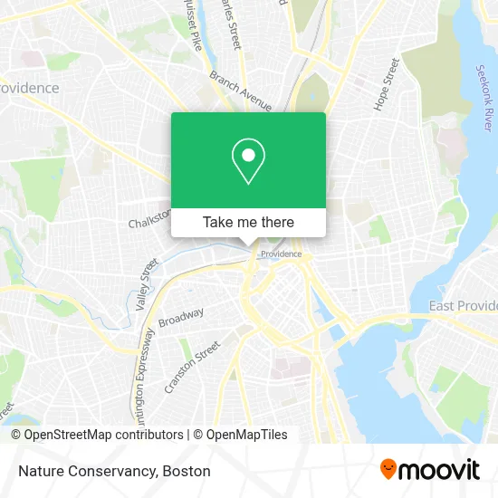
See Nature Conservancy, Boston, on the map
Public Transit to Nature Conservancy in Boston
Wondering how to get to Nature Conservancy in Boston? Moovit helps you find the best way to get to Nature Conservancy with step-by-step directions from the nearest public transit station.
Moovit provides free maps and live directions to help you navigate through your city. View schedules, routes, timetables, and find out how long does it take to get to Nature Conservancy in real time.
Looking for the nearest stop or station to Nature Conservancy? Check out this list of stops closest to your destination: Providence Place Mall; Fountain Before Union; Convention Center Providence Ri; Providence Station (Park Row W Before Exchange); Memorial After Exchange; Rhode Island Convention Center (Sabin); Providence.
Bus: 1, 21, 35, 54, R, 50, 55, 56, 57, 6, 27, 28, 92, PETER PAN, PETER PAN, PETER PAN, PETER PAN, PETER PAN, 3, 4, 51, 58.Train: PROVIDENCE/STOUGHTON, ACELA, NORTHEAST REGIONAL, PROVIDENCE LINE SHUTTLE, PROVIDENCE LINE SHUTTLE, PROVIDENCE LINE SHUTTLE, FOXBORO EVENT SERVICE.
Want to see if there’s another route that gets you there at an earlier time? Moovit helps you find alternative routes or times. Get directions from and directions to Nature Conservancy easily from the Moovit App or Website.
We make riding to Nature Conservancy easy, which is why over 1.7 million users, including users in Boston, trust Moovit as the best app for public transit. You don’t need to download an individual bus app or train app, Moovit is your all-in-one transit app that helps you find the best bus time or train time available.
For information on prices of bus and train, costs and ride fares to Nature Conservancy, please check the Moovit app.
Use the app to navigate to popular places including to the airport, hospital, stadium, grocery store, mall, coffee shop, school, college, and university.
Nature Conservancy Address: 235 Promenade St street in Boston
- Clean Water Finance Agency, Rhde Is,
- Seniorlink,
- Skyler Gleue - Mutual of Omaha,
- Studio Idol,
- Firstworks,
- HDR,
- Ansys,
- Adecco Staffing,
- Narragansett Bay Estuary Program,
- Famous Famiglia,
- Providence Place,
- Experience Rhode Island,
- Providence Insurance Bargains,
- New England Water Supply,
- Italian Experience,
- Rhode Island Tent & Party Rentals,
- Greenbytes,
- FedEx,
- Adam Badeau - Financial Advisor,
- Dish Network
Places Near Nature Conservancy (Boston)
- Td Garden, Boston,
- Castle Island, Boston,
- Wilbur Theatre, Boston,
- Prudential Center, Boston,
- North End, Boston,
- Faneuil Hall, Boston,
- Massachusetts General Hospital, Boston,
- Seaport District, Boston,
- Boston Medical Center, Boston,
- House Of Blues, Boston,
- Boston Common, Boston,
- Boston Convention & Exhibition Center, Boston,
- Museum Of Science, Boston,
- Cheers, Boston,
- Boston Children's Hospital, Boston,
- Mgm Music Hall, Boston,
- Quincy Market, Boston,
- Isabella Stewart Gardner Museum, Boston,
- Wang Theater, Boston,
- Leader Bank Pavilion (Leader Bank Pavillion), Boston
How to get to popular places in Boston with public transit
Get around Boston by public transit!
Traveling around Boston has never been so easy. See step by step directions as you travel to any attraction, street or major public transit station. View bus and train schedules, arrival times, service alerts and detailed routes on a map, so you know exactly how to get to anywhere in Boston.
When traveling to any destination around Boston use Moovit's Live Directions with Get Off Notifications to know exactly where and how far to walk, how long to wait for your line, and how many stops are left. Moovit will alert you when it's time to get off — no need to constantly re-check whether yours is the next stop.
Wondering how to use public transit in Boston or how to pay for public transit in Boston? Moovit public transit app can help you navigate your way with public transit easily, and at minimum cost. It includes public transit fees, ticket prices, and costs. Looking for a map of Boston public transit lines? Moovit public transit app shows all public transit maps in Boston with all Bus, Train, Subway and Ferry routes and stops on an interactive map.
Boston has 4 transit type(s), including: Bus, Train, Subway and Ferry, operated by several transit agencies, including MBTA, Southeastern Regional Transit Authority, MetroWest Regional Transit Authority, Rhode Island Public Transit Authority, WRTA, Lowell Regional Transit Authority, Merrimack Valley Transit, Montachusett Regional Transit Authority, Cape Cod Regional Transit Authority, Brockton Area Transit Authority, Martha's Vineyard Transit Authority, the WAVE - Nantucket Regional Transit Authority, GATRA, Cape Ann Transportation Authority and Massport