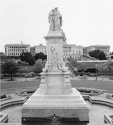
See Naval Monument, Washington, on the map
Directions to Naval Monument (Washington) with public transportation
The following transit lines have routes that pass near Naval Monument
 Bus:
Bus: - Train:
- Metro:
How to get to Naval Monument by bus?
Click on the bus route to see step by step directions with maps, line arrival times and updated time schedules.
How to get to Naval Monument by train?
Click on the train route to see step by step directions with maps, line arrival times and updated time schedules.
How to get to Naval Monument by metro?
Click on the metro route to see step by step directions with maps, line arrival times and updated time schedules.
Bus stations near Naval Monument in Washington
- Constitution Ave & 3rd St Nw Wb,5 min walk,
Bus lines to Naval Monument in Washington
- 230,230/12 Severna Park,
- 250,250/8 Kent Island,
What are the closest stations to Naval Monument?
The closest stations to Naval Monument are:
- Constitution Ave & 3rd St Nw Wb is 342 yards away, 5 min walk.
Which bus lines stop near Naval Monument?
These bus lines stop near Naval Monument: 309E, 30S, 36, 417E, 80, MALL.
Which train lines stop near Naval Monument?
These train lines stop near Naval Monument: MANASSAS LINE, MARC.
Which metro lines stop near Naval Monument?
These metro lines stop near Naval Monument: METRORAIL GREEN LINE, METRORAIL ORANGE LINE, METRORAIL RED LINE, METRORAIL YELLOW LINE.
What’s the nearest bus stop to Naval Monument in Washington?
The nearest bus stop to Naval Monument in Washington is Constitution Ave & 3rd St Nw Wb. It’s a 5 min walk away.
See Naval Monument, Washington, on the map
Public Transit to Naval Monument in Washington
Wondering how to get to Naval Monument in Washington, United States? Moovit helps you find the best way to get to Naval Monument with step-by-step directions from the nearest public transit station.
Moovit provides free maps and live directions to help you navigate through your city. View schedules, routes, timetables, and find out how long does it take to get to Naval Monument in real time.
Looking for the nearest stop or station to Naval Monument? Check out this list of stops closest to your destination: Constitution Ave & 3rd St Nw Wb.
Bus:Train:Metro:
Want to see if there’s another route that gets you there at an earlier time? Moovit helps you find alternative routes or times. Get directions from and directions to Naval Monument easily from the Moovit App or Website.
We make riding to Naval Monument easy, which is why over 1.5 million users, including users in Washington, trust Moovit as the best app for public transit. You don’t need to download an individual bus app or train app, Moovit is your all-in-one transit app that helps you find the best bus time or train time available.
For information on prices of bus, metro and train, costs and ride fares to Naval Monument, please check the Moovit app.
Use the app to navigate to popular places including to the airport, hospital, stadium, grocery store, mall, coffee shop, school, college, and university.
Location: Washington, Washington, D.C. - Baltimore, MD
Attractions near Naval Monument
Peace Monument,Peace Monument,Double Decker Tour Bus,US Capitol West Lawn,Capitol Christmas Tree,Running The Hill At The US Capitol,Civil War Sailors Statue,61,Center Of Washington,101 1st Street Northwest,Ulysses S. Grant Memorial,Ulysses S. Grant Statue,60,Ulysses S Grant Memorial,James Abram Garfield Memorial,Flamingo Fountain,Battery Of Horse Artillery,U.S. Senate Judiciary Committee Hearing Room,Order of the Eastern Star,104 Constitution Ave NW (Constitution Ave NW,104)How to get to popular attractions in Washington with public transit
Union Pub, Washington,Hyatt Regency Baltimore Inner Harbor, Baltimore,P.J. Clarke's, Washington,Charles Village, Baltimore,Hamilton's Bar & Grill, Washington,Ebenezers Coffeehouse, Washington,Buffalo Wild Wings, Anne Arundel County,Estadio, Washington,AMC Owings Mills 17, Baltimore County,Dundalk, Maryland, Baltimore County,Tunnicliff's Tavern, Washington,Daniel O'Connell's Irish Restaurant & Bar, Alexandria,Maryland State Fairgrounds, Baltimore County,Baltimore Farmers' Market & Bazaar, Baltimore,The Greene Turtle Sports Bar & Grille, Washington,Pigtown / Washington Village, Baltimore,Fogo de Chao, Washington,Shaw's Tavern, Washington,Urbana, Washington,New Psalmist Baptist Church, Baltimore CountyGet around Washington by public transit!
Traveling around Washington has never been so easy. See step by step directions as you travel to any attraction, street or major public transit station. View bus and train schedules, arrival times, service alerts and detailed routes on a map, so you know exactly how to get to anywhere in Washington.
When traveling to any destination around Washington use Moovit's Live Directions with Get Off Notifications to know exactly where and how far to walk, how long to wait for your line, and how many stops are left. Moovit will alert you when it's time to get off — no need to constantly re-check whether yours is the next stop.
Wondering how to use public transit in Washington or how to pay for public transit in Washington? Moovit public transit app can help you navigate your way with public transit easily, and at minimum cost. It includes public transit fees, ticket prices, and costs. Looking for a map of Washington public transit lines? Moovit public transit app shows all public transit maps in Washington with all bus, metro or train routes and stops on an interactive map.
Washington has 3 transit type(s), including: bus, metro or train, operated by several transit agencies, including WMATA, WMATA, Montgomery County Ride On, Fairfax Connector, TheBus, DC Circulator, MDOT MTA, Marc, MDOT MTA, MDOT MTA, Virginia Railway Express (VRE), PRTC, DASH - Alexandria, Arlington Transit (ART) and DC Streetcar