See Navy Hall, Niagara-On-The-Lake, on the map
Directions to Navy Hall (Niagara-On-The-Lake) with public transportation
The following transit lines have routes that pass near Navy Hall
 Bus:
Bus:
How to get to Navy Hall by bus?
Click on the bus route to see step by step directions with maps, line arrival times and updated time schedules.
Bus stations near Navy Hall in Niagara-On-The-Lake
- Picton St. @ Wellington,13 min walk,
Bus lines to Navy Hall in Niagara-On-The-Lake
- NOTL,Old Town-Glendale Loop,
What are the closest stations to Navy Hall?
The closest stations to Navy Hall are:
- Picton St. @ Wellington is 986 meters away, 13 min walk.
Which bus line stops near Navy Hall?
NOTL
What’s the nearest bus stop to Navy Hall in Niagara-On-The-Lake?
The nearest bus stop to Navy Hall in Niagara-On-The-Lake is Picton St. @ Wellington. It’s a 13 min walk away.
See Navy Hall, Niagara-On-The-Lake, on the map
Public Transit to Navy Hall in Niagara-On-The-Lake
Wondering how to get to Navy Hall in Niagara-On-The-Lake, Canada? Moovit helps you find the best way to get to Navy Hall with step-by-step directions from the nearest public transit station.
Moovit provides free maps and live directions to help you navigate through your city. View schedules, routes, timetables, and find out how long does it take to get to Navy Hall in real time.
Looking for the nearest stop or station to Navy Hall? Check out this list of stops closest to your destination: Picton St. @ Wellington.
Bus:
Want to see if there’s another route that gets you there at an earlier time? Moovit helps you find alternative routes or times. Get directions from and directions to Navy Hall easily from the Moovit App or Website.
We make riding to Navy Hall easy, which is why over 1.5 million users, including users in Niagara-On-The-Lake, trust Moovit as the best app for public transit. You don’t need to download an individual bus app or train app, Moovit is your all-in-one transit app that helps you find the best bus time or train time available.
For information on prices of bus, train, Streetcar and subway, costs and ride fares to Navy Hall, please check the Moovit app.
Use the app to navigate to popular places including to the airport, hospital, stadium, grocery store, mall, coffee shop, school, college, and university.
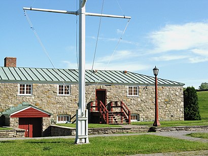
Navy Hall Address: Ricardo Street street in Niagara-On-The-Lake
Attractions near Navy Hall
Simcoe Memorial,Artists' Garden,Lieu Historique Natl Manoir de Navy,Music Niagara,247 Ricardo Street,Niagara Steamship CO,Niagara Pumphouse,Fort George,51 Queen's Parade,Fort George,Lieu Historique Natl du Fort-George,Fort George – Parks Canada,Merrin Financial,Nelson Park,Fort George National Historic Site Of Canada,Fort George National Historic Site of Canada,Boat Waste Pumpout.,Niagara River Range Front,Anchorage,The AnchorageHow to get to popular attractions in Niagara-On-The-Lake with public transit
University of Guelph, Guelph,Starbucks, Toronto,Mapleview Shopping Centre, Burlington,GoodLife Fitness Centres, Toronto,Starbucks, Toronto,Charles Street Transit Terminal, Kitchener,Whitby, Ontario, Whitby,Dixie Outlet Mall, Mississauga,Erin Mills Town Centre, Mississauga,Toronto Zoo, Toronto,Square One Bus Terminal, Mississauga,Communitech Hub, Kitchener,Canada's Wonderland, Vaughan,Starbucks, Toronto,Starbucks, Toronto,Highway 401 & 404 Merge, Toronto,Hwy 401 & Hwy 400, Toronto,IKEA, Burlington,Costco Wholesale, Burlington,The Junction, TorontoGet around Niagara-On-The-Lake by public transit!
Traveling around Niagara-On-The-Lake has never been so easy. See step by step directions as you travel to any attraction, street or major public transit station. View bus and train schedules, arrival times, service alerts and detailed routes on a map, so you know exactly how to get to anywhere in Niagara-On-The-Lake.
When traveling to any destination around Niagara-On-The-Lake use Moovit's Live Directions with Get Off Notifications to know exactly where and how far to walk, how long to wait for your line, and how many stops are left. Moovit will alert you when it's time to get off — no need to constantly re-check whether yours is the next stop.
Wondering how to use public transit in Niagara-On-The-Lake or how to pay for public transit in Niagara-On-The-Lake? Moovit public transit app can help you navigate your way with public transit easily, and at minimum cost. It includes public transit fees, ticket prices, and costs. Looking for a map of Niagara-On-The-Lake public transit lines? Moovit public transit app shows all public transit maps in Niagara-On-The-Lake with all bus, train, Streetcar or subway routes and stops on an interactive map.
Niagara-On-The-Lake has 4 transit type(s), including: bus, train, Streetcar or subway, operated by several transit agencies, including TTC, TTC Streetcar, Toronto Subway, GO Transit Bus, GO Transit, Amtrak, York Region Transit, Grand River Transit, Guelph Transit, grt, Hamilton Street Railway, MiWay, Brampton Transit, Burlington Transit and Oakville Transit