How to get to Naylor Electrical by bus?
Click on the bus route to see step by step directions with maps, line arrival times and updated time schedules.
Bus stop near Naylor Electrical in Boston
- 199 Chelmsford, 3 min walk,VIEW
Bus lines to Naylor Electrical in Boston
- 16, Radisson,VIEW
What are the closest stations to Naylor Electrical?
The closest stations to Naylor Electrical are:
- 199 Chelmsford is 197 yards away, 3 min walk.
Which bus lines stop near Naylor Electrical?
These bus lines stop near Naylor Electrical: 14, 16.
What’s the nearest bus station to Naylor Electrical in Boston?
The nearest bus station to Naylor Electrical in Boston is 199 Chelmsford. It’s a 3 min walk away.
What time is the first bus to Naylor Electrical in Boston?
The 16 is the first bus that goes to Naylor Electrical in Boston. It stops nearby at 6:00 AM.
What time is the last bus to Naylor Electrical in Boston?
The 16 is the last bus that goes to Naylor Electrical in Boston. It stops nearby at 7:58 PM.
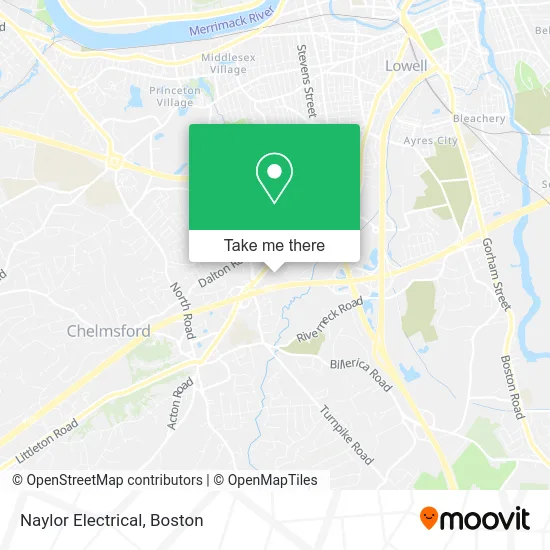
See Naylor Electrical, Boston, on the map
Public Transit to Naylor Electrical in Boston
Wondering how to get to Naylor Electrical in Boston? Moovit helps you find the best way to get to Naylor Electrical with step-by-step directions from the nearest public transit station.
Moovit provides free maps and live directions to help you navigate through your city. View schedules, routes, timetables, and find out how long does it take to get to Naylor Electrical in real time.
Looking for the nearest stop or station to Naylor Electrical? Check out this list of stops closest to your destination: 199 Chelmsford.
Bus: 14, 16.
Want to see if there’s another route that gets you there at an earlier time? Moovit helps you find alternative routes or times. Get directions from and directions to Naylor Electrical easily from the Moovit App or Website.
We make riding to Naylor Electrical easy, which is why over 1.7 million users, including users in Boston, trust Moovit as the best app for public transit. You don’t need to download an individual bus app or train app, Moovit is your all-in-one transit app that helps you find the best bus time or train time available.
For information on prices of bus, costs and ride fares to Naylor Electrical, please check the Moovit app.
Use the app to navigate to popular places including to the airport, hospital, stadium, grocery store, mall, coffee shop, school, college, and university.
Naylor Electrical Address: 15 Maple Ave Chelmsford, MA 01824 street in Boston
- Andella Homes,
- Creative Styles,
- Skylight Nail Bar Chelmsford,
- Shampoo Hair Salon & Spa,
- Northeast Scuba,
- Humble Home Care Services LLC,
- Izamara Beauty,
- Dr. Tanya Zouzas Internal Medicine Office,
- Pickering Interfaces, Inc.,
- Nouria Chelmsford - Chelmsford Street,
- RE/MAX,
- Scott Sigman Md,
- Agape Mental Health,
- Astrologer And Spiritual Psychic Healer,
- Heritage Tint Co.,
- Commonwealth Auto & Home Insurance/ Baystate Financial,
- RE/MAX,
- Dedham Homes for Sale and Beyond with Jay McHugh,
- Prospect Mortgage,
- Perreira And Paquette Team
Places Near Naylor Electrical (Boston)
- Prudential Center, Boston,
- Massachusetts General Hospital, Boston,
- Boston Convention & Exhibition Center, Boston,
- Cheers, Boston,
- Boston Common, Boston,
- House Of Blues, Boston,
- Isabella Stewart Gardner Museum, Boston,
- Leader Bank Pavilion (Leader Bank Pavillion), Boston,
- Seaport District, Boston,
- Museum Of Science, Boston,
- Wang Theater, Boston,
- Quincy Market, Boston,
- Td Garden, Boston,
- North End, Boston,
- Mgm Music Hall, Boston,
- Wilbur Theatre, Boston,
- Boston Medical Center, Boston,
- Boston Children's Hospital, Boston,
- Castle Island, Boston,
- Faneuil Hall, Boston
How to get to popular places in Boston with public transit
Get around Boston by public transit!
Traveling around Boston has never been so easy. See step by step directions as you travel to any attraction, street or major public transit station. View bus and train schedules, arrival times, service alerts and detailed routes on a map, so you know exactly how to get to anywhere in Boston.
When traveling to any destination around Boston use Moovit's Live Directions with Get Off Notifications to know exactly where and how far to walk, how long to wait for your line, and how many stops are left. Moovit will alert you when it's time to get off — no need to constantly re-check whether yours is the next stop.
Wondering how to use public transit in Boston or how to pay for public transit in Boston? Moovit public transit app can help you navigate your way with public transit easily, and at minimum cost. It includes public transit fees, ticket prices, and costs. Looking for a map of Boston public transit lines? Moovit public transit app shows all public transit maps in Boston with all Bus, Train, Subway and Ferry routes and stops on an interactive map.
Boston has 4 transit type(s), including: Bus, Train, Subway and Ferry, operated by several transit agencies, including MBTA, Southeastern Regional Transit Authority, MetroWest Regional Transit Authority, Rhode Island Public Transit Authority, WRTA, Lowell Regional Transit Authority, Merrimack Valley Transit, Montachusett Regional Transit Authority, Cape Cod Regional Transit Authority, Brockton Area Transit Authority, Martha's Vineyard Transit Authority, the WAVE - Nantucket Regional Transit Authority, GATRA, Cape Ann Transportation Authority and Massport