How to get to Ndb Fitness by bus?
Click on the bus route to see step by step directions with maps, line arrival times and updated time schedules.
Bus stop near Ndb Fitness in Boston
- Across From 2341 Main, 12 min walk,VIEW
Train stations near Ndb Fitness in Boston
Bus lines to Ndb Fitness in Boston
- 12, Kennedy Center,VIEW
What are the closest stations to Ndb Fitness?
The closest stations to Ndb Fitness are:
- Across From 2341 Main is 1009 yards away, 12 min walk.
- Wilmington is 4187 yards away, 49 min walk.
- North Wilmington is 5348 yards away, 63 min walk.
Which bus line stops near Ndb Fitness?
12 (Wilmington Train Station)
What’s the nearest bus station to Ndb Fitness in Boston?
The nearest bus station to Ndb Fitness in Boston is Across From 2341 Main. It’s a 12 min walk away.
What time is the first train to Ndb Fitness in Boston?
The HAVERHILL is the first train that goes to Ndb Fitness in Boston. It stops nearby at 5:11 AM.
What time is the last train to Ndb Fitness in Boston?
The HAVERHILL is the last train that goes to Ndb Fitness in Boston. It stops nearby at 12:19 AM.
What time is the first bus to Ndb Fitness in Boston?
The 12 is the first bus that goes to Ndb Fitness in Boston. It stops nearby at 6:41 AM.
What time is the last bus to Ndb Fitness in Boston?
The 12 is the last bus that goes to Ndb Fitness in Boston. It stops nearby at 7:19 PM.
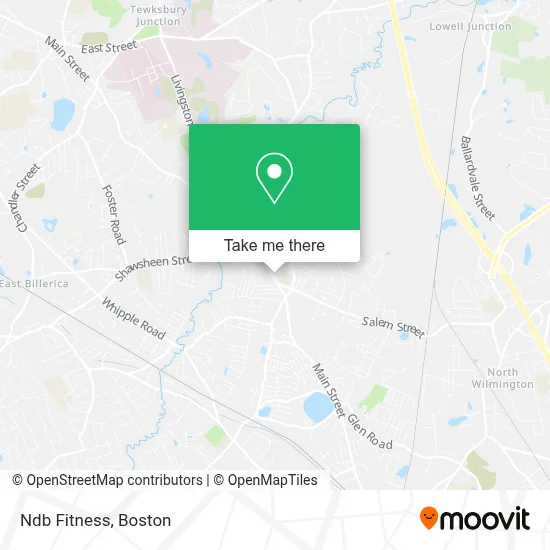
See Ndb Fitness, Boston, on the map
Public Transit to Ndb Fitness in Boston
Wondering how to get to Ndb Fitness in Boston? Moovit helps you find the best way to get to Ndb Fitness with step-by-step directions from the nearest public transit station.
Moovit provides free maps and live directions to help you navigate through your city. View schedules, routes, timetables, and find out how long does it take to get to Ndb Fitness in real time.
Looking for the nearest stop or station to Ndb Fitness? Check out this list of stops closest to your destination: Across From 2341 Main; Wilmington; North Wilmington.
Bus: 12.Train: LOWELL, HAVERHILL.
Want to see if there’s another route that gets you there at an earlier time? Moovit helps you find alternative routes or times. Get directions from and directions to Ndb Fitness easily from the Moovit App or Website.
We make riding to Ndb Fitness easy, which is why over 1.7 million users, including users in Boston, trust Moovit as the best app for public transit. You don’t need to download an individual bus app or train app, Moovit is your all-in-one transit app that helps you find the best bus time or train time available.
For information on prices of bus and train, costs and ride fares to Ndb Fitness, please check the Moovit app.
Use the app to navigate to popular places including to the airport, hospital, stadium, grocery store, mall, coffee shop, school, college, and university.
Ndb Fitness Address: 2230 Main St street in Boston
- Pull-Up,
- Alpha Motors,
- Tewksbury 24 7 Locksmith,
- Wood Mechanical Services,
- McMillan Electric & Alarm,
- KDC Management,
- Lux Spa and Laser,
- Tewksbury MA Locksmith Store,
- United Methodist Church,
- Giovannis Roast Beef and Pizza Tewksbury,
- Clifford Air Conditioning & Heating,
- Donnas Day Care,
- Chef Jason's Catered Events,
- RE/MAX,
- Harnois Chiropractic & Spinal Decompression Office,
- AA Real Estate Home Buyers,
- Fido's First Choice Pet Care,
- Mississippi Rd & South St,
- Reco Auto Garage,
- United Healthcare
Places Near Ndb Fitness (Boston)
- Boston Convention & Exhibition Center, Boston,
- Mgm Music Hall, Boston,
- Quincy Market, Boston,
- North End, Boston,
- Boston Children's Hospital, Boston,
- Leader Bank Pavilion (Leader Bank Pavillion), Boston,
- Wang Theater, Boston,
- Seaport District, Boston,
- Prudential Center, Boston,
- House Of Blues, Boston,
- Cheers, Boston,
- Isabella Stewart Gardner Museum, Boston,
- Massachusetts General Hospital, Boston,
- Wilbur Theatre, Boston,
- Boston Common, Boston,
- Castle Island, Boston,
- Faneuil Hall, Boston,
- Td Garden, Boston,
- Museum Of Science, Boston,
- Boston Medical Center, Boston
How to get to popular places in Boston with public transit
Get around Boston by public transit!
Traveling around Boston has never been so easy. See step by step directions as you travel to any attraction, street or major public transit station. View bus and train schedules, arrival times, service alerts and detailed routes on a map, so you know exactly how to get to anywhere in Boston.
When traveling to any destination around Boston use Moovit's Live Directions with Get Off Notifications to know exactly where and how far to walk, how long to wait for your line, and how many stops are left. Moovit will alert you when it's time to get off — no need to constantly re-check whether yours is the next stop.
Wondering how to use public transit in Boston or how to pay for public transit in Boston? Moovit public transit app can help you navigate your way with public transit easily, and at minimum cost. It includes public transit fees, ticket prices, and costs. Looking for a map of Boston public transit lines? Moovit public transit app shows all public transit maps in Boston with all Bus, Train, Subway and Ferry routes and stops on an interactive map.
Boston has 4 transit type(s), including: Bus, Train, Subway and Ferry, operated by several transit agencies, including MBTA, Southeastern Regional Transit Authority, MetroWest Regional Transit Authority, Rhode Island Public Transit Authority, WRTA, Lowell Regional Transit Authority, Merrimack Valley Transit, Montachusett Regional Transit Authority, Cape Cod Regional Transit Authority, Brockton Area Transit Authority, Martha's Vineyard Transit Authority, the WAVE - Nantucket Regional Transit Authority, GATRA, Cape Ann Transportation Authority and Massport