How to get to Ndc Young People's Union by bus?
Click on the bus route to see step by step directions with maps, line arrival times and updated time schedules.
Bus stops near Ndc Young People's Union in Worcester
Bus lines to Ndc Young People's Union in Worcester
What are the closest stations to Ndc Young People's Union?
The closest stations to Ndc Young People's Union are:
- Main St + Arbor Vitae St is 11 yards away, 1 min walk.
- Stafford St + Curtis Pkwy is 241 yards away, 3 min walk.
Which bus lines stop near Ndc Young People's Union?
These bus lines stop near Ndc Young People's Union: 19, 33, 825.
What’s the nearest bus station to Ndc Young People's Union in Worcester?
The nearest bus station to Ndc Young People's Union in Worcester is Main St + Arbor Vitae St. It’s a 1 min walk away.
What time is the first bus to Ndc Young People's Union in Worcester?
The 19 is the first bus that goes to Ndc Young People's Union in Worcester. It stops nearby at 5:06 AM.
What time is the last bus to Ndc Young People's Union in Worcester?
The 19 is the last bus that goes to Ndc Young People's Union in Worcester. It stops nearby at 10:41 PM.
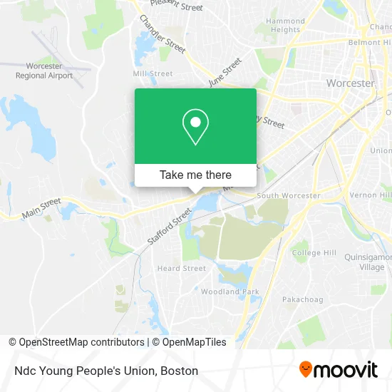
See Ndc Young People's Union, Worcester, on the map
Public Transit to Ndc Young People's Union in Worcester
Wondering how to get to Ndc Young People's Union in Worcester? Moovit helps you find the best way to get to Ndc Young People's Union with step-by-step directions from the nearest public transit station.
Moovit provides free maps and live directions to help you navigate through your city. View schedules, routes, timetables, and find out how long does it take to get to Ndc Young People's Union in real time.
Looking for the nearest stop or station to Ndc Young People's Union? Check out this list of stops closest to your destination: Main St + Arbor Vitae St; Stafford St + Curtis Pkwy.
Bus: 19, 33, 825, 27.
Want to see if there’s another route that gets you there at an earlier time? Moovit helps you find alternative routes or times. Get directions from and directions to Ndc Young People's Union easily from the Moovit App or Website.
We make riding to Ndc Young People's Union easy, which is why over 1.7 million users, including users in Worcester, trust Moovit as the best app for public transit. You don’t need to download an individual bus app or train app, Moovit is your all-in-one transit app that helps you find the best bus time or train time available.
For information on prices of bus and train, costs and ride fares to Ndc Young People's Union, please check the Moovit app.
Use the app to navigate to popular places including to the airport, hospital, stadium, grocery store, mall, coffee shop, school, college, and university.
Ndc Young People's Union Address: 1189 Main St street in Worcester
- Ctac,
- Q Look Bridal,
- Ma Rehabilitation Center & Addiction Treatment Programs,
- Our Lady of the Angels Parish,
- Ruby Hair Salon,
- Prime Auto Detail,
- Rhema Gospel Church,
- Pachecos Auto Body,
- LTJBM Church,
- Lularoe Tana Zoller,
- Suprema Mamma Seamstress & More,
- Extended Care,
- New Creation Christian Church,
- Butcher Family Foundation,
- Gates Lane Elementary School,
- Premier Chiropractic Centers,
- First Worcester Pentecostal Chu,
- House of Restoration Ministry,
- Coinbridge Bitcoin ATM - 91 Stafford St, Worcester, Ma,
- Park Ave Pawn
Places Near Ndc Young People's Union (Worcester)
- Faneuil Hall, Boston,
- Museum Of Science, Boston,
- Td Garden, Boston,
- Wang Theater, Boston,
- Mgm Music Hall, Boston,
- Boston Common, Boston,
- Castle Island, Boston,
- Boston Medical Center, Boston,
- Massachusetts General Hospital, Boston,
- Prudential Center, Boston,
- House Of Blues, Boston,
- North End, Boston,
- Boston Convention & Exhibition Center, Boston,
- Boston Children's Hospital, Boston,
- Isabella Stewart Gardner Museum, Boston,
- Leader Bank Pavilion (Leader Bank Pavillion), Boston,
- Wilbur Theatre, Boston,
- Quincy Market, Boston,
- Seaport District, Boston,
- Cheers, Boston
How to get to popular places in Boston with public transit
Get around Worcester by public transit!
Traveling around Worcester has never been so easy. See step by step directions as you travel to any attraction, street or major public transit station. View bus and train schedules, arrival times, service alerts and detailed routes on a map, so you know exactly how to get to anywhere in Worcester.
When traveling to any destination around Worcester use Moovit's Live Directions with Get Off Notifications to know exactly where and how far to walk, how long to wait for your line, and how many stops are left. Moovit will alert you when it's time to get off — no need to constantly re-check whether yours is the next stop.
Wondering how to use public transit in Worcester or how to pay for public transit in Worcester? Moovit public transit app can help you navigate your way with public transit easily, and at minimum cost. It includes public transit fees, ticket prices, and costs. Looking for a map of Worcester public transit lines? Moovit public transit app shows all public transit maps in Worcester with all Bus, Train, Subway and Ferry routes and stops on an interactive map.
Boston has 4 transit type(s), including: Bus, Train, Subway and Ferry, operated by several transit agencies, including MBTA, Southeastern Regional Transit Authority, MetroWest Regional Transit Authority, Rhode Island Public Transit Authority, WRTA, Lowell Regional Transit Authority, Merrimack Valley Transit, Montachusett Regional Transit Authority, Cape Cod Regional Transit Authority, Brockton Area Transit Authority, Martha's Vineyard Transit Authority, the WAVE - Nantucket Regional Transit Authority, GATRA, Cape Ann Transportation Authority and Massport