Directions to Needham Bank Mission Hill (Boston) with public transportation
The following transit lines have routes that pass near Needham Bank Mission Hill
 Bus: 39, 66, 14, 41, 22.
- Train: PROVIDENCE/STOUGHTON.
- Subway: ORANGE LINE, GREEN LINE E.
How to get to Needham Bank Mission Hill by bus?
Click on the bus route to see step by step directions with maps, line arrival times and updated time schedules.
From Ac Hotel Cambridge, Cambridge
94 minFrom Medford Square, Medford
89 minFrom McLean Hospital, Belmont
88 minFrom Academy Of the Pacific Rim Charter Public School, Boston
68 minFrom SharkNinja Operating LLC, Needham
116 minFrom Hyatt Place Medford, Medford
92 minFrom Regent Theatre, Arlington
87 minFrom Apple Cinemas, Cambridge
77 minFrom Belle Isle Lobster & Seafood, Winthrop Town
106 minFrom Rino's Place, Boston
56 min
How to get to Needham Bank Mission Hill by train?
Click on the train route to see step by step directions with maps, line arrival times and updated time schedules.
How to get to Needham Bank Mission Hill by subway?
Click on the subway route to see step by step directions with maps, line arrival times and updated time schedules.
Subway stations near Needham Bank Mission Hill in Boston
Bus stops near Needham Bank Mission Hill in Boston
Bus lines to Needham Bank Mission Hill in Boston
- 14, Heath St,VIEW
- 41, Centre St & Eliot St,VIEW
- 22, Ruggles - Ashmont,VIEW
- ORANGE LINE SHUTTLE, Forest Hills - Back Bay (Shuttle),VIEW
- ORANGE LINE SHUTTLE, Forest Hills - Ruggles,VIEW
- ORANGE LINE SHUTTLE, Forest Hills - Copley,VIEW
- ORANGE LINE SHUTTLE, Forest Hills - Back Bay via Ruggles Busway (Shuttle),VIEW
- ORANGE LINE SHUTTLE, Jackson Square - Copley,VIEW
- ORANGE LINE SHUTTLE, Jackson Square - Back Bay,VIEW
- ORANGE LINE SHUTTLE, Forest Hills - Back Bay via Copley (Shuttle),VIEW
- 19, Gallivan Blvd,VIEW
- 66, Nubian Via Allston,VIEW
- 15, Ruggles - Fields Corner,VIEW
- 23, Ruggles - Ashmont,VIEW
- 28, Ruggles - Mattapan,VIEW
- 44, Ruggles - Jackson Square,VIEW
- 45, Ruggles - Franklin Park,VIEW
What are the closest stations to Needham Bank Mission Hill?
The closest stations to Needham Bank Mission Hill are:
- Museum Of Fine Arts is 67 yards away, 1 min walk.
- Centre St @ Gardner St is 273 yards away, 4 min walk.
- Tremont St @ Roxbury Crossing Station is 281 yards away, 4 min walk.
- Tremont St Opp Roxbury Crossing Sta is 304 yards away, 4 min walk.
- Malcolm X Blvd @ King St is 456 yards away, 6 min walk.
- Roxbury Crossing is 937 yards away, 11 min walk.
Which bus lines stop near Needham Bank Mission Hill?
These bus lines stop near Needham Bank Mission Hill: 39, 66.
Which train line stops near Needham Bank Mission Hill?
PROVIDENCE/STOUGHTON (#824 | South Station)
Which subway line stops near Needham Bank Mission Hill?
ORANGE LINE (Forest Hills)
What’s the nearest subway station to Needham Bank Mission Hill in Boston?
The nearest subway station to Needham Bank Mission Hill in Boston is Museum Of Fine Arts. It’s a 1 min walk away.
What’s the nearest bus station to Needham Bank Mission Hill in Boston?
The nearest bus stations to Needham Bank Mission Hill in Boston are Centre St @ Gardner St, Tremont St @ Roxbury Crossing Station and Tremont St Opp Roxbury Crossing Sta. The closest one is a 4 min walk away.
What time is the first subway to Needham Bank Mission Hill in Boston?
The ORANGE LINE is the first subway that goes to Needham Bank Mission Hill in Boston. It stops nearby at 5:22 AM.
What time is the last subway to Needham Bank Mission Hill in Boston?
The GREEN LINE E is the last subway that goes to Needham Bank Mission Hill in Boston. It stops nearby at 2:04 AM.
What time is the first bus to Needham Bank Mission Hill in Boston?
The 66 is the first bus that goes to Needham Bank Mission Hill in Boston. It stops nearby at 4:49 AM.
What time is the last bus to Needham Bank Mission Hill in Boston?
The 28 is the last bus that goes to Needham Bank Mission Hill in Boston. It stops nearby at 2:32 AM.
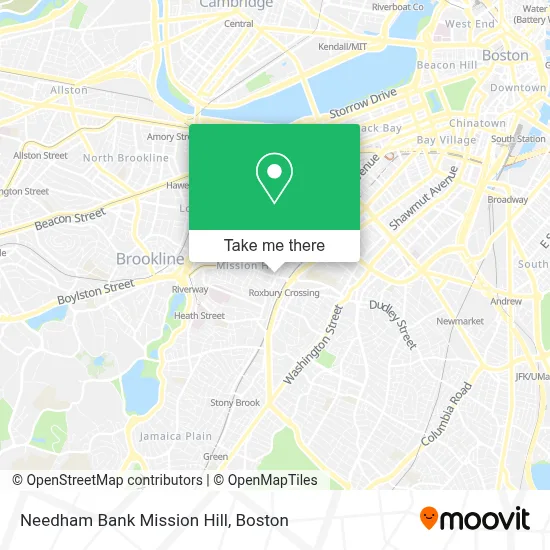
See Needham Bank Mission Hill, Boston, on the map
Public Transit to Needham Bank Mission Hill in Boston
Wondering how to get to Needham Bank Mission Hill in Boston? Moovit helps you find the best way to get to Needham Bank Mission Hill with step-by-step directions from the nearest public transit station.
Moovit provides free maps and live directions to help you navigate through your city. View schedules, routes, timetables, and find out how long does it take to get to Needham Bank Mission Hill in real time.
Looking for the nearest stop or station to Needham Bank Mission Hill? Check out this list of stops closest to your destination: Museum Of Fine Arts; Centre St @ Gardner St; Tremont St @ Roxbury Crossing Station; Tremont St Opp Roxbury Crossing Sta; Malcolm X Blvd @ King St; Roxbury Crossing.
Bus: 39, 66, 14, 41, 22, ORANGE LINE SHUTTLE, ORANGE LINE SHUTTLE, ORANGE LINE SHUTTLE, ORANGE LINE SHUTTLE, 19, 15, 23, 28, 44, 45.Train: PROVIDENCE/STOUGHTON.Subway: ORANGE LINE, GREEN LINE E.
Want to see if there’s another route that gets you there at an earlier time? Moovit helps you find alternative routes or times. Get directions from and directions to Needham Bank Mission Hill easily from the Moovit App or Website.
We make riding to Needham Bank Mission Hill easy, which is why over 1.7 million users, including users in Boston, trust Moovit as the best app for public transit. You don’t need to download an individual bus app or train app, Moovit is your all-in-one transit app that helps you find the best bus time or train time available.
For information on prices of bus, subway and train, costs and ride fares to Needham Bank Mission Hill, please check the Moovit app.
Use the app to navigate to popular places including to the airport, hospital, stadium, grocery store, mall, coffee shop, school, college, and university.
Needham Bank Mission Hill Address: 1457 Tremont St. street in Boston
- Valor,
- Tobin Community Center,
- Boston City Hall,
- Tavern of Tales,
- Maurice J Tobin,
- Local Locksmith Company,
- Milkweed,
- Parker St & Station St,
- Crispy Dough Pizzeria (Crispy Dough Pizza Menu),
- MBTA Roxbury Crossing Station,
- Roxbury Community College Mainstage Theater,
- Fenway High School,
- Horadan Way Building 42 ,
- Boston's Basilica (Basilica of Our Lady of Perpetual Help),
- Mission Church,
- Kush Groove,
- Canna Nation,
- Roxbury Community College,
- Philip Mahoney,
- City of Boston
Places Near Needham Bank Mission Hill (Boston)
- Isabella Stewart Gardner Museum, Boston,
- Mgm Music Hall, Boston,
- Wilbur Theatre, Boston,
- Boston Medical Center, Boston,
- Quincy Market, Boston,
- Leader Bank Pavilion (Leader Bank Pavillion), Boston,
- Cheers, Boston,
- Castle Island, Boston,
- House Of Blues, Boston,
- Wang Theater, Boston,
- Boston Children's Hospital, Boston,
- Seaport District, Boston,
- Faneuil Hall, Boston,
- Boston Convention & Exhibition Center, Boston,
- Massachusetts General Hospital, Boston,
- Prudential Center, Boston,
- North End, Boston,
- Td Garden, Boston,
- Museum Of Science, Boston,
- Boston Common, Boston
How to get to popular places in Boston with public transit
Get around Boston by public transit!
Traveling around Boston has never been so easy. See step by step directions as you travel to any attraction, street or major public transit station. View bus and train schedules, arrival times, service alerts and detailed routes on a map, so you know exactly how to get to anywhere in Boston.
When traveling to any destination around Boston use Moovit's Live Directions with Get Off Notifications to know exactly where and how far to walk, how long to wait for your line, and how many stops are left. Moovit will alert you when it's time to get off — no need to constantly re-check whether yours is the next stop.
Wondering how to use public transit in Boston or how to pay for public transit in Boston? Moovit public transit app can help you navigate your way with public transit easily, and at minimum cost. It includes public transit fees, ticket prices, and costs. Looking for a map of Boston public transit lines? Moovit public transit app shows all public transit maps in Boston with all Bus, Train, Subway and Ferry routes and stops on an interactive map.
Boston has 4 transit type(s), including: Bus, Train, Subway and Ferry, operated by several transit agencies, including MBTA, Southeastern Regional Transit Authority, MetroWest Regional Transit Authority, Rhode Island Public Transit Authority, WRTA, Lowell Regional Transit Authority, Merrimack Valley Transit, Montachusett Regional Transit Authority, Cape Cod Regional Transit Authority, Brockton Area Transit Authority, Martha's Vineyard Transit Authority, the WAVE - Nantucket Regional Transit Authority, GATRA, Cape Ann Transportation Authority and Massport