Directions to Nefa (Boston) with public transportation
The following transit lines have routes that pass near Nefa
 Bus: 19, 504, SL4, SL5, 9.
- Train: FITCHBURG, FRAMINGHAM/WORCESTER, HAVERHILL, NEEDHAM.
- Subway: ORANGE LINE, RED LINE, GREEN LINE B, GREEN LINE C, GREEN LINE D.
How to get to Nefa by bus?
Click on the bus route to see step by step directions with maps, line arrival times and updated time schedules.
From Melrose Wakefield Hospital, Malden
106 minFrom Four Points by Sheraton Boston Logan Airport, Revere
82 minFrom West Roxbury, Boston
51 minFrom Suffolk Downs, Boston
65 minFrom Beth Israel Deaconess Hospital-Milton, Milton
76 minFrom Harvard Museum Of Natural History, Cambridge
49 minFrom Malden Catholic High School, Malden
96 minFrom FOUR POINTS BY SHERATON Boston Newton, Newton
29 minFrom Boston Scientific, Quincy
141 minFrom MBTA Suffolk Downs Station, Boston
70 min
How to get to Nefa by train?
Click on the train route to see step by step directions with maps, line arrival times and updated time schedules.
How to get to Nefa by subway?
Click on the subway route to see step by step directions with maps, line arrival times and updated time schedules.
Bus stops near Nefa in Boston
Subway stations near Nefa in Boston
Bus lines to Nefa in Boston
What are the closest stations to Nefa?
The closest stations to Nefa are:
- Washington St @ Herald St is 308 yards away, 5 min walk.
- E Berkeley St @ Harrison Ave is 326 yards away, 5 min walk.
- Tremont St @ Charles St S is 431 yards away, 6 min walk.
- Chinatown is 441 yards away, 6 min walk.
- Broadway is 1045 yards away, 13 min walk.
- Boylston is 1506 yards away, 19 min walk.
Which bus lines stop near Nefa?
These bus lines stop near Nefa: 19, 504, SL4, SL5.
Which train lines stop near Nefa?
These train lines stop near Nefa: FITCHBURG, FRAMINGHAM/WORCESTER, HAVERHILL, NEEDHAM.
Which subway lines stop near Nefa?
These subway lines stop near Nefa: ORANGE LINE, RED LINE.
What’s the nearest subway station to Nefa in Boston?
The nearest subway station to Nefa in Boston is Chinatown. It’s a 6 min walk away.
What’s the nearest bus station to Nefa in Boston?
The nearest bus stations to Nefa in Boston are Washington St @ Herald St and E Berkeley St @ Harrison Ave. The closest one is a 5 min walk away.
What time is the first subway to Nefa in Boston?
The GREEN LINE D is the first subway that goes to Nefa in Boston. It stops nearby at 5:07 AM.
What time is the last subway to Nefa in Boston?
The GREEN LINE E is the last subway that goes to Nefa in Boston. It stops nearby at 2:16 AM.
What time is the first bus to Nefa in Boston?
The 15 is the first bus that goes to Nefa in Boston. It stops nearby at 5:06 AM.
What time is the last bus to Nefa in Boston?
The 9 is the last bus that goes to Nefa in Boston. It stops nearby at 1:16 AM.
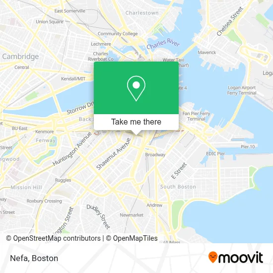
See Nefa, Boston, on the map
Public Transit to Nefa in Boston
Wondering how to get to Nefa in Boston? Moovit helps you find the best way to get to Nefa with step-by-step directions from the nearest public transit station.
Moovit provides free maps and live directions to help you navigate through your city. View schedules, routes, timetables, and find out how long does it take to get to Nefa in real time.
Looking for the nearest stop or station to Nefa? Check out this list of stops closest to your destination: Washington St @ Herald St; E Berkeley St @ Harrison Ave; Tremont St @ Charles St S; Chinatown; Broadway; Boylston.
Bus: 19, 504, SL4, SL5, 9, 11, 15, 43.Train: FITCHBURG, FRAMINGHAM/WORCESTER, HAVERHILL, NEEDHAM.Subway: ORANGE LINE, RED LINE, GREEN LINE B, GREEN LINE C, GREEN LINE D, GREEN LINE E.
Want to see if there’s another route that gets you there at an earlier time? Moovit helps you find alternative routes or times. Get directions from and directions to Nefa easily from the Moovit App or Website.
We make riding to Nefa easy, which is why over 1.7 million users, including users in Boston, trust Moovit as the best app for public transit. You don’t need to download an individual bus app or train app, Moovit is your all-in-one transit app that helps you find the best bus time or train time available.
For information on prices of bus, subway, train and ferry, costs and ride fares to Nefa, please check the Moovit app.
Use the app to navigate to popular places including to the airport, hospital, stadium, grocery store, mall, coffee shop, school, college, and university.
Nefa Address: 321 Harrison Ave street in Boston
- 1000 washington street boston,
- Whole Foods Market,
- Ink Block Fitness,
- Tatte Bakery & Cafe,
- Whole Foods,
- Josiah Quincy Upper School,
- MBTA Silverline Bus SL5,
- Troy Boston Apartments,
- commuter rail train 809 To Attleboro.,
- Bar Mezzana,
- Amtrak Train 169 BOS -> NYP,
- Underground at Ink Block,
- Roslindale Taxi (Independent Taxi Operators),
- Body SQD Ink Block,
- South End Open Market @ Ink Block,
- Josiah Quincy Elementary School,
- Ink Block,
- Corepower Yoga,
- Planet Self Storage,
- Ink Block Underground
Places Near Nefa (Boston)
- Prudential Center, Boston,
- Td Garden, Boston,
- Boston Medical Center, Boston,
- House Of Blues, Boston,
- North End, Boston,
- Mgm Music Hall, Boston,
- Wang Theater, Boston,
- Boston Common, Boston,
- Boston Convention & Exhibition Center, Boston,
- Quincy Market, Boston,
- Cheers, Boston,
- Castle Island, Boston,
- Wilbur Theatre, Boston,
- Isabella Stewart Gardner Museum, Boston,
- Leader Bank Pavilion (Leader Bank Pavillion), Boston,
- Museum Of Science, Boston,
- Faneuil Hall, Boston,
- Seaport District, Boston,
- Boston Children's Hospital, Boston,
- Massachusetts General Hospital, Boston
How to get to popular places in Boston with public transit
Get around Boston by public transit!
Traveling around Boston has never been so easy. See step by step directions as you travel to any attraction, street or major public transit station. View bus and train schedules, arrival times, service alerts and detailed routes on a map, so you know exactly how to get to anywhere in Boston.
When traveling to any destination around Boston use Moovit's Live Directions with Get Off Notifications to know exactly where and how far to walk, how long to wait for your line, and how many stops are left. Moovit will alert you when it's time to get off — no need to constantly re-check whether yours is the next stop.
Wondering how to use public transit in Boston or how to pay for public transit in Boston? Moovit public transit app can help you navigate your way with public transit easily, and at minimum cost. It includes public transit fees, ticket prices, and costs. Looking for a map of Boston public transit lines? Moovit public transit app shows all public transit maps in Boston with all Bus, Train, Subway and Ferry routes and stops on an interactive map.
Boston has 4 transit type(s), including: Bus, Train, Subway and Ferry, operated by several transit agencies, including MBTA, Southeastern Regional Transit Authority, MetroWest Regional Transit Authority, Rhode Island Public Transit Authority, WRTA, Lowell Regional Transit Authority, Merrimack Valley Transit, Montachusett Regional Transit Authority, Cape Cod Regional Transit Authority, Brockton Area Transit Authority, Martha's Vineyard Transit Authority, the WAVE - Nantucket Regional Transit Authority, GATRA, Cape Ann Transportation Authority and Massport