How to get to Neighbors Moving & Storage Boston by bus?
Click on the bus route to see step by step directions with maps, line arrival times and updated time schedules.
From Charles W. Eliot Bridge
80 minFrom crown Colony Shuttle
103 minFrom The Burren
82 minFrom Davis Sq
82 minFrom The Tall Ship
91 minFrom VFW Parkway
56 minFrom The Mall At Chestnut Hill
102 minFrom Brattle St / Harvard Sq
53 minFrom Citizenm Boston North Station
56 minFrom Terminal B- Logan International Airport
56 min
How to get to Neighbors Moving & Storage Boston by train?
Click on the train route to see step by step directions with maps, line arrival times and updated time schedules.
How to get to Neighbors Moving & Storage Boston by subway?
Click on the subway route to see step by step directions with maps, line arrival times and updated time schedules.
Bus stops near Neighbors Moving & Storage Boston
Train stations near Neighbors Moving & Storage Boston
Bus lines to Neighbors Moving & Storage Boston
- 18, Andrew,VIEW
- 8, Harbor Point Via South Bay Center,VIEW
- 41, Jfk/Umass,VIEW
- RED LINE SHUTTLE, Ashmont - JFK/UMass (Shuttle),VIEW
- RED LINE SHUTTLE, Ashmont - JFK/UMass,VIEW
- RED/MATTAPAN LINE SHUTTLE, Mattapan - JFK/UMass,VIEW
- 16, Harbor Point Via South Bay Center,VIEW
- RED LINE SHUTTLE, JFK/UMass - Broadway,VIEW
- RED LINE SHUTTLE, Braintree - Broadway,VIEW
- RED LINE SHUTTLE, Harvard - JFK/UMass via Congress Street,VIEW
- RED LINE SHUTTLE, North Quincy - Broadway (Shuttle),VIEW
- RED LINE SHUTTLE, Quincy Center - Broadway (Shuttle),VIEW
- RED LINE SHUTTLE, North Quincy - JFK/UMass,VIEW
- RED LINE SHUTTLE, JFK/UMass - Park Street,VIEW
- RED LINE SHUTTLE, Kendall/MIT - JFK/UMass,VIEW
- RED LINE SHUTTLE, Ashmont - Park Street via Post Office,VIEW
- RED LINE SHUTTLE, JFK/UMass - Park Street via Post Office,VIEW
- RED LINE SHUTTLE, Braintree - JFK/UMass (Shuttle),VIEW
- RED LINE SHUTTLE, Harvard - JFK/UMass via State Street,VIEW
- RED LINE SHUTTLE, North Quincy - Broadway,VIEW
What are the closest stations to Neighbors Moving & Storage Boston?
The closest stations to Neighbors Moving & Storage Boston are:
- Dorchester Ave @ Columbia Rd is 78 yards away, 2 min walk.
- Columbia Rd @ Buttonwood St is 155 yards away, 3 min walk.
- Dorchester Ave @ Crescent Ave is 213 yards away, 3 min walk.
- Mt Vernon St @ Bay Side Expo Center is 603 yards away, 8 min walk.
- Jfk/Umass is 768 yards away, 10 min walk.
- Newmarket is 2090 yards away, 25 min walk.
Which bus lines stop near Neighbors Moving & Storage Boston?
These bus lines stop near Neighbors Moving & Storage Boston: 16, 41, 8.
Which train lines stop near Neighbors Moving & Storage Boston?
These train lines stop near Neighbors Moving & Storage Boston: FALL RIVER/NEW BEDFORD, KINGSTON.
Which subway line stops near Neighbors Moving & Storage Boston?
RED LINE (Ashmont/Braintree)
What’s the nearest train station to Neighbors Moving & Storage Boston?
The nearest train station to Neighbors Moving & Storage Boston is Jfk/Umass. It’s a 10 min walk away.
What’s the nearest bus station to Neighbors Moving & Storage Boston?
The nearest bus station to Neighbors Moving & Storage Boston is Dorchester Ave @ Columbia Rd. It’s a 2 min walk away.
What time is the first subway to Neighbors Moving & Storage Boston?
The RED LINE is the first subway that goes to Neighbors Moving & Storage Boston. It stops nearby at 5:21 AM.
What time is the last subway to Neighbors Moving & Storage Boston?
The RED LINE is the last subway that goes to Neighbors Moving & Storage Boston. It stops nearby at 1:57 AM.
What time is the first train to Neighbors Moving & Storage Boston?
The FAIRMOUNT is the first train that goes to Neighbors Moving & Storage Boston. It stops nearby at 4:47 AM.
What time is the last train to Neighbors Moving & Storage Boston?
The FAIRMOUNT is the last train that goes to Neighbors Moving & Storage Boston. It stops nearby at 11:57 PM.
What time is the first bus to Neighbors Moving & Storage Boston?
The 41 is the first bus that goes to Neighbors Moving & Storage Boston. It stops nearby at 5:05 AM.
What time is the last bus to Neighbors Moving & Storage Boston?
The 8 is the last bus that goes to Neighbors Moving & Storage Boston. It stops nearby at 12:54 AM.
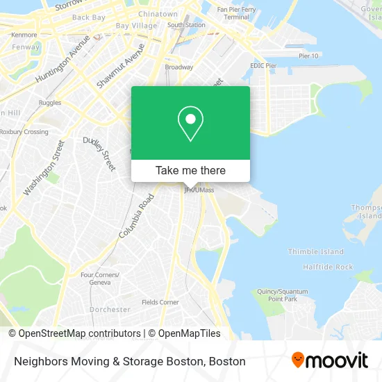
See Neighbors Moving & Storage Boston on the map
Public Transportation to Neighbors Moving & Storage Boston
Wondering how to get to Neighbors Moving & Storage Boston? Moovit helps you find the best way to get to Neighbors Moving & Storage Boston with step-by-step directions from the nearest public transit station.
Moovit provides free maps and live directions to help you navigate through your city. View schedules, routes, timetables, and find out how long does it take to get to Neighbors Moving & Storage Boston in real time.
Looking for the nearest stop or station to Neighbors Moving & Storage Boston? Check out this list of stops closest to your destination: Dorchester Ave @ Columbia Rd; Columbia Rd @ Buttonwood St; Dorchester Ave @ Crescent Ave; Mt Vernon St @ Bay Side Expo Center; Jfk/Umass; Newmarket.
Bus: 16, 41, 8, 18, RED LINE SHUTTLE, RED LINE SHUTTLE, RED/MATTAPAN LINE SHUTTLE.Train: FALL RIVER/NEW BEDFORD, KINGSTON, GREENBUSH, RED LINE, FAIRMOUNT, FRANKLIN/FOXBORO, PROVIDENCE/STOUGHTON.Subway: RED LINE.
Want to see if there’s another route that gets you there at an earlier time? Moovit helps you find alternative routes or times. Get directions from and directions to Neighbors Moving & Storage Boston easily from the Moovit App or Website.
We make riding to Neighbors Moving & Storage Boston easy, which is why over 1.7 million users, including users in Boston, trust Moovit as the best app for public transit. You don’t need to download an individual bus app or train app, Moovit is your all-in-one transit app that helps you find the best bus time or train time available.
For information on prices of subway, bus and train, costs and ride fares to Neighbors Moving & Storage Boston, please check the Moovit app.
Use the app to navigate to popular places including to the airport, hospital, stadium, grocery store, mall, coffee shop, school, college, and university.
Neighbors Moving & Storage Boston Address: 128 Willow Ave street in Boston
- Columbia Point, Massachusetts,
- Sim Mao,
- Mls Property Information Network,
- North Reading Homes for Sale,
- Patrick's Racket Solutions,
- Az Signs,
- Nepal Kasthamandap,
- Boston Homestel,
- Display Now Digital Signage,
- Boston Collegiate Charter School - Lower School Campus,
- Healthcare Global,
- Dr Richard Crossman,
- The Banshee Bar,
- Miami,
- Thanh Danh Multi Service,
- Neurological Rehabilitation,
- Plymouth & Brockton Bus to Hyannis,
- Kit Clark Senior Service,
- MBTA JFK/UMass Station,
- JFK / Umass Braintree - Inbound (JFK / Umass Ashmont - Outbound)
Places Near Neighbors Moving & Storage Boston
- North End, Boston,
- Wilbur Theatre, Boston,
- Boston Convention & Exhibition Center, Boston,
- Isabella Stewart Gardner Museum, Boston,
- Quincy Market, Boston,
- Leader Bank Pavilion (Leader Bank Pavillion), Boston,
- Boston Common, Boston,
- Boston Medical Center, Boston,
- Boston Children's Hospital, Boston,
- Museum Of Science, Boston,
- Cheers, Boston,
- Mgm Music Hall, Boston,
- House Of Blues, Boston,
- Prudential Center, Boston,
- Castle Island, Boston,
- Wang Theater, Boston,
- Faneuil Hall, Boston,
- Td Garden, Boston,
- Seaport District, Boston,
- Massachusetts General Hospital, Boston
How to get to popular places in Boston with public transit
Get around Boston by public transit!
Traveling around Boston has never been so easy. See step by step directions as you travel to any attraction, street or major public transit station. View bus and train schedules, arrival times, service alerts and detailed routes on a map, so you know exactly how to get to anywhere in Boston.
When traveling to any destination around Boston use Moovit's Live Directions with Get Off Notifications to know exactly where and how far to walk, how long to wait for your line, and how many stops are left. Moovit will alert you when it's time to get off — no need to constantly re-check whether yours is the next stop.
Wondering how to use public transit in Boston or how to pay for public transit in Boston? Moovit public transit app can help you navigate your way with public transit easily, and at minimum cost. It includes public transit fees, ticket prices, and costs. Looking for a map of Boston public transit lines? Moovit public transit app shows all public transit maps in Boston with all Bus, Train, Subway and Ferry routes and stops on an interactive map.
Boston has 4 transit type(s), including: Bus, Train, Subway and Ferry, operated by several transit agencies, including MBTA, Southeastern Regional Transit Authority, MetroWest Regional Transit Authority, Rhode Island Public Transit Authority, WRTA, Lowell Regional Transit Authority, Merrimack Valley Transit, Montachusett Regional Transit Authority, Cape Cod Regional Transit Authority, Brockton Area Transit Authority, Martha's Vineyard Transit Authority, the WAVE - Nantucket Regional Transit Authority, GATRA, Cape Ann Transportation Authority and Massport