How to get to Neponset by bus?
Click on the bus route to see step by step directions with maps, line arrival times and updated time schedules.
From Spaulding Hospital, Cambridge
106 minFrom Mass Ave, Cambridge
99 minFrom Sowa, Boston
72 minFrom Warren St, Boston
107 minFrom Bow Market, Somerville
120 minFrom Hood Park, Boston
115 minFrom Intercontinental Boston, Boston
83 minFrom the mall at rockingham park mall, Boston
107 minFrom Yotel, Boston
91 minFrom Fairfield Inn Suites by Marriott Boston Cambridge, Cambridge
105 min
How to get to Neponset by train?
Click on the train route to see step by step directions with maps, line arrival times and updated time schedules.
How to get to Neponset by subway?
Click on the subway route to see step by step directions with maps, line arrival times and updated time schedules.
From Spaulding Hospital, Cambridge
72 minFrom Mass Ave, Cambridge
60 minFrom Sowa, Boston
51 minFrom Warren St, Boston
92 minFrom Bow Market, Somerville
80 minFrom Hood Park, Boston
62 minFrom Intercontinental Boston, Boston
49 minFrom the mall at rockingham park mall, Boston
95 minFrom Yotel, Boston
55 minFrom Fairfield Inn Suites by Marriott Boston Cambridge, Cambridge
68 min
Subway station near Neponset in Boston
- Savin Hill, 2 min walk,VIEW
Bus stop near Neponset in Boston
- Freeport St @ Morrisey Blvd, 5 min walk,VIEW
Train station near Neponset in Boston
- Jfk/Umass, 23 min walk,VIEW
Bus lines to Neponset in Boston
- 201, Keystone Apts Via Neponset Ave & Puritan Mall,VIEW
What are the closest stations to Neponset?
The closest stations to Neponset are:
- Savin Hill is 142 yards away, 2 min walk.
- Freeport St @ Morrisey Blvd is 413 yards away, 5 min walk.
- Jfk/Umass is 1880 yards away, 23 min walk.
Which bus lines stop near Neponset?
These bus lines stop near Neponset: 15, 19, 201, 210.
Which train lines stop near Neponset?
These train lines stop near Neponset: FAIRMOUNT, FALL RIVER/NEW BEDFORD.
Which subway line stops near Neponset?
RED LINE (Ashmont/Braintree)
What’s the nearest subway station to Neponset in Boston?
The nearest subway station to Neponset in Boston is Savin Hill. It’s a 2 min walk away.
What’s the nearest train station to Neponset in Boston?
The nearest train station to Neponset in Boston is Jfk/Umass. It’s a 23 min walk away.
What’s the nearest bus station to Neponset in Boston?
The nearest bus station to Neponset in Boston is Freeport St @ Morrisey Blvd. It’s a 5 min walk away.
What time is the first subway to Neponset in Boston?
The RED LINE is the first subway that goes to Neponset in Boston. It stops nearby at 5:16 AM.
What time is the last subway to Neponset in Boston?
The RED LINE is the last subway that goes to Neponset in Boston. It stops nearby at 2:03 AM.
What time is the first train to Neponset in Boston?
The KINGSTON is the first train that goes to Neponset in Boston. It stops nearby at 5:50 AM.
What time is the last train to Neponset in Boston?
The KINGSTON is the last train that goes to Neponset in Boston. It stops nearby at 8:02 PM.
What time is the first bus to Neponset in Boston?
The 201 is the first bus that goes to Neponset in Boston. It stops nearby at 10:20 AM.
What time is the last bus to Neponset in Boston?
The 201 is the last bus that goes to Neponset in Boston. It stops nearby at 3:10 PM.
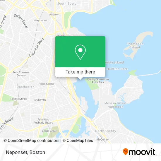
See Neponset, Boston, on the map
Public Transit to Neponset in Boston
Wondering how to get to Neponset in Boston? Moovit helps you find the best way to get to Neponset with step-by-step directions from the nearest public transit station.
Moovit provides free maps and live directions to help you navigate through your city. View schedules, routes, timetables, and find out how long does it take to get to Neponset in real time.
Looking for the nearest stop or station to Neponset? Check out this list of stops closest to your destination: Savin Hill; Freeport St @ Morrisey Blvd; Jfk/Umass.
Bus: 15, 19, 201, 210.Train: FAIRMOUNT, FALL RIVER/NEW BEDFORD, GREENBUSH, KINGSTON.Subway: RED LINE.
Want to see if there’s another route that gets you there at an earlier time? Moovit helps you find alternative routes or times. Get directions from and directions to Neponset easily from the Moovit App or Website.
We make riding to Neponset easy, which is why over 1.7 million users, including users in Boston, trust Moovit as the best app for public transit. You don’t need to download an individual bus app or train app, Moovit is your all-in-one transit app that helps you find the best bus time or train time available.
For information on prices of subway, bus and train, costs and ride fares to Neponset, please check the Moovit app.
Use the app to navigate to popular places including to the airport, hospital, stadium, grocery store, mall, coffee shop, school, college, and university.
Location: Boston
- Victory Road Park,
- Victory Road Park,
- Expressway Toyota,
- 730 Morrissey Blvd Parking,
- 7-Eleven,
- Amazon Locker-Popcorn,
- Appliance Repair Viking,
- Expressway Motors,
- Ramada Boston,
- Ramada Inn,
- Wyndham,
- Ramada by Wyndham Boston,
- Santander,
- Atm CVS,
- Ramada Inn Boston Hotel Boston,
- Boston Bowl - Dorchester,
- Boston Bowl,
- Bay Cove Early Intervention,
- Dorchester Pottery Works,
- Brigham Square
Places Near Neponset (Boston)
- Seaport District, Boston,
- Museum Of Science, Boston,
- Faneuil Hall, Boston,
- Boston Common, Boston,
- Boston Convention & Exhibition Center, Boston,
- Boston Children's Hospital, Boston,
- Leader Bank Pavilion (Leader Bank Pavillion), Boston,
- Td Garden, Boston,
- Wilbur Theatre, Boston,
- House Of Blues, Boston,
- Isabella Stewart Gardner Museum, Boston,
- Wang Theater, Boston,
- Massachusetts General Hospital, Boston,
- Castle Island, Boston,
- Cheers, Boston,
- Boston Medical Center, Boston,
- Prudential Center, Boston,
- Quincy Market, Boston,
- North End, Boston,
- Mgm Music Hall, Boston
How to get to popular places in Boston with public transit
Get around Boston by public transit!
Traveling around Boston has never been so easy. See step by step directions as you travel to any attraction, street or major public transit station. View bus and train schedules, arrival times, service alerts and detailed routes on a map, so you know exactly how to get to anywhere in Boston.
When traveling to any destination around Boston use Moovit's Live Directions with Get Off Notifications to know exactly where and how far to walk, how long to wait for your line, and how many stops are left. Moovit will alert you when it's time to get off — no need to constantly re-check whether yours is the next stop.
Wondering how to use public transit in Boston or how to pay for public transit in Boston? Moovit public transit app can help you navigate your way with public transit easily, and at minimum cost. It includes public transit fees, ticket prices, and costs. Looking for a map of Boston public transit lines? Moovit public transit app shows all public transit maps in Boston with all Bus, Train, Subway and Ferry routes and stops on an interactive map.
Boston has 4 transit type(s), including: Bus, Train, Subway and Ferry, operated by several transit agencies, including MBTA, Southeastern Regional Transit Authority, MetroWest Regional Transit Authority, Rhode Island Public Transit Authority, WRTA, Lowell Regional Transit Authority, Merrimack Valley Transit, Montachusett Regional Transit Authority, Cape Cod Regional Transit Authority, Brockton Area Transit Authority, Martha's Vineyard Transit Authority, the WAVE - Nantucket Regional Transit Authority, GATRA, Cape Ann Transportation Authority and Massport