Directions to Nesconset (Nesconset, Ny) with public transportation
The following transit lines have routes that pass near Nesconset
How to get to Nesconset by bus?
Click on the bus route to see step by step directions with maps, line arrival times and updated time schedules.
How to get to Nesconset by train?
Click on the train route to see step by step directions with maps, line arrival times and updated time schedules.
Bus stations near Nesconset in Nesconset, Ny
- Doyle Street, 17 min walk,
Train stations near Nesconset in Nesconset, Ny
- St. James, 46 min walk,
Bus lines to Nesconset in Nesconset, Ny
- 5, Smith Haven Mall Via Brentwood Railroad,
What are the closest stations to Nesconset?
The closest stations to Nesconset are:
- Doyle Street is 1436 yards away, 17 min walk.
- St. James is 3926 yards away, 46 min walk.
Which bus lines stop near Nesconset?
These bus lines stop near Nesconset: 3D, S56, S58.
Which train lines stop near Nesconset?
These train lines stop near Nesconset: PORT JEFFERSON, RONKONKOMA.
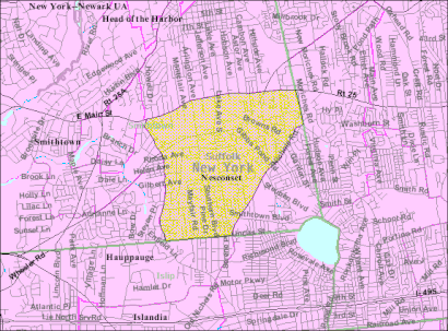
See Nesconset, Nesconset, Ny, on the map
Public Transit to Nesconset in Nesconset, Ny
Wondering how to get to Nesconset in Nesconset, Ny, United States? Moovit helps you find the best way to get to Nesconset with step-by-step directions from the nearest public transit station.
Moovit provides free maps and live directions to help you navigate through your city. View schedules, routes, timetables, and find out how long does it take to get to Nesconset in real time.
Looking for the nearest stop or station to Nesconset? Check out this list of stops closest to your destination: Doyle Street; St. James.
Bus: 3D, S56, S58, 5.Train: PORT JEFFERSON, RONKONKOMA, PORT JEFFERSON BRANCH.
Want to see if there’s another route that gets you there at an earlier time? Moovit helps you find alternative routes or times. Get directions from and directions to Nesconset easily from the Moovit App or Website.
We make riding to Nesconset easy, which is why over 1.5 million users, including users in Nesconset, Ny, trust Moovit as the best app for public transit. You don’t need to download an individual bus app or train app, Moovit is your all-in-one transit app that helps you find the best bus time or train time available.
For information on prices of bus, train and subway, costs and ride fares to Nesconset, please check the Moovit app.
Get to Nesconset with public transit and pay for the ride in the Moovit app. In addition to all info you may need for your trip to Nesconset, including live directions, real-time arrivals and fare prices, you can also buy public transit passes for your rides. No need for cash or paper tickets to get to Nesconset - everything you need is accessible in the app with a click of the button.
Use the app to navigate to popular places including to the airport, hospital, stadium, grocery store, mall, coffee shop, school, college, and university.
Nesconset Address: Lake Avenue South street in Nesconset, Ny
Nesconset is a hamlet and census-designated place (CDP) in the town of Smithtown, located in Suffolk County, Long Island, New York, United States. The population was 13,387 at the 2010 census.Wiki
Attractions near Nesconset
11767,All You Need Is Love Weddings,Lake Ave and RT 347,RT 347 Lake,159 Lake Ave S,New York 347,Lake Ave S ,Lake Ave S (lake ave s nesconset),Lake Ave S (lincoln ave lake),Long Island Insurance Company,Two Guys Home Improvements,Golf Fore Women & Children Inc,Bocchichio Linda DC,Shutter World,A A Appliance,A Wet N Wild Dance Company,2 Shady Pl,Lincoln Ave (lincoln ave garfield),Shurgard Storage Ctr,Ozone ParkHow to get to popular attractions in Nesconset, Ny with public transit
Six Flags, Manhattan,JFK American Airlines Terminal 8 Gate 44, Queens,Jamaican Consulate, Manhattan,Ikea Ferry, Manhattan,World Headquarters Of Jehovah's Witnesses, Warwick, Ny,360 Adams St,John F Kennedy Blvd, Jersey City, Nj,Maimonides Medical Center,Vernon, NJ, Clifton, Nj,Pier 36, Manhattan,Peter Pan Bus Lines, Manhattan,Queens County Civil Court, Queens,103 Canal St, Manhattan,Danbury, CT, Danbury, Ct,Governors Island, Manhattan,111 East 210th Street, Bronx,168th street, Manhattan,Orchard St, Manhattan,Beacon Theatre (Beacon Theater), Manhattan,Irvington, NJ, Irvington, NjGet around New York - New Jersey by public transit!
Traveling around New York - New Jersey has never been so easy. See step by step directions as you travel to any attraction, street or major public transit station. View bus and train schedules, arrival times, service alerts and detailed routes on a map, so you know exactly how to get to anywhere in New York - New Jersey.
When traveling to any destination around New York - New Jersey use Moovit's Live Directions with Get Off Notifications to know exactly where and how far to walk, how long to wait for your line, and how many stops are left. Moovit will alert you when it's time to get off — no need to constantly re-check whether yours is the next stop.
Wondering how to use public transit in New York - New Jersey or how to pay for public transit in New York - New Jersey? Moovit public transit app can help you navigate your way with public transit easily, and at minimum cost. It includes public transit fees, ticket prices, and costs. Looking for a map of New York - New Jersey public transit lines? Moovit public transit app shows all public transit maps in New York - New Jersey with all Bus, Train, Subway, Light Rail, Ferry and Cable Car routes and stops on an interactive map.
New York - New Jersey has 6 transit type(s), including: Bus, Train, Subway, Light Rail, Ferry and Cable Car, operated by several transit agencies, including MTA Subway, Metro-North Railroad, LIRR, PATH, Shore Line East, MTA Bus Company, MTA New York City Transit - Express routes, MTA Bus, NJ Transit, NYC Ferry, NICE bus, Bee-Line Bus, NJ Transit Rail, Norwalk Transit District, CTTransit - Waterbury-Meriden