Directions to Nespresso (Newton) with public transportation
The following transit lines have routes that pass near Nespresso
 Bus: 52, 60.
- Subway: GREEN LINE D, GREEN LINE B.
How to get to Nespresso by bus?
Click on the bus route to see step by step directions with maps, line arrival times and updated time schedules.
From The Swan Boats, Boston
54 minFrom MBTA-Chinatown, Boston
73 minFrom 300 Longwood Ave, Boston
72 minFrom Chinatown Station MBTA, Boston
73 minFrom Sarma, Somerville
78 minFrom The Colonnade Hotel Boston, Boston
42 minFrom Brighton Music Hall, Boston
41 minFrom I-95 / Route 128 & Route 16 Interchange (Exit 21), Newton
92 minFrom Dedham, MA, Dedham
121 minFrom Huntington Theatre, Boston
41 min
How to get to Nespresso by subway?
Click on the subway route to see step by step directions with maps, line arrival times and updated time schedules.
From The Swan Boats, Boston
57 minFrom MBTA-Chinatown, Boston
58 minFrom 300 Longwood Ave, Boston
68 minFrom Chinatown Station MBTA, Boston
57 minFrom Sarma, Somerville
83 minFrom The Colonnade Hotel Boston, Boston
55 minFrom Brighton Music Hall, Boston
58 minFrom I-95 / Route 128 & Route 16 Interchange (Exit 21), Newton
48 minFrom Huntington Theatre, Boston
59 min
Bus stop near Nespresso in Newton
- Boylston St @ Star Market - Service Rd, 7 min walk,VIEW
Subway stations near Nespresso in Newton
Bus lines to Nespresso in Newton
- 60, Brookline Village,VIEW
What are the closest stations to Nespresso?
The closest stations to Nespresso are:
- Boylston St @ Star Market - Service Rd is 587 yards away, 7 min walk.
- Newton Highlands is 2887 yards away, 34 min walk.
- Boston College is 3661 yards away, 43 min walk.
Which bus lines stop near Nespresso?
These bus lines stop near Nespresso: 52, 60.
Which subway line stops near Nespresso?
GREEN LINE D (Riverside)
What’s the nearest bus station to Nespresso in Newton?
The nearest bus station to Nespresso in Newton is Boylston St @ Star Market - Service Rd. It’s a 7 min walk away.
What time is the first subway to Nespresso in Newton?
The GREEN LINE D is the first subway that goes to Nespresso in Newton. It stops nearby at 4:52 AM.
What time is the last subway to Nespresso in Newton?
The GREEN LINE D is the last subway that goes to Nespresso in Newton. It stops nearby at 2:39 AM.
What time is the first bus to Nespresso in Newton?
The 60 is the first bus that goes to Nespresso in Newton. It stops nearby at 5:00 AM.
What time is the last bus to Nespresso in Newton?
The 60 is the last bus that goes to Nespresso in Newton. It stops nearby at 12:19 AM.
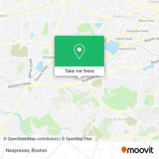
See Nespresso, Newton, on the map
Public Transit to Nespresso in Newton
Wondering how to get to Nespresso in Newton? Moovit helps you find the best way to get to Nespresso with step-by-step directions from the nearest public transit station.
Moovit provides free maps and live directions to help you navigate through your city. View schedules, routes, timetables, and find out how long does it take to get to Nespresso in real time.
Looking for the nearest stop or station to Nespresso? Check out this list of stops closest to your destination: Boylston St @ Star Market - Service Rd; Newton Highlands; Boston College.
Bus: 52, 60.Subway: GREEN LINE D, GREEN LINE B.
Want to see if there’s another route that gets you there at an earlier time? Moovit helps you find alternative routes or times. Get directions from and directions to Nespresso easily from the Moovit App or Website.
We make riding to Nespresso easy, which is why over 1.7 million users, including users in Newton, trust Moovit as the best app for public transit. You don’t need to download an individual bus app or train app, Moovit is your all-in-one transit app that helps you find the best bus time or train time available.
For information on prices of bus and subway, costs and ride fares to Nespresso, please check the Moovit app.
Use the app to navigate to popular places including to the airport, hospital, stadium, grocery store, mall, coffee shop, school, college, and university.
Nespresso Address: 225 Boylston St street in Newton
- Longchamp,
- Fortycarrotschmbloomingdales,
- The Kooples,
- maje,
- MAC,
- Charlotte Tilbury,
- Space.NK.Apothecary,
- Mauboussin,
- Michael Kors Collection,
- Maximilian at Bloomingdale's,
- Clarins Skin Spa at Bloomingdales,
- The Mall At Chestnut Hill,
- Crate & Barrel (Crate and Barrel Chestnut Hill),
- Cell Fix,
- Ross-Simons Jewelers,
- Niczoe,
- Pepe's Pizza (Frank Pepe's of Chesnut Hill),
- Frank Pepe Pizzeria Napoletana,
- Glazed Bytes,
- Frank Pepe's (Pepe's Pizza)
Places Near Nespresso (Newton)
- Prudential Center, Boston,
- Td Garden, Boston,
- Boston Medical Center, Boston,
- House Of Blues, Boston,
- North End, Boston,
- Mgm Music Hall, Boston,
- Wang Theater, Boston,
- Boston Common, Boston,
- Boston Convention & Exhibition Center, Boston,
- Quincy Market, Boston,
- Cheers, Boston,
- Castle Island, Boston,
- Wilbur Theatre, Boston,
- Isabella Stewart Gardner Museum, Boston,
- Leader Bank Pavilion (Leader Bank Pavillion), Boston,
- Museum Of Science, Boston,
- Faneuil Hall, Boston,
- Seaport District, Boston,
- Boston Children's Hospital, Boston,
- Massachusetts General Hospital, Boston
How to get to popular places in Boston with public transit
Get around Newton by public transit!
Traveling around Newton has never been so easy. See step by step directions as you travel to any attraction, street or major public transit station. View bus and train schedules, arrival times, service alerts and detailed routes on a map, so you know exactly how to get to anywhere in Newton.
When traveling to any destination around Newton use Moovit's Live Directions with Get Off Notifications to know exactly where and how far to walk, how long to wait for your line, and how many stops are left. Moovit will alert you when it's time to get off — no need to constantly re-check whether yours is the next stop.
Wondering how to use public transit in Newton or how to pay for public transit in Newton? Moovit public transit app can help you navigate your way with public transit easily, and at minimum cost. It includes public transit fees, ticket prices, and costs. Looking for a map of Newton public transit lines? Moovit public transit app shows all public transit maps in Newton with all Bus, Train, Subway and Ferry routes and stops on an interactive map.
Boston has 4 transit type(s), including: Bus, Train, Subway and Ferry, operated by several transit agencies, including MBTA, Southeastern Regional Transit Authority, MetroWest Regional Transit Authority, Rhode Island Public Transit Authority, WRTA, Lowell Regional Transit Authority, Merrimack Valley Transit, Montachusett Regional Transit Authority, Cape Cod Regional Transit Authority, Brockton Area Transit Authority, Martha's Vineyard Transit Authority, the WAVE - Nantucket Regional Transit Authority, GATRA, Cape Ann Transportation Authority and Massport